
 Portuguese
  Spanish
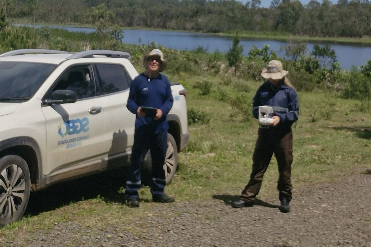
The Geological Survey Of Brazil Carries Out Surveys In Passo De Torres, Balneário Gaivota And Balneário Arroio Do Silva To Map Geological Risk In Santa Catarina And Strengthen Disaster Prevention
The geological risk in Santa Catarina has gained prominence due to the increase in landslides and floods affecting coastal municipalities, according to an article published.
This week, the Geological Survey Of Brazil (SGB) began a series of surveys in Passo De Torres, Balneário Gaivota And Balneário Arroio Do Silva, with the aim of identifying areas susceptible to natural phenomena and providing technical support for urban and environmental planning.
The study is part of a broad Partnership Agreement For Research, Development, And Innovation With The Government Of Santa Catarina, aimed at the preparation of Landslide And Flood Susceptibility Maps and Geotechnical Aptitude Maps For Urbanization.
-
European Parliament Approves Digital Euro, Aiming to Challenge Visa and Mastercard’s Dominance and Transform Payments Across Europe by 2029

-
Green Roofs on Homes Gain Popularity for Reducing Heat, Noise, and Rain Impact in Brazil
-
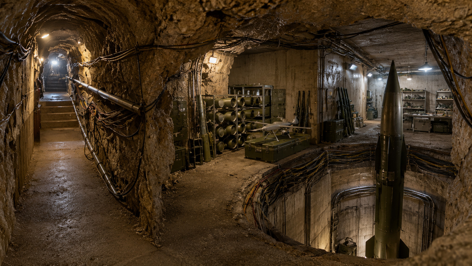
Israel finds Hezbollah militarized tunnel over 200 meters long under village, with 4 missile launch shafts, 12 chambers, anti-tank missiles, drones, and weapons depots at a depth of 25 meters.

-
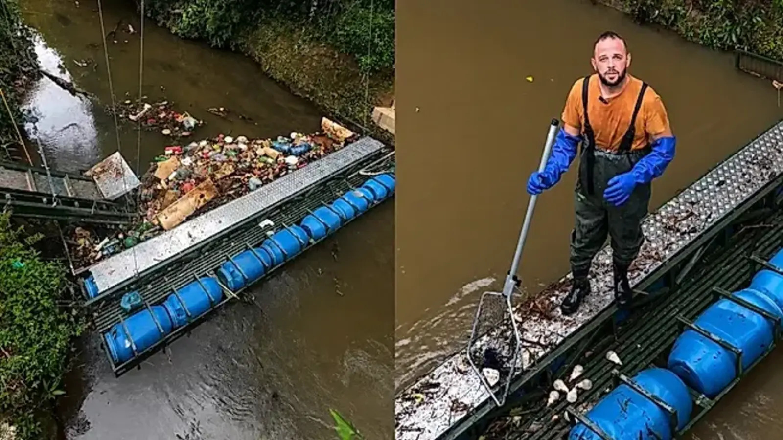
Brazilian promises his children to save a river, creates an eco-barrier in his backyard, has already removed more than 40 tons of trash from the water, and even inspires the idea in other states of the country.


These tools are essential for guiding the growth of cities in a safer and more sustainable way, reducing human and economic losses.
Detailed Geotechnical Studies Strengthen The Prevention Of Coastal Landslides
The analysis of geological risk in Santa Catarina begins with a desk phase, in which SGB researchers study maps, satellite images, and geological data to adapt models to the regional context.
Subsequently, field teams travel through the study areas, validating information directly on the ground with the support of digital tools.
This methodology allows the identification of slope zones, floodplains, and other sensitive areas of southern Santa Catarina’s coast.
The first surveys conducted in municipalities such as Ascurra, Ibirama, Morro Da Fumaça, Cocal Do Sul, And Urussanga have proven the efficiency of the process.
Now, the goal is to expand the analyses to the entire state, ensuring that each municipality has access to accurate technical information for decision-making.
Currently, 103 municipalities in Santa Catarina already have their Susceptibility Maps completed.
Urban Floods And Impacts On Territorial Planning In Santa Catarina
The presence of urban floods is one of the main challenges faced by cities on the coast and in the Itajaí Valley.
With the new mapping, municipalities will be able to better understand the behavior of the terrain and watercourses, identifying areas with greater vulnerability.
The geological risk in Santa Catarina, therefore, is not limited to slopes; it also includes floodplains and natural drainage zones that, when occupied without planning, amplify the impact of heavy rains.
This data will directly support municipal and state Civil Defenses, environmental licensing, and the definition of urban expansion areas.
The expected result is safe territorial planning, with investments directed towards infrastructure projects that reduce the risk of disasters and protect lives.
Geological Risk In Santa Catarina: Disaster Prevention And Sustainable Urban Development
The results of the studies on geological risk in Santa Catarina will be consolidated into technical reports that will be available to the public on the SGB website.
The material will also be delivered to the state government, municipalities, and civil defense agencies.
In addition to supporting immediate prevention actions, this information contributes to sustainable urban development and the strengthening of environmental risk management in the state.
The expectation is that, with the advancement of research, Santa Catarina will be able to cover 100% of its municipalities with updated cartography, reducing the population’s exposure to natural phenomena and promoting safer and more resilient cities.
Thus, the geological risk in Santa Catarina becomes not only a technical challenge but an opportunity for integrated planning between science, government, and community.


Great article, thank you for sharing these insights! I’ve tested many methods for building backlinks, and what really worked for me was using AI-powered automation. With us, we can scale link building in a safe and efficient way. It’s amazing to see how much time this saves compared to manual outreach.
thanks my friend