






 Portuguese
  Spanish


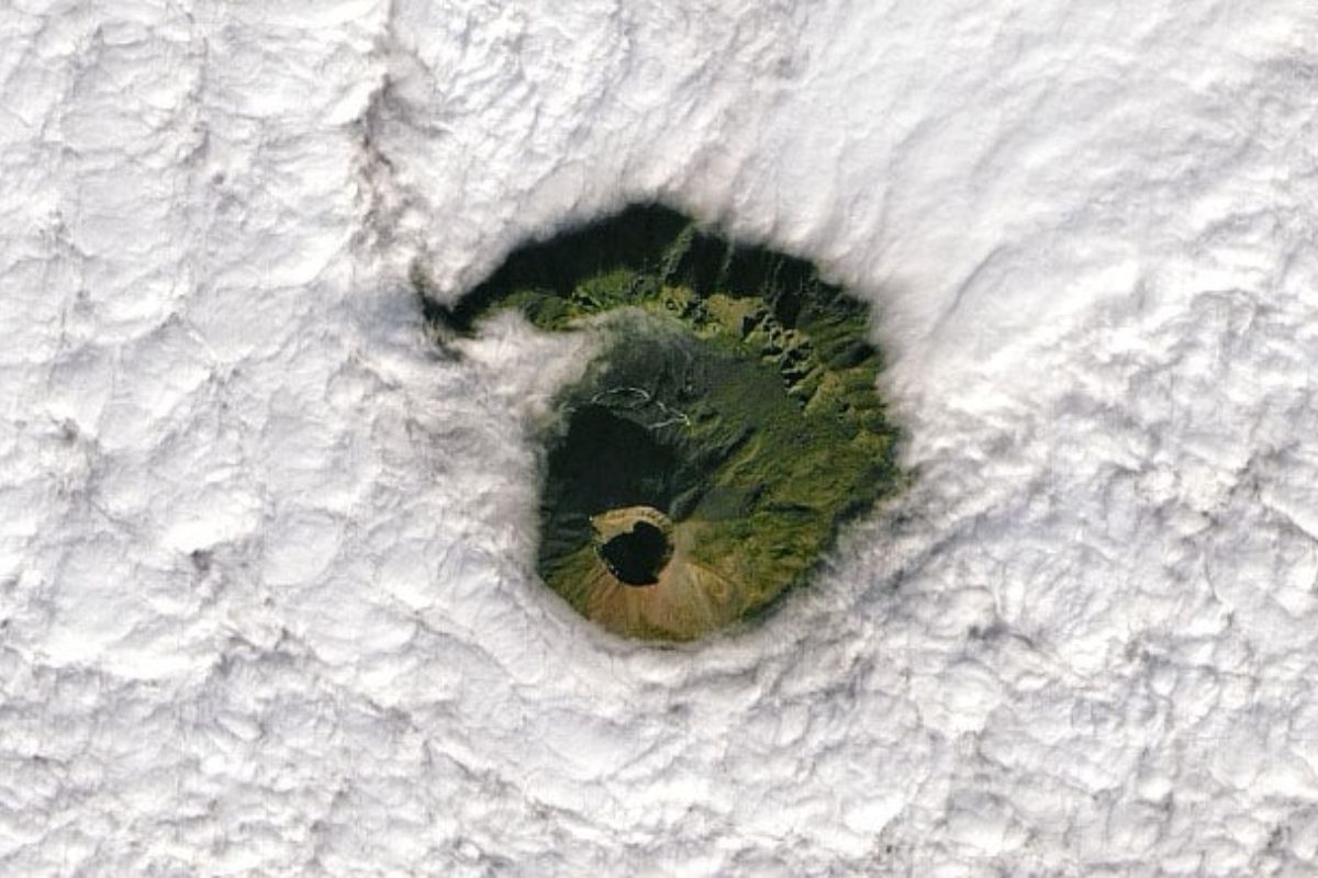


In January 2022, the NASA satellite recorded Mount Vesuvius visible through a circle of clouds, in Naples, on a Landsat-8 pass with the Operational Land Imager sensor. The opening exposed the caldera and the relief of Mount Somma, reminding that the volcano remains active, monitored, even without recent eruptions in the Italian region
The NASA satellite captured a rare timing shot: Mount Vesuvius was readable for a few seconds through a circular opening in the clouds, with the crater in prominence and the city of Naples around it as an immediate reference for scale and proximity.
The image drew attention because it combines two layers at the same time. It is visually unusual and technically useful, as Landsat-8 provides a consistent record for comparing terrain, outlines and physical signals over time.
How Landsat-8 Turns An Instant Into Comparable Data

Landsat-8 operates in orbit with systematic scanning of the surface, and the Operational Land Imager sensor records different spectral bands to compose a detailed reading of the terrain.
-
How to Prevent Brown Recluse Spider Bites: Common Hiding Spots and Free Tips to Reduce Risks

-
Natto: The Unusual Japanese Superfood Gaining Popularity on Social Media and Driving Record Exports
-
Brazilian Mayor Goes Undercover as Homeless for 24 Hours to Assess Public Services

-
15-Year-Old Entrepreneur Malu Lira Publishes 20 Children’s Books on Financial Education, Earns $500,000, and Expands Her Project to the Amazon Rainforest




When the clouds align and allow a clean hole, the NASA satellite gains a window that does not depend on helicopter, drone, or local team.
The critical point is that the image is not just a “pretty click”.
The value lies in the repetition and standardization of the record, as the same acquisition geometry from Landsat-8 allows for comparison of scenes on different days, separating atmospheric noise from real changes in the relief, coloration, and physical signature of Mount Vesuvius.
What Appears When The Clouds Part Over Naples
The opening in the clouds made visible the caldera of the summit, described as a bowl-shaped depression associated with eruptive episodes and collapse.
To the north, the remnant of Mount Somma appears, a geological element cited as the structure from which Mount Vesuvius grew, composing a sharp contrast between old edges and the current cone.
This reading matters because Naples is close enough to turn any interpretation into a discussion about risk and planning.
When Mount Vesuvius becomes visible with this level of clarity, the gaze shifts from contemplation to context, and the clouds cease to be just a backdrop and become a filter that, for a moment, has been removed.
Why NASA Satellite And Clouds Enter The Same Technical Conversation
The NASA satellite does not only measure “if it is visible,” it helps to build series.
Clouds interfere, hide, and distort, and therefore a clear opening becomes an event: it reduces interpretative uncertainty and improves the reading of what is at the summit and around Mount Vesuvius.
Moreover, Mount Vesuvius is classified as an active volcano and can exhibit underground earthquakes and gas emissions at the summit, which supports the logic of continuous observation.
In this context, Landsat-8 becomes part of a surveillance package, and the clouds, which normally hinder, end up providing the frame that made the scene unusual and memorable.
The History That Keeps Mount Vesuvius As A Risk Reference
The most famous eruption of Mount Vesuvius is associated with the year 79 of the Common Era, when Roman cities such as Pompeii and Herculaneum were simultaneously destroyed and preserved.
The most recent cited eruption occurred in 1944 and affected the neighboring village of San Sebastiano, reinforcing that the volcano is not just an ancient landmark, but a system with a modern history.
On a long scale, Mount Vesuvius is said to have had eight major eruptions in the last 17,000 years, based on geological analysis of the layers around.
The factor that weighs in the European debate is geography: Naples is about 12 kilometers northwest of the volcano, and the region is home to over 3 million people, which makes any image from the NASA satellite more than curiosity and any hole in the clouds more than coincidence.
An opening in the clouds, an exact angle, and the passage of Landsat-8 were enough to produce an image that seems casual but carries a technical and historical reading.
When the NASA satellite “cuts” Mount Vesuvius over Naples, the photo becomes a reminder of proximity, and the discussion returns to the basics: monitor, understand, and communicate risk without relying on alarm.
If you saw Mount Vesuvius appearing like this, through the clouds, what would catch your attention more: the clarity of the crater, the notion of distance to Naples, or the idea that Landsat-8 can record similar patterns for years? And what would be, for you, the acceptable limit of tourism near this type of area?








Landsat is NOT owned nor operated by NASA. Landsat is owned and operated by the US Geological Survey (USGS) which is part of the Department of The Interior.