Portuguese
  Spanish


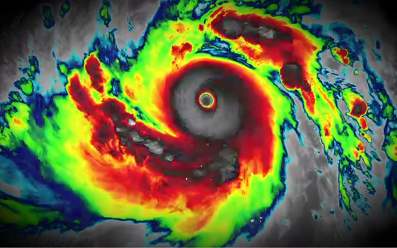


Super Typhoon Sinlaku in the Pacific Ocean advances in 2026 with winds of up to 306 km/h and threatens the Northern Mariana Islands, according to alerts from the NWS and Japanese meteorology.
Super Typhoon Sinlaku in the Pacific Ocean reached an extreme intensity stage on Monday, April 13, 2026, at 03:45 AM (Brasília time), with recorded winds of up to 306 km/h, according to data released by the Japan Meteorological Agency. The system is advancing towards the Northern Mariana Islands, a territory of the United States, with severe impact forecasts.
According to meteorologists, the phenomenon began to form from small atmospheric disturbances in early April 2026 and consolidated as a tropical typhoon on April 9, 2026, according to official monitoring of the Western Pacific region.
Formation of Super Typhoon Sinlaku in the Pacific Ocean was rapid and intense
According to the Meteorological Authority, the system intensified rapidly while crossing the extremely warm waters of the Northwest Pacific Ocean, a condition that favors the formation of high-intensity tropical cyclones.
-
She spent 73 years breathing inside an iron lung, survived the aftereffects of polio, and became the last woman in the United States dependent on the equipment before dying at 78 years old.

-
Brazilian students created a $1 filter using pine bark, cotton, and 3D-printed parts to clean cassava wastewater, reduce the toxicity of a hazardous waste, and transform contaminated water into biofertilizer.

-
Astronaut from Artemis II steps down after mission to the Moon and decision surprises after a record of 406,771 km, a historic 10-day journey, and an unprecedented achievement for Canada.

-
A fossil kept for years in a small museum in Montreal concealed 450-million-year-old soft tissue, a discovery that has only happened once before in history.


The phenomenon follows the pattern known as the “Typhoon Corridor,” located in the Western Pacific Basin, an area considered one of the most active on the planet for tropical storms, according to historical records of regional climatology.
Northern Mariana Islands are under NWS alert
The Northern Mariana Islands, a territory of the United States, are expected to be hit by the system in the coming days, according to an official statement from the U.S. National Weather Service released on April 13, 2026.
The agency stated that Sinlaku could reach the region as a Category 4 or 5 typhoon, even with possible gradual weakening. In an official note, the NWS warned:
“For those under warning in the Marianas, the window of time to complete preparations for the protection of lives and property is very close to closing” (NWS, official statement, 2026).
Super Typhoon Sinlaku: Risks include extreme winds, heavy rains, and dangerous waves
According to meteorological projections from the NWS (2026), expected impacts include winds exceeding 250 km/h in exposed areas, as well as torrential rains with a high risk of flash floods.
Among the main predicted effects are:
- Destructive winds with structural potential
- Flooding in coastal and urban areas
- Dangerous ocean waves in the Pacific Ocean
- Landslides in mountainous regions
The agency also emphasized that “harmful and potentially destructive winds pose a deadly threat” to exposed individuals during the event (NWS, 2026).
Guam and nearby areas also enter a state of alert
Although Guam is not directly in the path of the system, local authorities, based on alerts from the NWS (2026), recommended preventive preparation due to indirect effects, such as heavy rains and atmospheric instability.
The typhoon is expected to continue its trajectory towards the north of the Pacific Ocean, crossing the Mariana Islands and gradually losing strength after interacting with less favorable waters, according to regional meteorological projections.


Comparison with Tropical Cyclone Maila reinforces alert scenario
As Super Typhoon Sinlaku advances in the Northern Hemisphere, Tropical Cyclone Maila, recorded the previous week, gained strength over the Solomon Sea, directly affecting Papua New Guinea.
According to local emergency authorities (2026), the cyclone left at least 11 dead, including victims of landslides and falling trees, reinforcing the destructive impact of tropical systems in the Pacific region.
Experts continue to monitor the system’s advance over the Pacific Ocean, highlighting that, despite possible gradual weakening, risks remain high until the system completely loses its typhoon structure, according to meteorological updates from 2026.
With information from Olhar Digital