Portuguese
  Spanish




With a 62% chance, El Niño could raise global temperatures, warm the ocean, expand drought, and push 2027 to the hottest year
The hottest year in history could gain a new chapter in the coming months if forecasts for the formation of a super El Niño are confirmed. According to the data presented, there is a 62% chance that the phenomenon will establish itself between June and August, with the potential to raise global temperatures and push 2027 to a new climate record.
This scenario is concerning because it is not just about above-average heat. A very strong event could warm the sea surface by more than 2°C above the historical average, alter rainfall patterns in different continents, and directly affect regions like Northern Brazil, which may face drier conditions.
What is behind the possibility of a new hottest year
El Niño is a climate phenomenon marked by the warming of waters in the central and eastern ocean, which interferes with atmospheric circulation and rainfall patterns in various parts of the world. When this warming intensifies, the effects also tend to be greater.
-
She spent 73 years breathing inside an iron lung, survived the aftereffects of polio, and became the last woman in the United States dependent on the equipment before dying at 78 years old.

-
Brazilian students created a $1 filter using pine bark, cotton, and 3D-printed parts to clean cassava wastewater, reduce the toxicity of a hazardous waste, and transform contaminated water into biofertilizer.

-
Astronaut from Artemis II steps down after mission to the Moon and decision surprises after a record of 406,771 km, a historic 10-day journey, and an unprecedented achievement for Canada.

-
A fossil kept for years in a small museum in Montreal concealed 450-million-year-old soft tissue, a discovery that has only happened once before in history.


That is precisely why the chance of a stronger event draws so much attention. If this new cycle indeed advances to a super El Niño, the impact on global temperature could be sufficient to make 2027 the hottest year ever recorded.
Why oceans play a decisive role in this scenario
The data indicates that, in a super El Niño scenario, sea surface temperatures could exceed 2°C above the historical average. This additional warming is not confined to the ocean.
It influences atmospheric behavior and contributes to amplifying climate extremes. When the sea warms beyond normal, the entire planet feels the effects, whether through heatwaves, changes in rainfall patterns, or intensification of weather phenomena in specific areas.
The recent history reinforces the alert
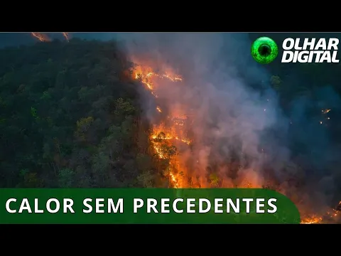

The last cited episode occurred between 2023 and 2024 and already had a significant impact on recent temperature records.
According to the data, 2023 ended as the second hottest year ever recorded, while 2024 took the top spot in the historical series.
This recent history increases concern about what may happen next. If a new event comes with even more force, the global thermal jump could lead 2027 to surpass marks that already seemed extreme.
What could change in Brazil and other regions of the planet
In addition to rising temperatures, the phenomenon could also alter rainfall distribution in various parts of the world.
The base text points to the possibility of drier conditions in Southeast Asia, Australia, southern Africa, and Northern Brazil.
At the same time, other areas may face more intense rainfall, such as the Horn of Africa, the southern United States, Peru, and Ecuador.
This shows that the advance of El Niño does not mean just more heat, but a broad reorganization of the climate on a global scale.
Hurricanes and extremes also come into focus
Another effect associated with this scenario is the intensification of hurricane activity in the central and eastern Pacific oceans.
This type of response reinforces how the phenomenon has the capacity to influence multiple atmospheric systems at the same time.
In other words, the risk of a new hottest year should not be seen merely as a temperature statistic.
It may be accompanied by more intense extreme events, regional droughts, and significant changes in atmospheric behavior.
Why the 62% forecast draws attention
The 62% probability for the formation of the phenomenon between June and August does not represent absolute certainty, but it is enough to place the topic at the center of climate attention.
In scenarios of this type, the weight of anticipation matters because it allows for closer monitoring of signs of strengthening in the oceanic and atmospheric systems.
If this trend is confirmed, the world could enter a new period of strong climate pressure. And, in this context, the possibility of 2027 becoming the hottest year ceases to be just a distant hypothesis and becomes a concrete projection.
What this scenario reveals about the coming years
The combination of a warmer ocean, recent temperature records, and the possibility of a more intense El Niño helps explain why the alert is so strong.
The described scenario points to a planet more vulnerable to extremes and a climate calendar that may continue to break records.
More than just a simple number in a ranking, the hottest year represents a signal of imbalance with real effects on rainfall, heat, agriculture, and atmospheric dynamics in various regions.
When the ocean’s temperature rises, the impact is not confined to the sea; it spreads throughout the entire climate system.
Do you believe that 2027 could really become the new hottest year in history?