Portuguese
  Spanish
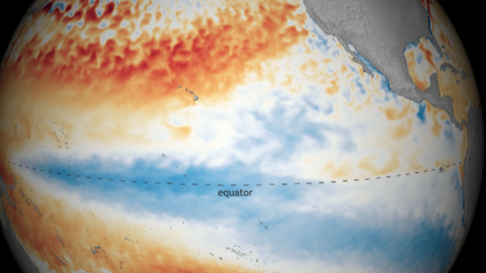
Equatorial Pacific warming reaches the technical threshold of El Niño and reignites global alert about possible climatic impacts in the coming months, with a trend of gradual intensification driven by subsurface heat still present in the ocean.
The Central-Eastern Equatorial Pacific has reached +0.5ºC sea surface temperature anomaly in the Niño 3.4 region, an area used as a reference for monitoring ENSO, the English acronym for El Niño-Southern Oscillation.
This data was released by the National Oceanic and Atmospheric Administration of the United States, NOAA, and marks for the first time in 2026 the entry into the minimum limit associated with the warm phase of the ocean.
What it means to reach +0.5ºC in the Pacific
This level is exactly on the border between neutrality and the characteristic warming of El Niño.
-
China Unveils 300-Ton Hybrid-Electric Truck as the Heavy Machinery of the Future

-
Brazilian mechanic invents simple solar lamp using water and chlorine in a PET bottle, providing up to 60 watts of light during the day

-
Swiss glaciers melting fast enough to fill an Olympic pool every 6 seconds, France confirms 3,700 heatwave deaths, and WMO predicts strong El Niño intensifying extremes until 2027

-
Sudden Sea Recession in São Paulo Sparks Tsunami Alert and Online Debate on Giant Wave Risks in Brazil


According to NOAA’s historical classification, values starting from +0.5ºC in the Niño 3.4 region fall within the warm phase interval, while neutrality ranges between -0.4ºC and +0.4ºC.
Still, simply reaching this value in a weekly reading is not enough, by itself, to officially declare the start of a consolidated event.
The mark draws attention because it interrupts a sequence of weeks without anomalies at this level and places the Pacific back in a more sensitive observation zone.
The last time this ocean range reached at least +0.5ºC was in early May 2024, a period when Southern Brazil was still suffering the effects of a very warm Pacific in the previous months.
Has El Niño started or not yet
Although the number falls within the range associated with El Niño, this does not mean that the phenomenon is fully established yet.
NOAA and other monitoring centers consider, in addition to sea warming, the persistence of the signal for several weeks or seasons and the presence of compatible atmospheric response, with changes in winds and tropical circulation.
In other words, the ocean may take the first step before the atmosphere follows.
When this coupling is not yet consolidated, the system remains in transition, even if the weekly anomaly reaches the classic threshold of +0.5ºC.
Therefore, the current reading is relevant as a sign of warming advancement, but it does not yet confirm the diagnosis of a classic El Niño episode in its mature form.
Warming trend until winter
The outlook, however, is for the continuation of warming in the coming weeks.
The movement is linked to the arrival of warmer waters at the surface, driven from west to east by a Kelvin wave, an oceanic mechanism that usually transports heat along the equatorial Pacific.
As there is still heat stored below the surface, the trend observed by monitoring centers is for a reinforcement of this short-term warming.
This process of subsurface warming helps explain why the Pacific signal changed so rapidly after a period of neutrality.
When large volumes of warmer water rise towards the surface, the Niño 3.4 region tends to respond with a more consistent high in anomalies.
It is precisely this type of evolution that usually precedes the configuration of El Niño events.
Comparison with intense historical events
The current value is still far from the major episodes recorded in recent decades, but historical comparison helps to gauge what sustained warming may represent.
In the 2023-2024 event, the weekly peak anomaly in the Niño 3.4 region reached +2.1ºC in November 2023.
In the 2015-2016 cycle, one of the most intense in the recent series, the reported weekly maximum for the same region reached +3.0ºC in November 2015.
In the 1997-1998 episode, another historical milestone of the phenomenon, the peak reached +2.3ºC in December 1997.
Before that, in the 1982-1983 event, the largest weekly anomaly recorded in the Central Pacific reached +2.6ºC at the end of December 1982.
These numbers show that the system is still far from an extreme scenario, but they also make it clear that initially modest warmings can evolve significantly over a few months.
Impacts of El Niño and La Niña on climate
El Niño occurs when the surface waters of the Equatorial Pacific become warmer than average and the easterly winds weaken in the region.
The opposite condition is La Niña, associated with cooler than normal waters and stronger trade winds.
In general, these episodes repeat at intervals of a few years, but vary greatly in duration and intensity.
The consequences spread far beyond the tropical ocean.
The interaction between sea and atmosphere modifies the distribution of rainfall, temperature, and circulation across different continents, which can lead to severe droughts in some areas and excessive rainfall in others.
These effects also impact agriculture, water resources, wildfires, food prices, and the economy.
Effects in Brazil and South America
In Brazil, the history shows known regional responses, although never identical from one event to another.
In the South, La Niña tends to increase the risk of drought, while El Niño is more frequently associated with episodes of heavy rainfall and floods.
In the Northeast, on the other hand, El Niño tends to increase the chance of drought, while La Niña favors more precipitation in part of the region.
Origin of the name El Niño
The origin of the name dates back to the 19th century, when fishermen on the Pacific coast of South America noticed that, in some years, warmer waters appeared around Christmas.
The warming reduced fishing and affected the livelihoods of coastal communities, especially in Peru, where the upwelling of cold, nutrient-rich waters is crucial for marine productivity.
By association with the Christmas season, these warm waters came to be called El Niño, a Spanish term linked to the baby Jesus.
During La Niña years, the opposite pattern favors the return of cold waters to the surface, which enhances nutrient transport and usually benefits fishing activity in areas of the eastern Pacific.