Portuguese
  Spanish
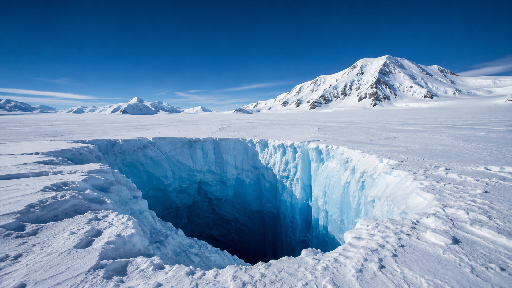
Scientists have discovered under the Denman Glacier in East Antarctica the deepest point of solid ground on the planet, hidden beneath kilometers of ice.
When talking about the deepest places on Earth, the most common image is that of the great ocean trenches of the Pacific. But one of the planet’s most impressive abysses is not in the open ocean. It is hidden beneath kilometers of ice in East Antarctica, below the Denman Glacier, in a region that has remained invisible for millions of years. According to the University of California, Irvine, new maps from the BedMachine Antarctica project revealed that the canyon buried under the Denman reaches 3,500 meters below sea level, the deepest point ever identified on solid ground.
The discovery drew attention not only for the size of the hidden relief but for what it represents for polar science. The Denman is not just a remote and colossal glacier. It is also a strategic area for understanding how Antarctica’s rocky base can influence ice stability and, in the future, the global sea level. According to the NASA Earth Observatory, the glacier’s grounding line retreated 5.4 kilometers between 1996 and 2018 in its western portion, precisely where the deep relief favors greater vulnerability to the advance of ocean water under the ice.
Denman Glacier hides a colossal canyon under thousands of meters of ice
The most impressive aspect of the discovery is that no one has ever seen this canyon directly. According to the University of California, Irvine, the depression is completely covered by the Antarctic ice sheet and could only be reconstructed through the combination of airborne radars, satellite data, and advanced computational modeling. The BedMachine Antarctica project gathered measurements from multiple scientific campaigns to generate the most accurate portrait ever made of the rocky base beneath the continent’s ice.
-
Ferrari, BMW, Tesla, and Chinese Automakers Shift from Copper to Aluminum Wiring to Reduce Weight and Costs in Electric Vehicles

-
Brazilian Researcher Unveils Innovative Intraocular Lens for Cataract Treatment with High-Precision Optics, Enhancing Vision at Multiple Distances and Reducing Unwanted Visual Effects

-
World’s Largest Particle Accelerator Begins Four-Year Hiatus for Magnet Overhaul, Aiming to Hunt Dark Matter by 2030
-
“Sahara Dust Turns Rain Red, Startling Residents Across Europe”


Until the publication of the new maps, scientists already knew there was a valley under the Denman, but they had no exact notion of its depth. According to the researchers, the actual relief appeared much more extreme than previous estimates suggested, revealing a subglacial landscape dramatically deeper and more complex than imagined.
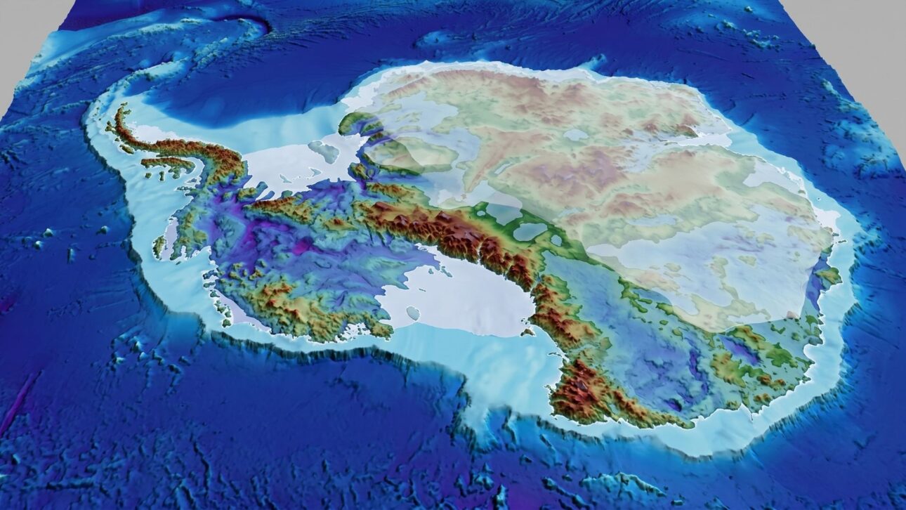
This changed the geographical reading of Antarctica. Instead of a relatively uniform base under the polar ice cap, the continent began to appear as a structure marked by deep valleys, buried mountains, rocky ridges, and gigantic depressions, many of them invisible on the surface.
The deepest point on land is in East Antarctica and cannot be seen with the naked eye
The case of Denman is fascinating because it challenges the way people normally think about extreme geography. Unlike famous canyons, deep deserts, or large exposed faults, the deepest point on land cannot be visited or observed directly. It is sealed under a colossal mass of Antarctic ice.
According to the University of California, Irvine, the canyon lies beneath a glacier that flows towards the Mawson Sea in East Antarctica, and the buried terrain descends to about 3.5 kilometers below sea level.

This scale helps to understand why the discovery had such an impact. What seemed like just a vast white surface actually hid a gigantic and deeply embedded geography, preserved out of human sight. The real landscape of Antarctica remains, for the most part, a landscape revealed by instruments and calculations, not by direct observation.
This is precisely what makes Denman so symbolic. Even in the satellite era, one of the planet’s greatest geographical secrets remained hidden until new mapping tools could penetrate the ice and reconstruct what lay beneath it.
BedMachine Antarctica project changed the real map of the frozen continent
According to the University of California, Irvine, the BedMachine Antarctica project was led by Mathieu Morlighem and gathered radar data from multiple institutions to create a new generation of Antarctic maps. The technique uses the physics of ice flow to fill in the areas between direct measurement lines much more accurately, producing a much more reliable bedrock model than previous maps.

This advance not only served to locate the Denman Canyon. It also revealed hundreds of subglacial features previously poorly resolved or completely unknown. The scientific consequence was immediate: Antarctica came to be understood as a much more complex subterranean continent, with regions potentially more vulnerable to ocean warming and ice retreat.
In the case of Denman, the new map showed that the deep valley connects to a broad geological structure, forming a potentially sensitive route for warmer water intrusion beneath the glacier’s base. It is this combination of extreme depth and glaciological relevance that has placed the region among the most observed in East Antarctica.
Denman Glacier’s Retreat Worries Scientists Due to Subglacial Valley Shape
According to the NASA Earth Observatory, the Denman Glacier has lost ground at its grounding line over more than two decades. Between 1996 and 2018, the line retreated 5.4 kilometers in its western portion. The grounding line is the region where the ice stops resting on the ground and begins to float, and its displacement is an important indicator of a glacier’s stability.
What worries researchers is the basal topography. According to NASA, the western side of Denman rests on a deep valley that descends towards the interior of the continent. This type of configuration can facilitate the entry of relatively warmer ocean water beneath the ice mass, favoring further losses of stability if the retreat continues.
This does not mean immediate collapse, but it explains why Denman has come to be monitored with such close attention. The size of the hidden canyon is not just a geographical curiosity. It directly influences how the glacier responds to the ocean and, therefore, its potential future contribution to sea level rise.
Earth’s Largest Continental Abyss Remains Invisible Beneath Antarctic Ice
The most fascinating aspect of the story is that the deepest place ever identified on land remains completely invisible to those who tread in Antarctica. Above it, there is a thick layer of ice that totally hides the landscape. There is no exposed cliff, no natural lookout, no grand scene like in the famous canyons of the planet. There is only ice, wind, satellites, radars, and digital models.
The discovery of the canyon under the Denman Glacier showed that some of Earth’s greatest geographical secrets are not yet in the depths of the ocean or in unexplored tropical areas, but buried under a frozen continent that continues to reveal new surprises even in the space age. And in the case of Denman, the geographical secret also became a climate alert.