Portuguese
  Spanish
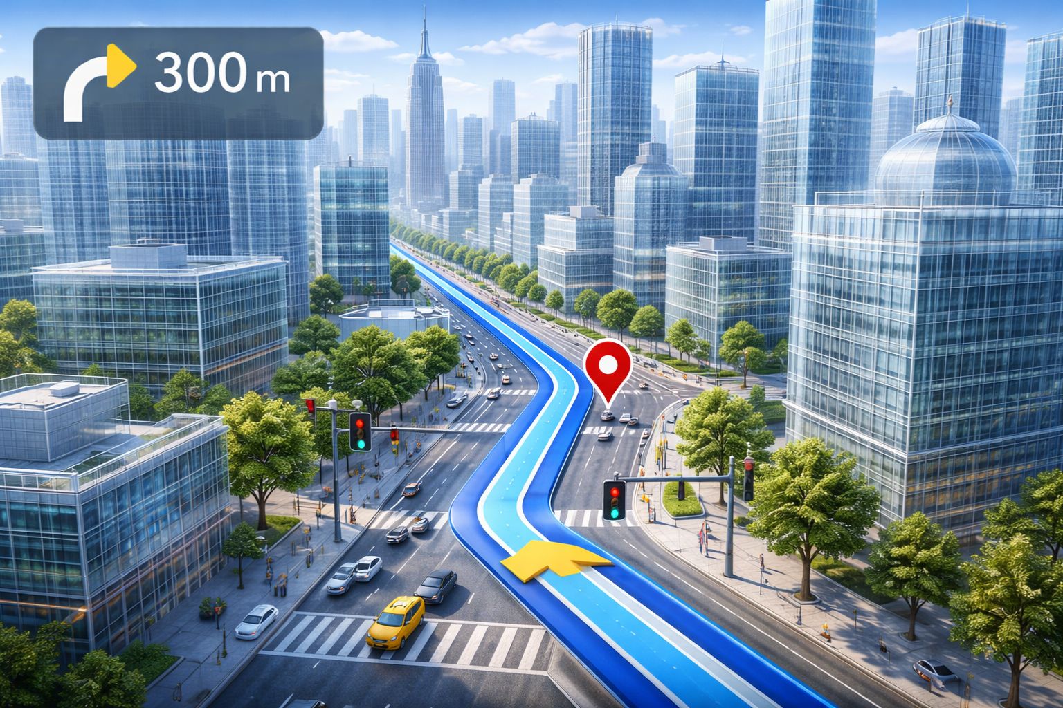
Google Maps receives its biggest update in years with two Gemini-based innovations: Immersive Navigation, which transforms the flat map into a 3D environment with buildings, traffic lights, and visible lanes, and Ask Maps, a chat assistant that understands questions in natural language. The update begins in the United States and will be gradually expanded.
The Google Maps you know is about to change radically. On March 12, 2026, Google announced two innovations that tackle the oldest problem of any navigation app: too much information and not enough clarity. Immersive Navigation transforms the classic top-down view into a 3D environment where buildings, bridges, traffic lights, lanes, and crosswalks appear as they do in the real world, and Ask Maps is a conversational assistant that understands questions written in natural language, without needing exact keywords. Both features were developed based on Gemini artificial intelligence models and represent the biggest overhaul of Google Maps in years.
The change addresses a frustration that any driver knows. Google Maps, until now, was essentially a flat map with lines over stylized blocks, requiring the driver to constantly interpret instructions like “in 300 meters, turn right” in scenarios where there are three possible turns ahead. The 3D navigation eliminates this ambiguity by showing the driving environment as it really is, with perspective, depth, and visual elements that the driver can recognize through the window. Ask Maps, in turn, allows searching for places with phrases like “cozy cafes where you can still work after 10 PM,” instead of combining keywords in the search bar.
What changes in Google Maps navigation with the 3D mode
According to information from the Forbes portal, Google Maps’ Immersive Navigation definitively moves away from the simplified aerial view that has defined navigation apps for over a decade. The system combines Street View images and aerial photos that Gemini analyzes and transforms into a detailed 3D model of the surroundings, displaying elements that were previously invisible or difficult to perceive on the flat map. Lanes appear separated with clear markings, traffic lights and stop signs become visible, crosswalks are highlighted, and differences in road elevation are accurately represented.
-
Artist’s 15-Meter Lighthouse in the Mojave Desert, 160 km from the Sea, Intrigues Visitors with 19 km Range After Years of Bureaucracy

-
Bluetti AC70 Solar-Powered Station: Powers Fridge and Wi-Fi During Blackouts, Delivers 1,000W, 3,000 Charge Cycles, Priced at $900

-
Enormous Black Hole Phoenix A* Challenges Scientific Understanding with Mass of 100 Billion Suns, Surpassing Famous TON 618 in One of the Largest Known Galaxy Clusters
-
Say Goodbye to Storing Wine in a Regular Fridge: Midea’s Climate-Controlled Cellar Holds 34 Bottles, Maintains 5-18°C, and Uses Only Half a kWh Daily


The difference is more practical than aesthetic. In confusing points like intersections of multiple lanes, highway exits, and complex roundabouts, Google Maps now automatically zooms in the image and makes certain buildings partially transparent to clear the view of the street layout. This solves the problem of last-second maneuvers when the driver cannot distinguish which is the correct exit on a flat map. For those driving in large cities with tight intersections surrounded by buildings, the change can be the difference between taking the right path and missing the exit.
How Google Maps Will Talk to the Driver Differently
In addition to the visual revolution, Google Maps is reformulating how it guides the driver by voice. The well-known mechanical voice with stiff phrases gives way to a more flexible style that adapts to the context of the road, bringing the instructions closer to what the driver actually sees. Instead of “in 300 meters, turn right,” the app might say something like “pass this exit and take the next right,” referencing recognizable visual elements like a fork, a building, or an obvious exit.
This change may seem subtle, but it has a real impact on the driving experience. Google processes several million traffic data points per second, including congestion, accidents, and flooding, as well as millions of alerts sent daily by the community about construction, blockages, and obstacles on the road. All this volume of information feeds both route calculations and Google Maps’ 3D navigation, allowing voice directions to consider not only the geometry of the street but also real-time conditions.
The Ask Maps: The Chat Assistant That Changes How You Search on Google Maps
The second major novelty is not in navigation, but in search. Ask Maps is a conversational assistant integrated into Google Maps that uses the Gemini model to interpret free-text questions, eliminating the need to think in “search mode” with combined keywords. Phrases like “where can I find family-friendly hotels with a pool near a ski resort” or “which neighborhoods are lively at night but not too noisy” are now directly understood by Google Maps.
The difference with Ask Maps is that the answers come with context, not just lists of addresses. The assistant cross-references reviews, photos, location data, and opening hours to explain why a particular place was suggested, what its most common strengths and weaknesses are, and even how to combine multiple destinations along a route. For travelers, Google Maps approaches the experience of a personal guide that understands open-ended questions and offers suggestions that go beyond distance and price.
The Alternative Routes That Google Maps Now Explains Better
Another relevant change is in the way Google Maps presents alternative routes to the driver. Previously, the app showed several routes without making it clear what differentiated each one. With the update, Google Maps now explains what concessions each route involves: a faster route with tolls, a longer free route with less traffic, or an option focused on fuel economy with a lower average speed.
This transparency allows the driver to make more informed decisions within Google Maps. For those who take fixed routes, the feature is particularly useful because traffic and construction change quickly, and the best route on Tuesday may not be the best on Thursday. Google Maps processing these variables in real-time and presenting the differences clearly is an advancement that directly affects how much time, money, and stress each trip will cost.
What the Google Maps update means for the future of navigation
The combination of 3D visualization and conversational assistant in Google Maps signals a broader trend. The app is moving from being a consultation tool to becoming a complete navigation environment, where driving and searching for places integrate into a seamless experience powered by artificial intelligence. A family can organize the route, ask Ask Maps for a playground with coffee along the way, choose the toll-free route, and continue their journey with navigation that shows the environment realistically.
However, the dependence on Google Maps also increases with these new features. The more decisions the app anticipates and the more natural it becomes, the greater the temptation to relax one’s attention to the road, a risk that no software update can resolve. The 3D view is a support, not a substitute for attention in traffic. The update starts in the United States and will gradually expand to other regions, including Brazil. When it arrives, the Google Maps you knew will no longer be the same.
Google Maps gains 3D navigation and a chat assistant with AI. Do you think these changes will help or distract the driver? Do you already use Maps as your main navigation app? Leave your opinion in the comments.