Portuguese
  Spanish
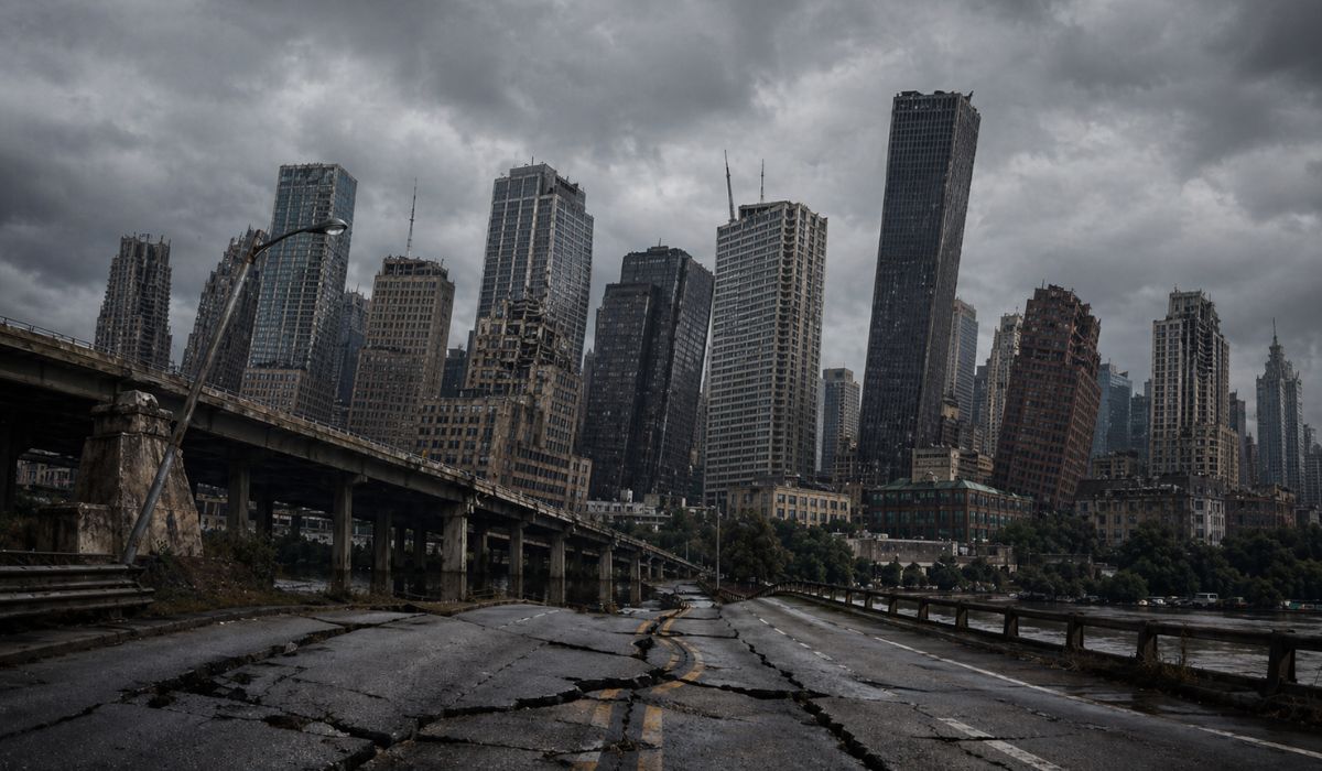
Satellite images reveal subtle movement beneath major urban centers in the United States and help to quantify a phenomenon that advances slowly, affects different types of terrain, and increases attention on the infrastructure of these metropolises.
A study published in Nature Cities journal identified soil subsidence in 28 major US cities and pointed to risks for urban structures such as buildings, bridges, highways, dams, and pipelines.
According to the research, all analyzed cities have at least 20% of their urban area sinking, while approximately 33.8 million people live in areas with this type of ground movement.
Researchers also estimated that more than 29,000 buildings are in zones classified as high or very high risk for damage.
-
She spent 73 years breathing inside an iron lung, survived the aftereffects of polio, and became the last woman in the United States dependent on the equipment before dying at 78 years old.

-
Brazilian students created a $1 filter using pine bark, cotton, and 3D-printed parts to clean cassava wastewater, reduce the toxicity of a hazardous waste, and transform contaminated water into biofertilizer.

-
Astronaut from Artemis II steps down after mission to the Moon and decision surprises after a record of 406,771 km, a historic 10-day journey, and an unprecedented achievement for Canada.

-
A fossil kept for years in a small museum in Montreal concealed 450-million-year-old soft tissue, a discovery that has only happened once before in history.


According to the authors, the main problem is that this process usually progresses gradually and can compromise infrastructure without immediate signs, with impacts only becoming visible when they are already severe or, in the words of the study, “potentially catastrophic”.
How the study measured subsidence in US cities
The analysis was conducted using images from Sentinel-1 satellites, between 2015 and 2021, to observe the vertical movement of the ground in the 28 most populous US cities with over 600,000 inhabitants.
With this method, the team was able to measure altitude variations on a millimeter scale and map differences within the same city.
The results indicate that sinking does not occur uniformly.
In several cases, neighboring areas show distinct behaviors, with sections undergoing subsidence next to stable zones or areas with slight elevation.
According to the authors, this spatial difference is one of the factors that most impacts infrastructure risk, because it increases the chance of unequal deformations in foundations, pavements, and urban networks.
In all 28 cities evaluated, at least one-fifth of the urban area is sinking.
In 25 of them, subsidence affects at least 65% of the territory.
The group with the largest extent of the phenomenon, with about 98% of the area affected, includes Chicago, Dallas, Columbus, Detroit, Fort Worth, Denver, New York, Indianapolis, Houston, and Charlotte.
In addition to mapping the ground, the study cross-referenced this data with the location of approximately 5.6 million buildings.
Most appear in low or moderate risk ranges, but researchers identified urban pockets where uneven ground movement can increase the likelihood of cracks, unevenness, and structural wear.
Groundwater extraction and causes of subsidence
According to the article, about 80% of the subsidence observed in the analyzed cities is associated with groundwater withdrawal.
The process occurs when aquifers are exploited at a faster rate than their replenishment capacity.
In these cases, the geological material can compact and cause surface lowering.
The research emphasizes, however, that subsidence does not have a single cause.
In some cities, ground movements are also linked to natural processes.
These include glacial isostatic adjustment, related to the slow accommodation of the Earth’s crust after the retreat of ancient ice sheets, and tectonic or sedimentary factors, more present in areas of the Western United States.
This combination helps explain why a city’s average alone does not summarize the local risk.
Even where the average movement is smaller, the existence of critical points can pose a greater threat to infrastructure than a more homogeneously distributed sinking.
Houston, Dallas, and other cities with greater ground sinking
The highest average subsidence rates appear in Texas cities.
Houston, Fort Worth, and Dallas recorded average rates exceeding 4 millimeters per year, according to the survey.
In Houston’s case, the research identified the most intense situation among the 28 cities studied.
In the Texan city, 42% of the area sinks more than 5 millimeters per year, while 12% records a drop exceeding 10 millimeters annually.
The authors observe that the regional situation involves strong pressure on underground water resources and, in some locations, interaction with other economic activities that affect the subsurface.
Still according to the study, these numbers do not mean that the entire city is sinking at the same rate.
The mapping shows areas with different speeds, and this variation, in the researchers’ assessment, is a central point for understanding the potential for damage to urban structures.
New York, Chicago and the urban weight of subsidence
New York appears among the cases with the largest population weight.
Alone, the city concentrates 26% of the total population living in subsidence areas among the 28 analyzed.
This data expands the relevance of the phenomenon from an urban perspective, because it involves a dense network of housing, transport, and services.
The study also identified stretches with subsidence exceeding 5 millimeters per year in areas of LaGuardia airport.
For the authors, this type of information reinforces the need to observe the internal distribution of sinking, and not just the general average of each municipality.
In Chicago, the survey indicated an average vertical movement exceeding 2 millimeters per year, with at least 10% of the area sinking more than 3 millimeters annually.
The city also appears among those where subsidence is more widespread across the territory.
West Coast, sea level and other risk factors
On the West Coast, the study indicates that the vertical movement of the soil may be linked, in part, to tectonic activity.
This is the case for cities like San Francisco, Seattle, and Portland, where subsidence adds to local geological characteristics.
In the case of San Francisco, the authors also highlight the combination of ground subsidence and rising sea level.
Los Angeles, San Diego, and Jacksonville also appear among the coastal cities where these factors can act simultaneously, increasing pressure on more vulnerable urban areas.
The research notes that not all cities had a negative average elevation.
Memphis, San Jose, and Jacksonville recorded a slight gain in altitude in the weighted average value.
Even so, this does not eliminate the presence of internal areas undergoing subsidence nor does it remove the risk associated with uneven ground deformation.
What the study points to for urban infrastructure
The authors state that the problem tends to worsen when cities grow over areas already subject to subsidence and increase the demand for groundwater.
Under these conditions, the impact can reach drainage systems, runways, buried networks, foundations, and structures built on soils more susceptible to compaction.
The study does not treat subsidence as a sudden event, but as an accumulative process.
According to the researchers, small changes over time can increase points of fragility and raise the risk of damage, especially in dense and expanding urban areas.
The data also shows that the phenomenon is not restricted to coastal cities nor to a single type of geological environment.
There are cases on the coast, inland, in regions with strong water exploitation, and in areas influenced by natural processes.
Given this scenario, the research expands the mapping of a problem that occurs below the surface and does not always appear immediately in urban daily life.