Portuguese
  Spanish
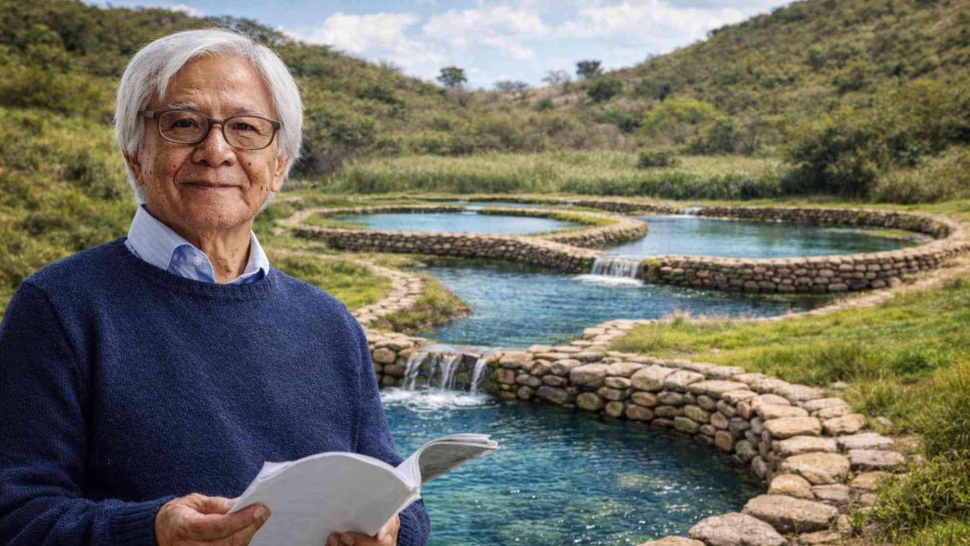
Based on Historical Research and Community Mobilization Begun in 2005, the Rescue of an Indigenous Pre-Inca System with About 250 Artificial Lagoons on Cerro Pisaca Allowed for the Storage of Rainwater, Recharge of Aquifers, and Ensure Continuous Supply in One of the Driest Regions in Southern Ecuador
The indigenous system of 250 artificial lagoons on Cerro Pisaca, recreated since 2005 in Catacocha, in southern Ecuador, allows for the storage of up to 182,482 cubic meters of rainwater, ensuring continuous supply, stable agricultural production, and recharge of aquifers in one of the driest regions of Loja province.
An Area Marked by Historical Water Scarcity
Catacocha, a small town in the Paltas district, has historically faced an extremely dry climate, high temperatures, and rainfall concentrated in just two months of the year. Between January and February, practically all of the annual rainfall in the region occurs.
Outside of this short period, the absence of precipitation was almost absolute. In exceptional years, it could rain in March. By April, that was already considered extraordinary. During the rest of the year, the landscape remained barren, with dry soils and quickly depleted water reserves.
-
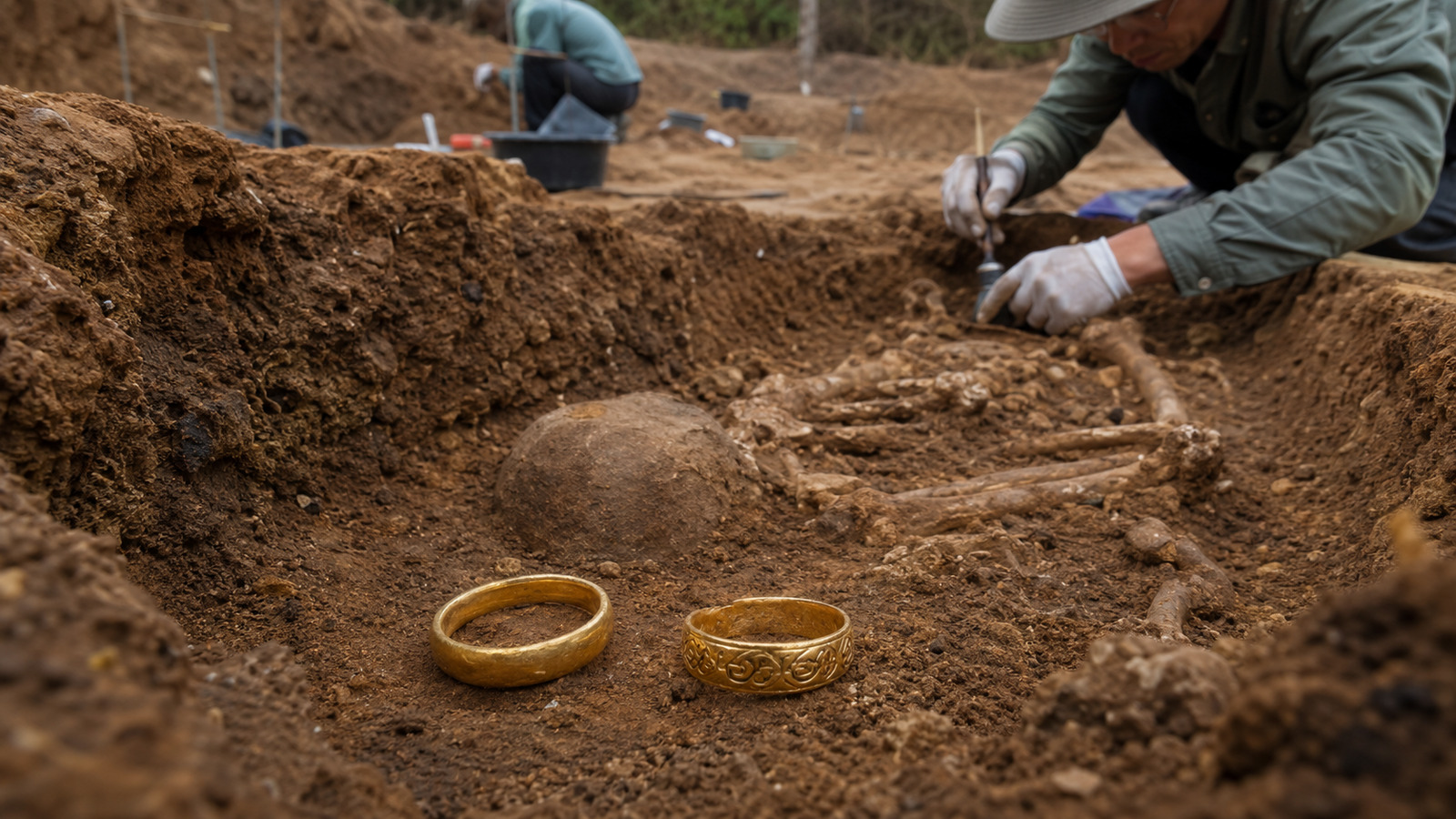
Forgotten Map Leads Diver to Shipwreck with Gold, Rare Jewels, and Secrets Hidden for Nearly 350 Years

-
Furong: The 2,000-Year-Old Chinese City Built on a 60-Meter Waterfall Becomes a Global Tourist Phenomenon

-
YouTube Inventor Dubbed “Real-Life Tony Stark” Builds Robotic Legs for Father’s Day, Creating a Wheelchair That Conquers Stairs and Rough Terrain
-
Brazilian Scrap Dealer Processes 3,000 Tons of Ferrous Scrap Monthly, Paying $0.09 to $0.70 per Pound, Reveals Why a Hidden Cylinder Costs 1,500 kg Discount


This reality directly affected daily life. In communities like San Vicente del Río, located in the mountains of Catacocha, access to water was limited to just one or two hours a day during the most critical periods.
Families organized their routines based on this rationing. The available water was only for cooking and drinking. To wash clothes or utensils, it was necessary to walk to a stream or the nearest river.
The walk to the stream took about 15 minutes. To reach the river, the journey could take up to an hour, depending on each person’s pace. In years of more intense drought, even these sources did not provide sufficient volume.
Daily Life Under Severe Rationing
Rosa Imelda Arias lives in San Vicente del Río, in an adobe and tile house, like many others in the community. Over the years, several homes have been abandoned as their residents migrated to urban areas in search of better conditions.
The facade of Arias’s house has been transformed into a garden filled with plants grown in small plastic pots. The colorful space contrasts with the arid landscape around it and has been built over 15 years.
During the most critical period of scarcity, Arias recalls that water only arrived for four hours a day, divided between morning and evening. Even then, there were occasions when the supply was even more restricted.
According to her, before the recovery of the water system in the mountains, “there was not enough water.” The dependence on distant sources was part of the routine and limited any agricultural activity or animal husbandry.
The situation began to change when the community started referring to the water that came “from up there,” an expression used to indicate Cerro Pisaca, the place where the indigenous system was gradually recovered.
The Recovery of Pre-Inca Knowledge
Since 2005, residents of Catacocha have been recreating a system for collecting, storing, and distributing water conceived by the Paltas, an indigenous people who inhabited the region over one thousand years ago, in the pre-Inca period.
The system consists of 250 artificial lagoons dug into the mountain, designed to capture rainwater, control its infiltration, and gradually and continuously recharge the underground aquifers.
Thanks to this method, communities located in areas classified as deserts now have water available year-round, even in extreme dry months, as well as more abundant harvests and well-nourished animals.
Rosa Imelda Arias claims that, after the implementation of the system, the supply became continuous. Today, she raises chickens, pigs, and has a garden behind her house, growing oranges, tangerines, bananas, and medicinal plants.
Among these plants is the parietaria, which she uses to relieve stomach pains. This type of cultivation was unfeasible before the system was restored, due to irregular access to water.
Perceptible Change in the Routine of Communities
The perception of transformation is shared by other residents. Rosaura Cobos, who works in a small store in San Vicente del Río, reports that previously the supply was alternated between sectors of the community.
One day, water would reach the lower houses. The next day, it would go to the higher areas. In both cases, the supply lasted only a few hours. Currently, according to her, water is available all day long.
At the time of the report, around noon, the sun was intense, dust dominated the environment, and the wind was constant. Still, the presence of running water made daily life more stable.
The most significant difference is in the underground storage. Controlled infiltration ensures that water captured in just two months of rain lasts until the beginning of the following year when new precipitation occurs.
Even in August, considered the peak of the dry season, some lagoons still maintain sufficient volume to sustain the system until January, ensuring continuity in supply.
The Historical Investigation That Changed the Scenario
When asked about the origin of this transformation, residents often mention “the historian.” This is Galo Ramón, a native of Catacocha, who grew up hearing the legend of Torito Cango and stories about lagoons considered dangerous.
According to oral tradition, some lagoons were avoided due to their association with snakes or supernatural events. These narratives persisted for generations and contributed to the gradual abandonment of the structures.
Ramón studied history in Quito, and although he remained in the capital, he maintained an interest in finding solutions to drought in his hometown. For him, water has always been a central issue in the region.
During a documentary investigation, he found records of a land conflict that occurred in 1680 between the communities of Coyana and Catacocha and an owner named Hortensio Celi. The dispute involved a lagoon located in Pisaca.
The documents did not indicate the winner of the dispute but contained a detailed drawing of the lagoon. When analyzing the image, Ramón realized that it was not a lagoon fed by a watershed.
On the contrary, the lagoon appeared to be the element that allowed the existence of watersheds at lower levels. From this observation, he concluded that the stored water came directly from the rain.
Understanding the Hydrological System of the Paltas
Ramón identified that other hills in the region also had similar lagoons, accompanied by their own legends. Although different in details, these stories presented similar narrative structures.
According to him, the Paltas developed the system by recognizing the recurrence of severe droughts. The rains, though scarce in number of days, were torrential and concentrated.
In just two months, up to 700 millimeters of rain could fall. To cope with this pattern, it was necessary to make the most of each heavy downpour, storing the water and controlling its infiltration into the soil.
The goal was to gradually recharge the underground aquifers, preventing losses through surface runoff. Small containment walls and stone reservoirs near the orchards complemented the system.
These reservoirs allowed for controlled irrigation of agricultural areas, ensuring production even during long periods without rain. The system functioned as an integrated network of collection, storage, and redistribution.
Estimates About the Origin of the System
It has not been possible to determine precisely when the system was created. However, Ramón estimates that its development occurred around the year 900 of our era.
This estimate is based on the fact that the most significant growth of the Palta people occurred after the year 500. The improvement of the system is believed to have been gradual over the centuries.
To identify ideal locations for the lagoons, the Paltas observed what Ramón refers to as the “green line.” Even in August or September, some deep-rooted plants withstood the drought.
These plants indicated the presence of underground aquifers. It was at these points that the lagoons were built, maximizing the efficiency of infiltration and water recharge.
Abandonment and Disappearance of the Lagoons
With the arrival of the colonial period, the lagoons began to gradually dry up. Forced by conquerors and the imposition of a new religion, the communities stopped using them.
The first lagoon to disappear was the one in Catacocha in 1605, exactly where the city was founded. According to Ramón’s records, the last to dry up was the lagoon of Pisaca, which still had water about 80 years ago.
The Paltas performed offerings and rituals related to the lagoons, practices that were not described in written records. For the Spanish, especially the priests, this cult was seen as a threat.
To combat it, myths were spread that the lagoons were demonic, inhabited by snakes, capable of impregnating women or causing murders of men who approached.
At the same time, water began to be presented as a gift from a deity associated with the new religion, conditioning rain to prayer and not to the management of the territory.
The Creation of a New Myth as a Community Strategy
Upon understanding the functioning and history of the system, Galo Ramón concluded that it was necessary to reapply the knowledge of the Paltas. In 2005, he tried to convince the residents to recover the lagoons.
The initial reception was cold. The population was predominantly elderly, with few young people, and showed no enthusiasm for the proposal. The idea seemed distant and impractical.
In light of this, Ramón decided to create a new narrative. He wrote a story called “The Return of Torito Cango,” described by him as a myth in reverse.
In the new version, the bull would return if people created lagoons again with suitable pasture. Water would return when the correct conditions were restored.
This narrative sparked interest in the community and facilitated the beginning of the recovery process. The first rehabilitated lagoon became known as the lagoon of snakes.
The Construction of New Lagoons
Galo Ramón leads the Fundación Comunidec, an organization dedicated to the defense of water, human rights, and culture. With support from international cooperation, local residents participated in a large community minga.
In five years, in addition to rehabilitating the two largest original lagoons, 248 other lagoons were built, totaling 250 artificial lagoons in operation.
Some lagoons were dug with excavators. Others were made manually to minimize environmental impact and protect the local ecosystem.
The process involves removing the top layer of soil, about 30 centimeters, which is reserved for later replacement. The shape of the lagoon cavity is similar to a spoon, rather than a deep pool.
After excavation, the organic soil is replaced and seeded with Bermuda grass, a hydrophilic species that allows controlled filtration of water.
From above, the lagoons form a system resembling bleachers. The two largest lagoons, located at the center, capture rainwater and initiate the cascade infiltration process.
Storage Capacity and Technical Data
The 28 lagoons closest to Cerro Pisaca, in the area known as “the reserve,” have a total storage capacity of 182,482 cubic meters, equivalent to 48.2 million gallons.
The largest lagoon in the system holds 78,422 cubic meters, or 20.7 million gallons. The smallest, located on private property, has a capacity of only 143 cubic meters, or 37,700 gallons.
This data is included in the book Ecohydrology and Its Implementation in Ecuador, published with support from UNESCO, the ecohydrology program, the Paltas city council, and Ingeraleza.
The gradual infiltration ensures that the water reappears further down, in natural springs, feeding communities and agricultural areas throughout the year.
Conservation, Reforestation, and Territorial Management
In December 2010, Nature and Culture International acquired an area of 406 hectares around Pisaca for US$ 160,000, forming what is called the reserve.
The goal was to ensure the conservation of the territory, remove cattle from the forest, and enable reforestation, creating suitable conditions for water collection and distribution.
According to José Romero, an agronomy engineer and spokesperson for the organization, Pisaca is one of the most important centers of Palta culture and the site where the system was developed and perfected.
The removal of cattle allowed for significant advances in restoring vegetation cover and ensuring the permanent maintenance of the lagoons, securing the effectiveness of infiltration.
The first sowing work began on February 12, 2011, with seeds from a community nursery. In 2012, water councils and an ecological school club joined the effort.
Reforestation occurred through active sowing, enrichment of recovering areas, and natural regeneration in isolated zones to prevent animal entry.
In total, 240 of the 406 hectares were targeted for intervention. Of these, 40 hectares were directly managed by Nature and Culture International and 200 hectares by the Mancomunidad Bosque Seco.
Between 2011 and 2020, at least 40,000 plants were sown. Of these, about 12,000 survived. Mortality varied between 50% and 60%, due to soil conditions.
The species selected included carob, walnut, fig, and other native trees, as well as primary succession species that aid in water filtration.
Institutional Recognition and Future Challenges
In 2013, the municipality of Paltas declared the lagoon area as a zone of conservation and sustainable use, recognizing its importance for the supply of Catacocha.
In 2018, UNESCO’s International Hydrological Program included the site in its list of demonstration sites in eco-hydrology, as an example of a solution applied to social and environmental problems.
Currently, there are nine such sites in Latin America and the Caribbean, with two in Ecuador, two in Colombia, and one each in Brazil, Argentina, Chile, Costa Rica, and the Bahamas.
Despite the success, there are concerns for the future. The next goal is for the Ministry of Environment to declare the area as a Water Protection Area.
This would prevent changes in land use and prohibit extractive activities. The urgency arises from the existence of a mining concession granted to the Australian company Titan Minerals.
According to information from the magazine Minergía, the company’s main project is the Dynasty gold project, with estimated resources of 2.1 million ounces and a grade of 4.5 grams per ton.
The Ministry of Environment confirmed that the declaration is in process and that if implemented, Pisaca will be integrated into the National System of Protected Areas, formalizing its conservation.
Direct Impact on the Lives of Families
For residents like Antonio Díaz, 85, the system represents stability and autonomy. He lives in Santa Gertrudis, another village at the foot of Cerro Pisaca.
Every morning at 6 a.m., Díaz climbs the hill on his donkey to check the lagoon that irrigates his property. He adjusts the sprayers and ensures the hydration of his entire crop.
Previously, he could only cultivate two small rows. Today, he sows up to 10 rows, maintaining constant production even during drought. Water, he says, is the most important thing.
In his garden, he grows vegetables, coffee, bananas, cassava, corn, peanuts, and beans. Part of the production is consumed by the family, and the surplus is sold in the local market.
Díaz claims to earn about US$ 70 per month from these sales. He also raises chickens, pigs, cows, a donkey, and dozens of guinea pigs that roam freely around his house.
Despite his age, he maintains an intense work routine. After taking care of irrigation, he needs to weed the land and feed the animals. “I don’t have enough time in the day,” he says, always smiling.
The restored system has transformed these communities’ relationship with water, allowing a region historically marked by scarcity to maintain continuous supply even under extreme climatic conditions.
Source: Mongabay