Portuguese
  Spanish
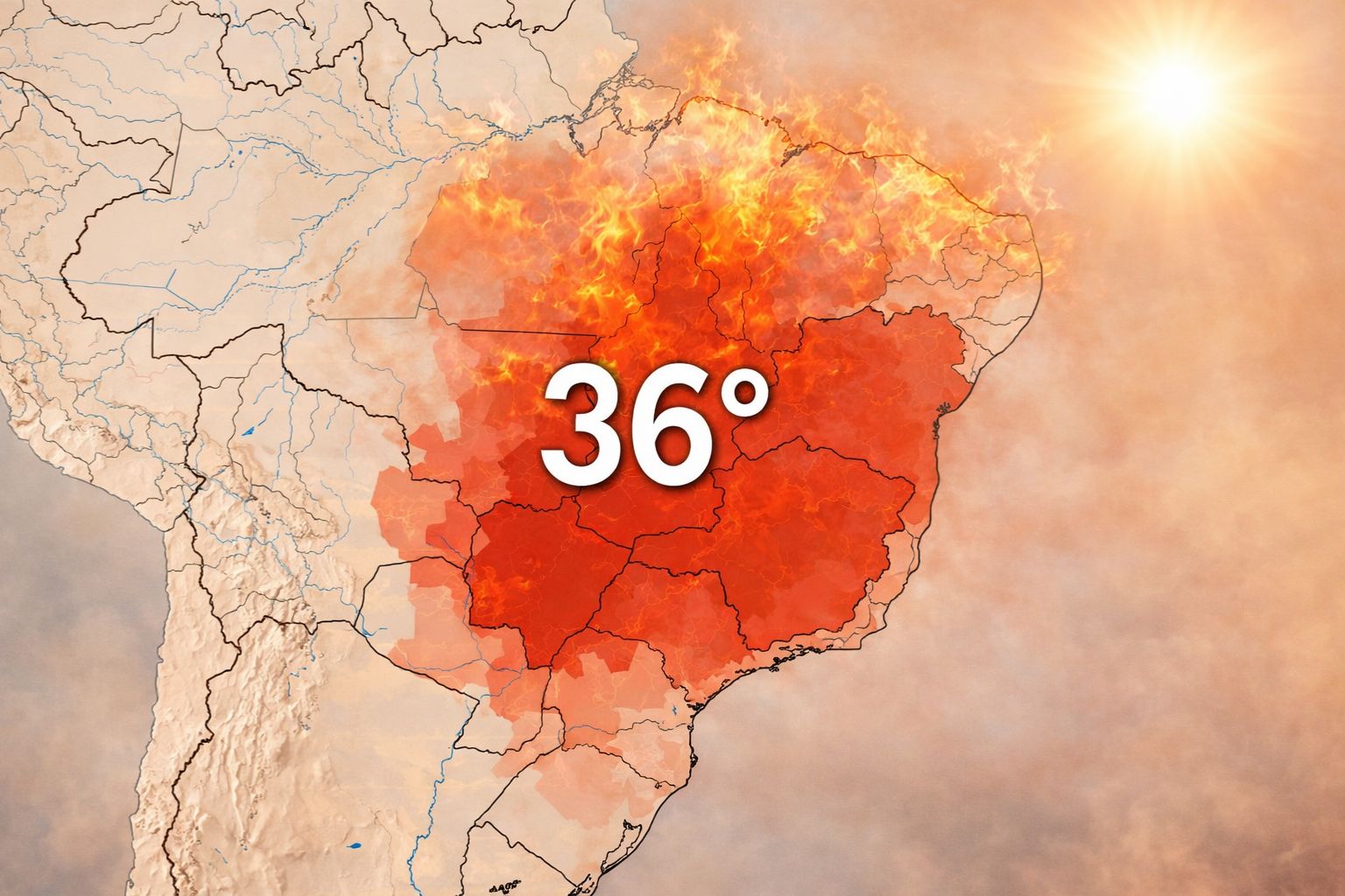
A new mass of hot air should reach six Brazilian states by the end of this week, with maximum temperatures of up to 36°C in Northern Paraná, Southern Mato Grosso do Sul, Western São Paulo, Triângulo Mineiro, Southern Goiás, and Southern Mato Grosso. The forecast indicates anomalies of 3°C to 6°C above average, with no rain in sight.
A new mass of hot air is advancing over central Brazil and is expected to raise temperatures to up to 36°C in six states in the coming days. The phenomenon occurs following a cyclone forming over Southern Brazil between this Wednesday (15) and Thursday (16), bringing cloudiness and heavy rains to Rio Grande do Sul, but not advancing to other regions of the country. With the absence of systems capable of causing rain and temperature drops in central Brazil, the mass of hot air gains ground and is associated with a high-pressure area that keeps the weather dry and stable, creating ideal conditions for an out-of-season heat peak.
According to Meteored, the states most affected by the mass of hot air are Paraná (Northern region), Southern Mato Grosso do Sul, São Paulo (Western region), Minas Gerais (Triângulo Mineiro), Goiás (Southern region), and Mato Grosso (Southern region). The forecast indicates thermal anomalies between 3°C and 6°C above average for this time of year, meaning that temperatures that would normally be around 28°C to 30°C could reach 34°C to 36°C in several cities in these regions. The scenario is of hot and dry weather in parts of the South, Midwest, and Southeast, with rainfall well below average.
Which states will be affected by the mass of hot air this week
According to information from the portal ndmais, the mass of hot air advancing over Brazil has a well-defined geographical reach. Northern Paraná is one of the areas where temperatures are expected to rise most intensely, with maximums that can reach 36°C in cities like Londrina, Maringá, and Umuarama. The entire Southern Mato Grosso do Sul is on the route of the mass of hot air, especially in Campo Grande and Dourados, where the dry heat tends to be more intense in the afternoon.
-
The large jar blender has a rival: Oster Ultra Power bets on 1,000 W, six stainless steel blades, and two portable cups with leak-proof lids.

-
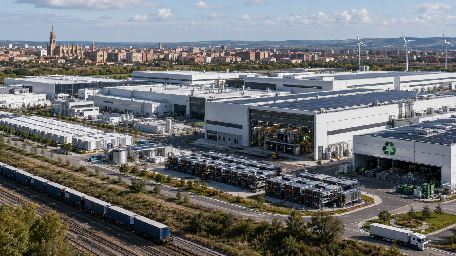
Tesla injected an additional $250 million into the German factory, doubled the battery cell target, and opened its own production line for startups.

-
No more TV stuck on the wall: Samsung The Freestyle+, the new projector with over 400 lumens projects on walls, floors, and ceilings, bringing cinema to any corner of the house.
-
A Japanese governor single-handedly stalled the construction of the world’s fastest train for nine years, and only now has he agreed to allow a tunnel excavated at a depth of 1,400 meters.


In the Southeast, the Western region of São Paulo and Triângulo Mineiro will be the most affected. Cities like Presidente Prudente, Araçatuba, and Uberlândia are expected to record temperatures well above what would be expected for mid-April, a period when autumn usually begins to moderate summer heat. In the Midwest, Southern Goiás and Southern Mato Grosso complete the list of areas under the direct influence of the mass of hot air, with Goiânia and Cuiabá among the capitals that will feel the effects.
Why is the mass of hot air forming now
The formation of the warm air mass is directly linked to the atmospheric dynamics dominating the center of Brazil this week. A cyclone is forming over the South of the country between Wednesday and Thursday, concentrating atmospheric instability in Rio Grande do Sul, where heavy rains and a drop in temperature are expected. However, this system does not have the strength to move north, leaving the center of Brazil without any cold front or rain system in sight.
With the atmospheric void that sets in, an area of high pressure dominates the center of the country and blocks the entry of moisture and frontal systems, creating conditions for the air to progressively warm up. The warm air mass is the direct result of this blockage: without rain to cool the surface and without polar winds to renew the air, the temperature rises day after day until it reaches the forecast peaks of 36°C. This pattern is common in the Brazilian autumn, but the intensity expected for this week is higher than usual.
What temperatures 6 degrees above average mean in practice
The expression “anomaly of 3°C to 6°C above average” may seem technical, but its consequences are concrete. For those living in the regions affected by the warm air mass, temperatures 6 degrees above average mean afternoons with a summer-like feel in a month that should mark the transition to milder temperatures. The impact is felt in health, energy consumption, and agriculture.
The combination of intense heat with low humidity, which characterizes the action of the warm air mass this week, also increases the risk of respiratory problems. With the dry air, the mucous membranes of the respiratory tract lose hydration, and the incidence of allergic crises, nasal bleeding, and respiratory discomfort tends to increase, especially among the elderly and children. Health authorities recommend for periods like this to maintain constant hydration, avoid outdoor physical activities during the hottest hours, and humidify indoor environments.
The rain forecast for the states affected by the warm air mass
For the six states under the influence of the warm air mass, the rain forecast is discouraging. Precipitation remains below average throughout the center of Brazil, and there is no sign of frontal systems strong enough to break the atmospheric blockage that keeps the weather dry. While Rio Grande do Sul faces heavy rains caused by the cyclone, states like Goiás, Mato Grosso do Sul, and Minas Gerais continue without prospects for water relief.
For agriculture, the lack of rain combined with the warm air mass can affect corn and pasture crops. Producers in Northern Paraná and Mato Grosso do Sul, who rely on residual soil moisture to maintain productivity at this stage of the cycle, may face losses if the dry period extends beyond this week. Monitoring atmospheric conditions in the coming days will be crucial to assess whether the warm air mass is a one-time event or the beginning of a more prolonged drought period.
What to expect from the weather in the coming days in the center of Brazil
The mass of hot air is expected to reach its peak intensity between Thursday (17) and Friday (18), when the maximum temperatures in the six affected states are likely to reach the highest values of the week. Starting from the weekend, a slight moderation in temperatures is expected, but without significant rains that would alter the dry pattern that dominates the center of the country. The relative humidity may drop below 30% in some cities, a level considered a warning by the World Health Organization.
For those living in the affected regions, the week requires practical care. Constant hydration, light clothing, sun protection, and special attention to children, the elderly, and people with respiratory diseases are the basic recommendations to face a period in which the mass of hot air turns autumn into an extension of summer. The heat will pass, but taking care of health during episodes like this makes a difference between discomfort and problems.
A mass of hot air will raise temperatures to 36°C in six states of Brazil this week. Do you live in any of the affected regions? Have you felt the out-of-season heat? Tell us in the comments how the weather is in your city.