Portuguese
  Spanish
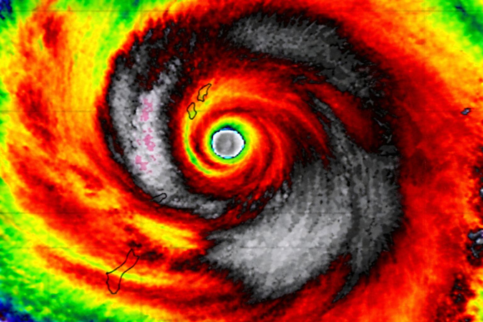
Super Typhoon Sinlaku reached category 5 in the Western Pacific over exceptionally warm waters and is yet another indication that El Niño is near and may be strong. For Brazil, this means a risk of floods and storms in the South, droughts in the Northeast, and intense heat waves in the Midwest and Southeast in the coming months.
The super typhoon Sinlaku has just reached strength equivalent to a category 5 hurricane in the Western Pacific, undergoing explosive intensification in just over a day. Although it is on the other side of the world and poses no direct risk to Brazil, the oceanic conditions in which the super typhoon formed are a harbinger that El Niño is near and may be strong to intense in the coming months, with profound consequences for Brazilian weather. Sea surface temperatures in the region where the tropical cyclone is operating are well above average, providing a large amount of energy that allowed the super typhoon to organize rapidly and reach extreme levels of intensity.
For Brazil, what happens in the Western Pacific is not a distant meteorological curiosity. The presence of very warm waters in this region is part of a reorganization of the global climate system that precedes El Niño episodes, and when the phenomenon settles in, the effects on Brazilian weather are significant and documented: excess rain with a risk of floods and storms in the Southern Region, intense heat waves in the Midwest and Southeast, and worsening drought risk in the Northeast. Super Typhoon Sinlaku is the most recent sign that this scenario is unfolding.
Why the super typhoon is a sign of El Niño for Brazil
According to the portal Metsul, the warming scenario in the Western Pacific where the super typhoon formed is not isolated. There is currently a large “pool” of warm waters in the Western Pacific, near Indonesia and Australia, a buildup of heat at the sea surface that was intensified during the La Niña period, when trade winds push warm water into this region. This balance is disrupted when the trade winds weaken or when the so-called westerly wind bursts occur, which displace the warm water towards the Center and East of the Pacific.
-
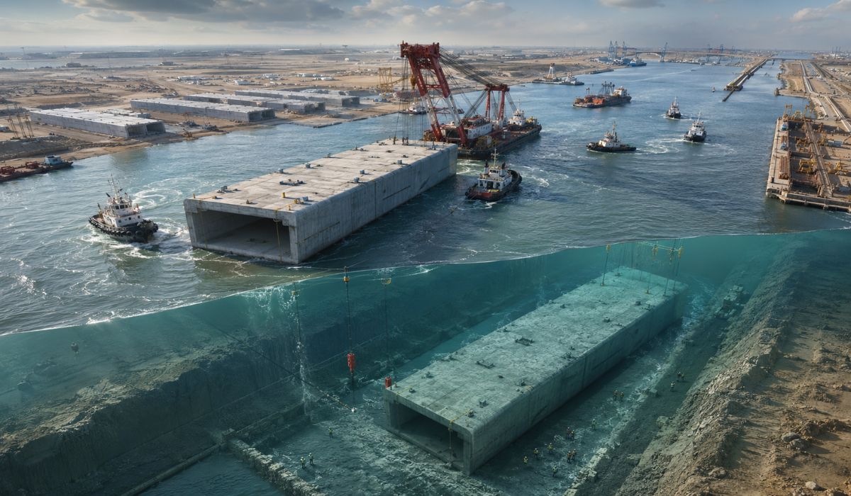
Iraq floats and sinks under an arm of the Euphrates 10 giant concrete boxes of 46,000 tons and 125 meters each to assemble a 2.4 km submerged tunnel and open a new land route between Asia and Europe.

-
Scientists use more than 20,000 artificial birds and solar speakers to “trick” seabirds, reactivate nesting routes, and revive a colony on an island that seemed abandoned.

-
She spent 73 years breathing inside an iron lung, survived the aftereffects of polio, and became the last woman in the United States dependent on the equipment before dying at 78 years old.
-
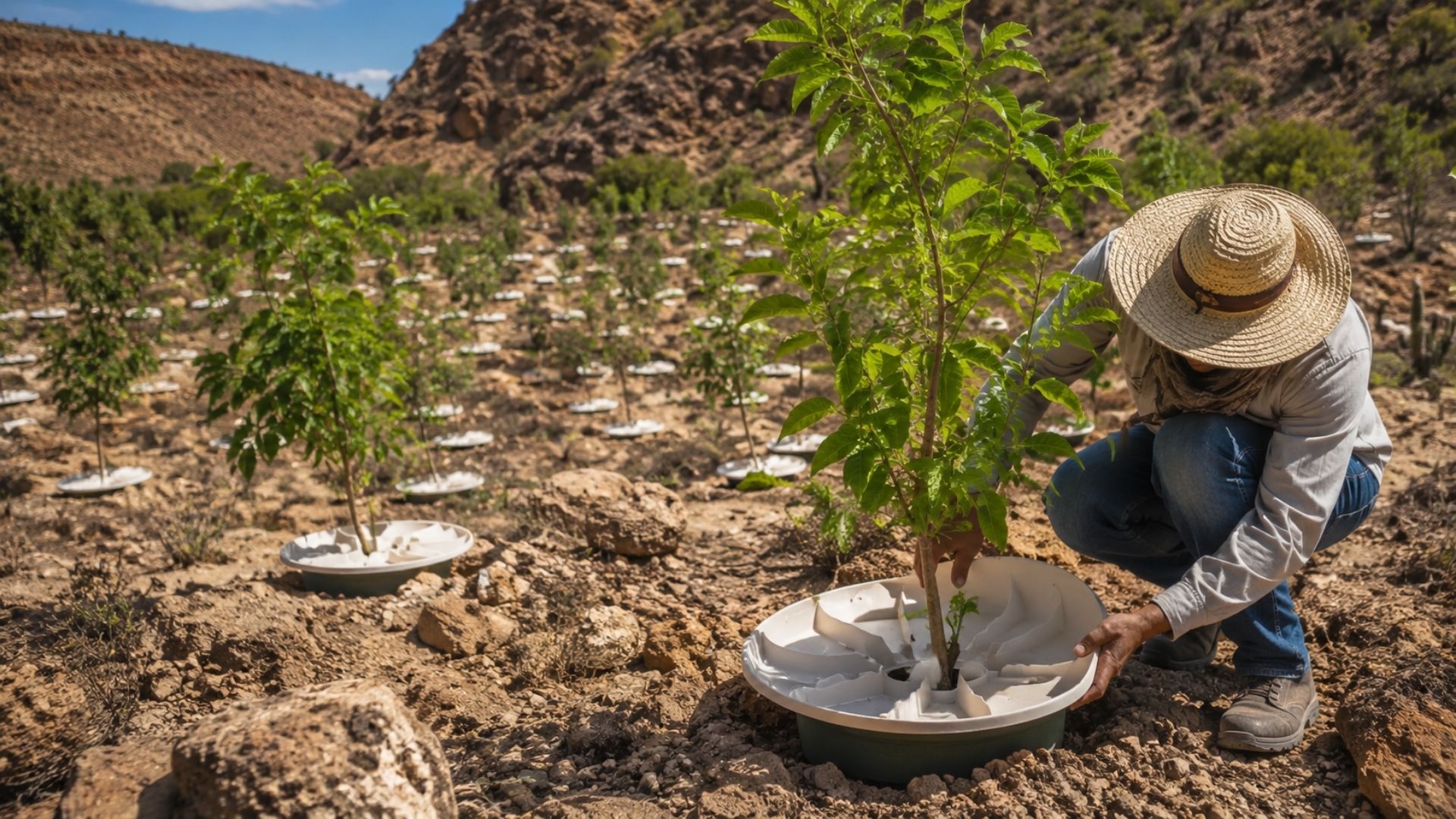
Brazilian students created a $1 filter using pine bark, cotton, and 3D-printed parts to clean cassava wastewater, reduce the toxicity of a hazardous waste, and transform contaminated water into biofertilizer.


This displacement of heat marks the beginning of an El Niño episode. Kelvin waves, which act as pulses of energy in the ocean, transport the accumulated warm water to areas that previously had cold waters, creating a band of warming along the equatorial Pacific. Super Typhoon Sinlaku formed exactly over the “stock” of warm waters that will fuel the next El Niño, and the fact that it reached category 5 so early in the season suggests that the energy available in the ocean is exceptional.
What El Niño Can Cause in Southern Brazil
For the Southern Region, El Niño historically means excess rain. When the phenomenon sets in, the cold fronts that hit southern Brazil become more frequent and intense, and the moisture available in the atmosphere increases, creating conditions for severe storms, rainfall accumulations well above average, and a high risk of flooding. The disasters that Rio Grande do Sul experienced in 2024 under the influence of the previous El Niño are a painful reminder of what the phenomenon is capable of producing.
The super typhoon in the Pacific does not directly cause this rain, but the conditions that generated it are the same that will feed El Niño. If the phenomenon is strong, as oceanic signals suggest, southern Brazil should prepare for months of persistent instability, with risks of flooding, landslides, and service interruptions in urban areas. Historically, the best agricultural harvests in the South occur during El Niño, but productivity gains can be nullified by the damage caused by excess water.
The Expected Impact of El Niño in Northeast and Central-West Brazil
While the South faces excessive rain, the Brazilian Northeast experiences the opposite scenario under El Niño. The phenomenon exacerbates the risk of drought in the region by altering atmospheric circulation patterns, reducing the rains that normally supply reservoirs, rivers, and crops between March and June. For a region that already deals with chronic water deficits in many areas, the arrival of a strong El Niño represents a direct threat to subsistence agriculture and water supply.
In the Central-West and Southeast, the predominant effect is heat. El Niño favors the formation of atmospheric blocks that prevent the arrival of cold fronts and keep warm air masses stationary over these regions for weeks, causing intense heat waves that affect public health, increase electricity consumption, and raise the risk of wildfires. The super typhoon Sinlaku, by confirming the exceptional warming of the Pacific, reinforces the expectation that these effects will be felt in Brazil in the coming months.
What Makes Super Typhoon Sinlaku So Unusual

image: metsul
The explosive intensification of the super typhoon draws attention not only for its strength but for the timing of its occurrence. The formation of such an intense tropical cyclone at this time of year suggests that the season may be more active than normal, a pattern consistent with El Niño years, when there is a higher likelihood of strong systems in the Western Pacific. The excess latent heat from the ocean provides the energy that allows the super typhoon to organize in a matter of hours.
The super typhoon is classified by the scale equivalent to category 5 hurricanes, the maximum level of intensity. This category implies sustained winds above 252 km/h, capable of causing catastrophic destruction in coastal areas. For the Western Pacific, where hundreds of millions of people live in countries like the Philippines, Japan, Taiwan, and China, the prospect of a more active season is a cause for concrete concern. For Brazil, the super typhoon does not pose a direct danger, but it serves as a thermometer for what is happening in the ocean that controls the planet’s climate.
What Brazil Should Do to Prepare
The confirmation of a strong El Niño in the coming months will require preparation on multiple fronts. In the South, state and municipal governments will need to reinforce alert systems, evacuation plans, and drainage infrastructure to deal with rainfall volumes that may significantly exceed historical averages. The lessons from the recent floods in Rio Grande do Sul need to be transformed into concrete actions before the next cycle of intense rains begins.
In the Northeast, preparation involves reservoir management and agricultural planning that considers the possibility of below-average rainfall. In the Midwest and Southeast, the focus should be on fire prevention and preparing health systems to deal with heatwaves that may break temperature records. The super typhoon Sinlaku is the latest warning that the global climate is shifting gears, and Brazil is directly in the path of the effects.
A super typhoon in the Pacific is the latest sign that a strong El Niño is coming and will affect all of Brazil. Have you felt the effects of previous El Niños? Is your region prepared? Let us know in the comments.