
 Portuguese
  Spanish
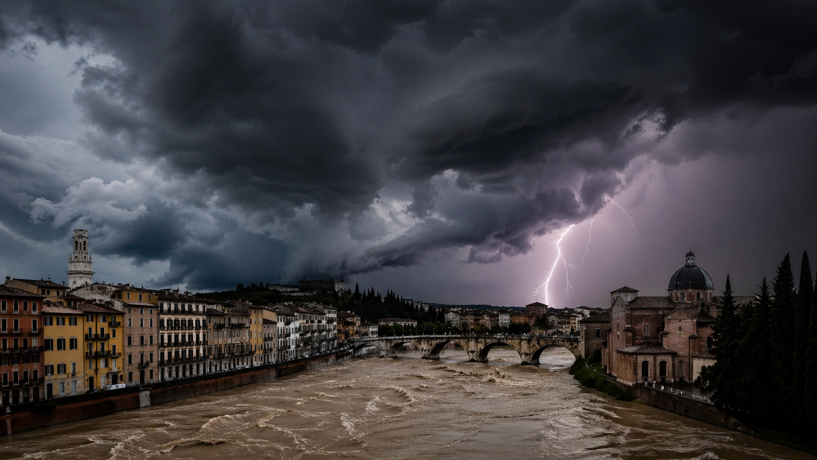
Storm sequence phenomenon in Europe draws attention with repetition of extreme events, increased flood risk, and direct impacts on people’s daily lives
The unusual sequence of storms in Europe is already causing significant impacts in several countries, with torrential rains, strong winds, and an increasing risk of floods. The phenomenon occurs without intervals between events, which further heightens the level of concern.
In practice, this means cities facing repeated flooding, waterlogged soil, and difficulty recovering. Regions of Portugal, Spain, and Italy are among the most affected, with events occurring one after another.
What is behind the sequence of storms in Europe
The scenario involves the continuous formation of low-pressure areas that follow practically the same path over the continent. This pattern creates the effect of storms in sequence without pause, something considered unusual in the observed intensity.
-
Artesian Well Becomes Lifeline for Small Brazilian Farm: Drilling Reaches 60 Meters, Finds Marble, Navigates Rock Fissures, and Strikes Fresh Water

-
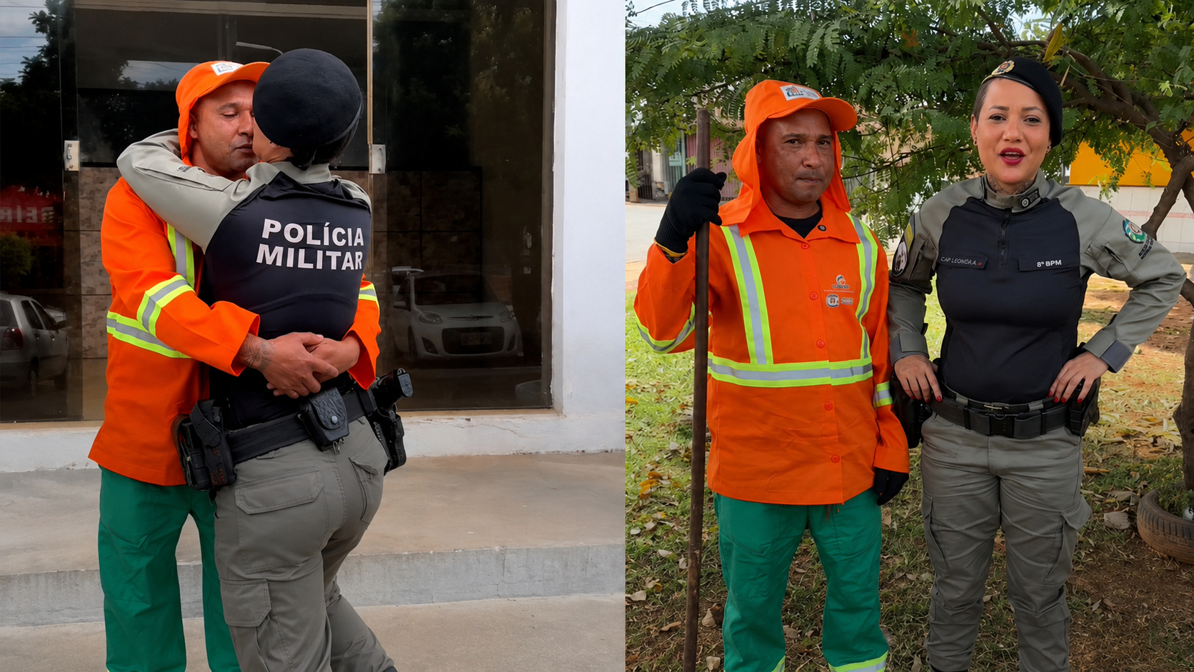
Street Cleaner in Brazil Finds Discarded Books That Helped His Wife Pass Civil Service Exam and Become Police Captain
-
July’s Night Sky to Feature Planetary Alignments, New Moon, Venus at Sunset, Buck Moon, and Two Meteor Showers

-
Fisherman Catches 18kg Catfish Near Brazil’s Itaipu Lake, Among Largest Recorded in Recent Years


The constant repetition prevents the soil from drying. As a result, new rains generate immediate impact, raising the risk of flash floods and landslides.
The result is an accumulation of effects that makes each new event more dangerous than the previous one.
Intense jet stream maintains continuous advance of storms
The dynamics of the phenomenon are linked to the jet stream, a flow of strong winds at altitude that directs weather systems. When this flow remains strong and aligned, it creates a corridor that favors the continuous arrival of storms.
The information was released by Met Office, the UK’s national meteorological service, which pointed to the presence of a persistent polar jet, responsible for maintaining the pattern of continuous low pressure over Europe.
This behavior keeps the weather unstable for several days, with repeated intense rains and strong winds.
Torrential rains and winds above 100 km/h are already causing impacts
The effects of this pattern are already visible in different regions. Portugal and Spain record high accumulated rainfall, with rivers near their limit and an increased risk of floods.
In Italy, the arrival of these storms combined with Mediterranean humidity further intensifies the events. The result includes urban flooding, power outages, and structural damage.
Wind gusts above 100 km per hour amplify the impacts, especially in coastal areas and more exposed regions.
Lack of interval between events increases flood risk
The most critical point is the absence of pauses between one storm and another. Normally, there is a period of stability that allows affected areas to recover.

In this case, the soil remains saturated for several days. This causes any new rain to rapidly increase the water volume, raising the risk of floods and landslides.
Met Office, the UK’s national meteorological service, highlighted that this continuous pattern intensifies the cumulative effects and makes the scenario more dangerous.
Mediterranean reinforces intensity of storms in Southern Europe
When the systems advance to the south of the continent, they encounter the Mediterranean Sea, which has warmer waters compared to the surrounding environment.
This factor adds energy to the storms, favoring more intense rains and greater instability. This explains why regions of Italy face stronger impacts even when systems form in the Atlantic.
The result is an increase in the reach and intensity of climate events.
Recent phenomenon reinforces alert for repeated extreme events
The sequence recorded in early 2026 drew attention due to its persistence. The repetition of strong storms within a few days is not common and indicates a more unstable climate pattern.

Environments with higher humidity tend to favor more intense and prolonged rains, which increases the impact of these events.
The scenario reinforces the need for constant attention and preparation, as the risk is not only in intensity but also in frequency.
Europe faces growing risk with successive storms
The unusual sequence of storms in Europe shows how the repetition of events can amplify damage over time. Torrential rains, winds above 100 km/h, and floods create a scenario of continuous concern.
The lack of interval between events increases the impact and hinders the recovery of affected regions, making each new storm more dangerous.
Do you believe that extreme events like this tend to become more frequent in the coming years, or are they still isolated episodes? Leave your opinion in the comments and share this content with others.


