Portuguese
  Spanish
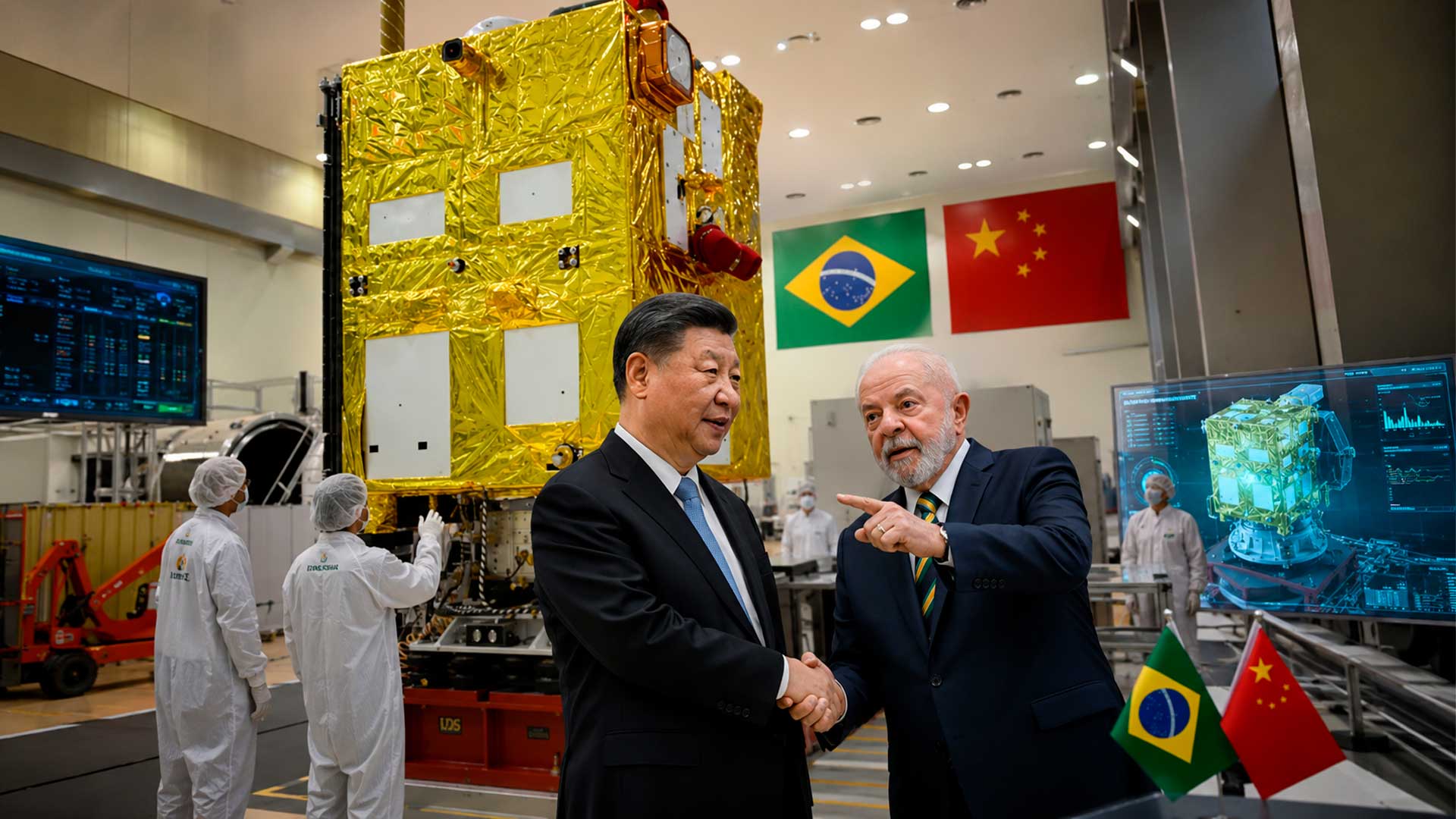
New Sino-Brazilian satellite will have radar capable of producing images even with rain, smoke, clouds, or absence of light and could strengthen the fight against deforestation
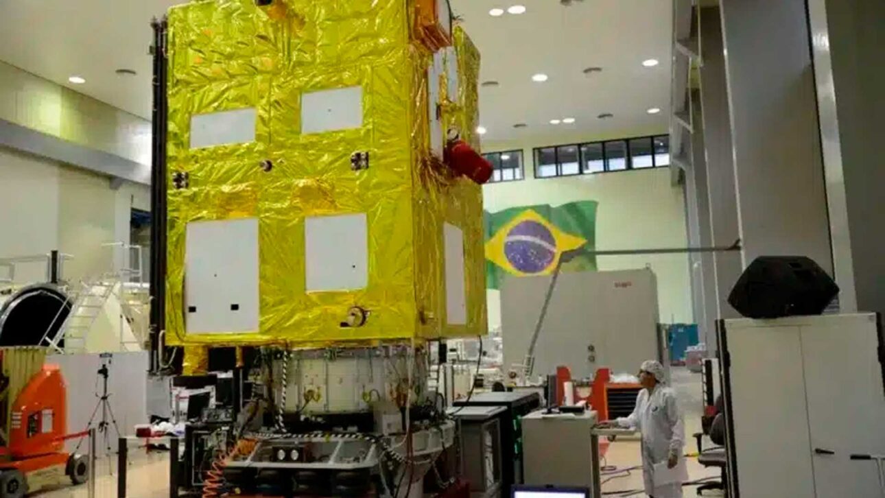
Brazil and China have advanced in a decisive stage of the preparation of the CBERS-6, a new Earth observation satellite that should expand Brazil’s capacity to monitor forests, agricultural areas, borders, coastal zones, and regions affected by disasters. The launch is still scheduled for 2028, from Chinese territory.
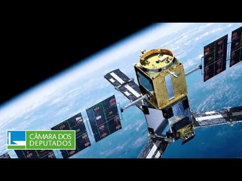
The main differential will be a synthetic aperture radar, known by the acronym SAR, capable of generating images during the day or night and even when clouds, smoke, or rain hinder the vision of traditional optical sensors. This feature is especially important for the Amazon, where cloud cover can prevent the acquisition of clear images for long periods.
On May 19 and 20, 2026, representatives from the China Centre for Resources Satellite Data and Applications, CRESDA, were at the National Institute for Space Research to discuss image processing, equipment calibration, and planning of future satellite operations. According to information from the INPE, the meetings also addressed the possible provision of data from other Chinese satellites to support Brazilian environmental monitoring.
-
AI Video Generator Automatically Creates Subtitles and Animated Captions

-
São Paulo Unveils Latin America’s Largest Underground Reservoir, Holding 900 Million Liters, in the Greater São Paulo Area

-
Chinese Teen Wins Gold in Germany for Invention Turning Air Moisture into Underground Irrigation in Drought-Stricken Areas

-
Desertification Threatens Brazil’s Caatinga: 85% of Semi-Arid Region Affected, 30 Million at Risk, and Efforts Underway to Restore 10 Million Hectares by 2045


The report published by Revista Fórum highlighted that the cooperation does not only involve the manufacture of the CBERS-6. The understanding could expand the exchange of orbital images between the two countries while the new equipment has not yet reached space.
Meetings defined how CBERS-6 images will be processed
The meetings held in May brought together Brazilian and Chinese specialists linked to processing, distribution, and interpretation of Earth observation data. The teams began to establish common rules for calibration, validation, tests, and formats of the future CBERS-6 images.
A draft signed by the leaders of the two institutions gathered the main technical directions. Among them are the joint development of the calibration and validation plan, the definition of data processing levels, and the preparation of tests to be conducted when the equipment enters orbit.
The operational strategy of the SAR radar was also discussed. This includes deciding which regions will be observed, how frequently images will be produced, and how commands sent from Earth will control the instrument’s operation.
Advance planning is necessary because a satellite does not start delivering ready information immediately after launch. Before regular operation, sensors and systems need to undergo a period of testing, adjustments, and comparison with measurements made on the ground or by other already known equipment.
Radar will allow viewing the territory even under clouds
Optical satellites function similarly to extremely advanced cameras. They record the radiation reflected by the surface but may encounter difficulties when thick clouds, smoke, or lack of light block the observed area.
The SAR radar works differently. The instrument sends microwave signals towards the ground and records the return of these waves, allowing for detailed representations of the surface even in unfavorable weather conditions.
According to the Brazilian Space Agency, the CBERS-6 will use an X-band SAR radar provided by China, while the service module will be based on the Multimission Platform developed in Brazil. This platform brings together the systems responsible for energy, position control, communication, and overall satellite operation.
The Brazilian technology was already validated in Amazonia-1, launched in February 2021. For the new mission, the platform is being updated to accommodate the radar and meet the specific requirements of the Sino-Brazilian project.
In practice, the CBERS-6 will be able to complement the optical images produced by previous satellites. The goal is not to abandon traditional cameras, but to combine different technologies to reduce unobserved areas and produce more frequent and reliable information.
Chinese images may reinforce Prodes and Deter before launch
CRESDA expressed willingness to provide Brazil with data obtained by the Chinese satellites Gaofen-1 and Gaofen-6. The provision should follow the International Data Policy of the China National Space Administration and still depends on the necessary technical and institutional procedures.
These images could support Prodes and Deter, two of Brazil’s main systems for monitoring native vegetation. Prodes produces the official annual mapping of vegetation suppression, while Deter issues faster alerts to guide enforcement and deforestation combat actions.
According to information from the TerraBrasilis platform, the data from these programs are used for consultation, analysis, and dissemination of geographic information about Brazilian biomes. The potential inclusion of new images may increase observation frequency and help fill gaps caused by clouds or satellite passage.
Nevertheless, the availability of Chinese images does not mean that Brazilian systems will rely exclusively on them. The data would serve as a complementary source to the set of satellites and sensors used by the country.
CBERS-6 underwent critical review and advances to manufacturing
The project reached an important stage in September 2025, when Brazilian and Chinese experts conducted the Mission Critical Design Review at the Chinese Academy of Space Technology facilities in Beijing. The analysis verified electrical, mechanical subsystems, position controls, telemetry, and communication.
The committee concluded that the mission had sufficient maturity to advance, although it presented recommendations related to electromagnetic compatibility and schedule compliance. After this approval, preparations began for equipment acquisition, manufacturing, integration, and testing.
According to the Ministry of Science, Technology and Innovation, the launch remains planned for 2028. The operation will be carried out with a Long March family rocket, and Brazil and China are expected to equally share the costs and responsibilities outlined in the agreement.
The model follows the division adopted in the most recent missions of the CBERS program. In the case of the new satellite, Brazil will be responsible for the service module, integration, and part of the tests, while China will provide the module containing the radar.
Technology will have applications in the Amazon, agriculture, and civil defense
The ability to observe cloud-covered regions could make CBERS-6 particularly useful in the Amazon during the rainy season. With more regular images, technical teams can compare areas over time and identify changes in vegetation cover.
The radar can also assist in monitoring floods, landslides, fires, river variations, and changes in coastal areas. In emergency situations, quickly obtained images can support Civil Defense in assessing the extent of damage and organizing the response.
In agriculture, the data can contribute to studies on soil moisture, crop development, land use, and impacts of climatic events. Agencies responsible for borders and the coast can also use the information, respecting the access rules and purposes established for the mission.
The satellite, however, will not monitor or prevent environmental crimes alone. The images need to be processed, interpreted, and transformed into public actions, involving research teams, monitoring, state governments, and federal agencies.
Space partnership between Brazil and China began in 1988
The China-Brazil Earth Resources Satellite Program was created in July 1988, at a time when developing countries had limited access to advanced space technologies. The cooperation allowed for sharing costs, knowledge, and industrial responsibilities.
Since then, six satellites in the series have been launched. The first, CBERS-1, reached space in 1999, while the most recent mission, CBERS-4A, was launched into orbit in December 2019.
The images produced by the program are used in environmental research, agriculture, urban planning, water management, and monitoring changes in the territory. The free distribution policy also helped universities, public agencies, and companies develop applications based on remote sensing.
CBERS-6 will be the first equipment in the series equipped with radar. This change represents a technological leap, but its outcome will depend on meeting the schedule, budget availability, system integration, and the success of the launch.
CBERS-5 and CBERS-6 are different projects
Brazil is also developing CBERS-5 with China, but the two missions should not be confused. CBERS-6 will be in low orbit and will be primarily aimed at observing the Earth’s surface with radar.
Meanwhile, CBERS-5 is expected to be a geostationary meteorological and environmental satellite, remaining over the same region of the planet. Its initial launch forecast is 2030, and the project aims to expand Brazilian autonomy in weather forecasting and continuous monitoring of extreme events.
Both pieces of equipment are part of an expansion of the China-Brazil space cooperation. While one is expected to observe details of the territory through different passages, the other will be designed to continuously monitor the atmosphere and environment.
Launch of 2028 still depends on complex stages
Before reaching space, CBERS-6 will need to complete the manufacturing of its components, the integration between the Brazilian platform and the Chinese radar, environmental tests, and communication tests. The equipment will need to be subjected to conditions that simulate vibration, extreme temperature variations, and the space environment.
A cross-calibration campaign is also planned for the second half of 2026 in the Dunhuang region, China. Teams will compare images from the CBERS-4, CBERS-4A, and Amazonia-1 satellites to improve the consistency of data produced by different sensors.
Therefore, the announced advancement does not represent the completion of the satellite, but shows that the mission has entered a more concrete phase. The expectation is that the CBERS-6 will reduce a historical vulnerability of optical monitoring, allowing Brazil to observe strategic areas even when the sky does not cooperate.