Portuguese
  Spanish
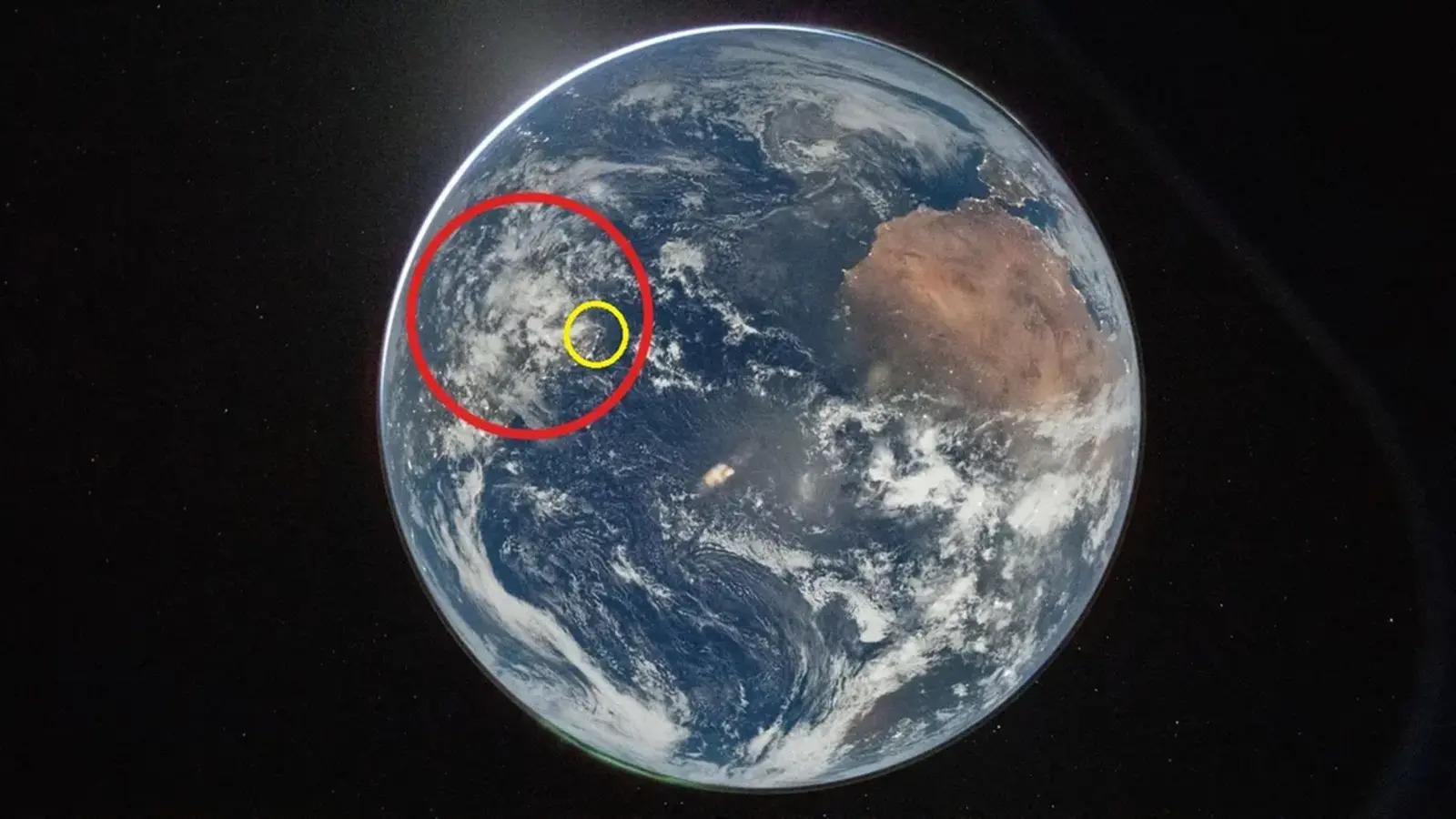
First image of Earth released by the Artemis II mission shows Ceará in Northeast Brazil, even with clouds covering part of the state
The Artemis II mission highlighted Ceará in the first image of Earth released by NASA this Friday (3). The state appears in the Northeast region of Brazil, partially covered by clouds, after a recording made from the Orion capsule shortly after the translunar injection maneuver. The information is from this article from Diário do Nordeste.
Ceará can be located in the photograph even with part of the territory covered. The identification was confirmed to the Diário do Nordeste portal by Astronomy professor and columnist Ednardo Rodrigues.
Record of Artemis II
The original image was taken by commander Reid Wiseman through the window of the Orion capsule. In the raw recording, Earth appears inverted compared to how the planet is usually seen on maps.
-
16-Year-Old from Brazil’s Sertão Wins Young Scientist Award for AI Predicting Rainfall with 94.5% Accuracy to Aid Farmers

-
Netherlands Reports First Child Euthanasia Case Since Rule Expansion for Minors

-
Brazilian Innovator Survives Homemade Submarine Dive in Paraty Despite Hatch Leak and False Oxygen Alarm
-
China Develops Custom 140-Ton Electric Mining Truck with 770 kWh Swappable Battery, Deploys 290 Units in Xinjiang’s Largest Zinc Mine


Rotation to facilitate reading
With the 180º rotation applied by Diário do Nordeste, the visualization of Brazilian territory becomes simpler. The adjustment, as the professor emphasized, is not considered a modification of the photograph.
In the image displayed at the top of the page, Brazil is marked by a red circle. Inside it, a smaller yellow circle indicates the area where Ceará can be identified.
What else the photo shows
In addition to Brazilian territory, the photograph also reveals areas of the African continent, the Iberian Peninsula, and the expanse of the Atlantic Ocean.
The recordings were made shortly after the completion of the translunar injection maneuver. The composition enhances the sense of scale of the planet observed by Artemis II at that moment of the flight.
With information from Diário do Nordeste.