Portuguese
  Spanish
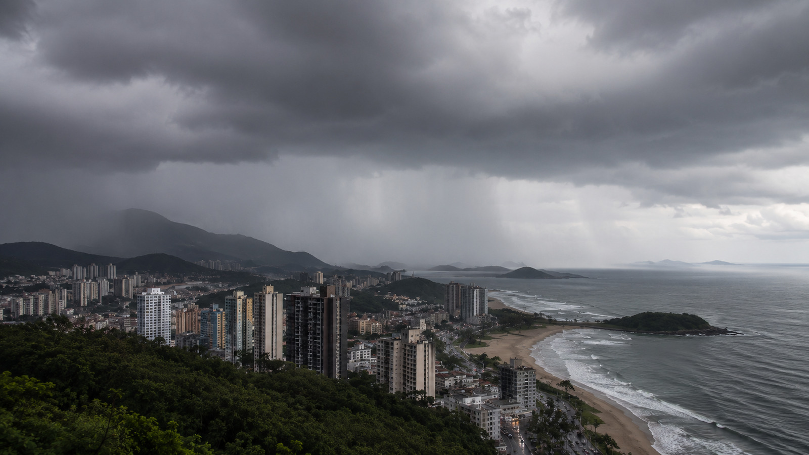
Inmet forecast indicates heavy rain, thunderstorms, and wind gusts in various regions of the country, with higher risk in São Paulo, South, Bahia, North, and cyclone formation on Monday
Storms are expected to hit various regions of Brazil between Saturday (5/23) and Sunday (5/24), with heavy rain, thunderstorms, and wind gusts that can reach 100 km/h, according to Inmet (READ THE INMET FORECAST HERE). São Paulo, the coast of Santa Catarina, southern Bahia, and areas of the North are expected to have the highest accumulations.
Storms in Brazil hit South, Southeast, North, and Northeast
The weekend will be unstable in a significant part of the country. In the Southeast, heavy rain is expected to hit much of the state of São Paulo, the Triângulo Mineiro, southern Minas Gerais, and southern Rio de Janeiro this Saturday.
Inmet maintains an alert for storms with thunderstorms and wind gusts. On Sunday, southeastern São Paulo continues to have favorable conditions for showers and isolated thunderstorms.
-
Iraq floats and sinks under an arm of the Euphrates 10 giant concrete boxes of 46,000 tons and 125 meters each to assemble a 2.4 km submerged tunnel and open a new land route between Asia and Europe.

-
Scientists use more than 20,000 artificial birds and solar speakers to “trick” seabirds, reactivate nesting routes, and revive a colony on an island that seemed abandoned.

-
She spent 73 years breathing inside an iron lung, survived the aftereffects of polio, and became the last woman in the United States dependent on the equipment before dying at 78 years old.
-
Brazilian students created a $1 filter using pine bark, cotton, and 3D-printed parts to clean cassava wastewater, reduce the toxicity of a hazardous waste, and transform contaminated water into biofertilizer.


Cyclone expected to increase hail risk on Monday
On Monday (5/25), the formation of a cyclone is expected to cause new storms throughout the Southern Region. The forecast also indicates the possibility of hail, especially in the western part of the southern states.
Despite the rain, cold weather continues to prevail in areas of the South and Southeast. In the gaucho and catarinense mountains, minimums can reach 4°C. In São Paulo, Minas Gerais, and Rio de Janeiro, the coldest areas are expected to register between 10°C and 12°C.
Central-West will have isolated showers and risk of storms
In the Central-West, the forecast indicates isolated showers in Mato Grosso and Mato Grosso do Sul. The highest alert is in the central-east and southern Mato Grosso do Sul, southern Goiás, and southeastern Mato Grosso, where there is a risk of storms.
North and Northeast will also have areas under alert
In the Northeast, the highest volumes are expected to hit the south of Bahia, the coast between Aracaju and Maceió, and the northwest of Maranhão. There is also a forecast of isolated showers in the north of Piauí and Ceará.
A large part of the northeastern interior, however, remains drier with many clouds. Highs can reach 36°C in Ceará, while lows are around 14°C in the central-south of Bahia.
In the North Region, the Intertropical Convergence Zone favors rain showers with thunderstorms in the north of Amazonas, in Roraima, and Amapá. In the southeast of Pará, temperatures can reach 38°C. Acre, Rondônia, and Tocantins are expected to have more stable weather.
This article was prepared based on information from the National Institute of Meteorology (Inmet), with data, numbers, and statements preserved as per the consulted material.