Portuguese
  Spanish
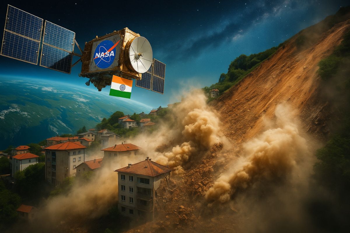
NISAR Mission Promises Unprecedented Images of the Planet and Free Data to Monitor Climate, Agriculture, and Natural Disasters
The NASA launches satellite to observe Earth in partnership with India this Wednesday (30), marking a milestone in international space cooperation. The NISAR mission, developed with ISRO, places one of the most advanced satellites ever created for environmental and geological monitoring into orbit.
The launch took place at the Satish Dhawan Space Center in India, with success confirmed at 9:10 AM (Brasilia time). NISAR now orbits the planet every 97 minutes, ready to capture crucial data on soils, glaciers, forests, and natural disasters — with free public access.
NISAR Satellite Promises a Revolution in Earth Monitoring
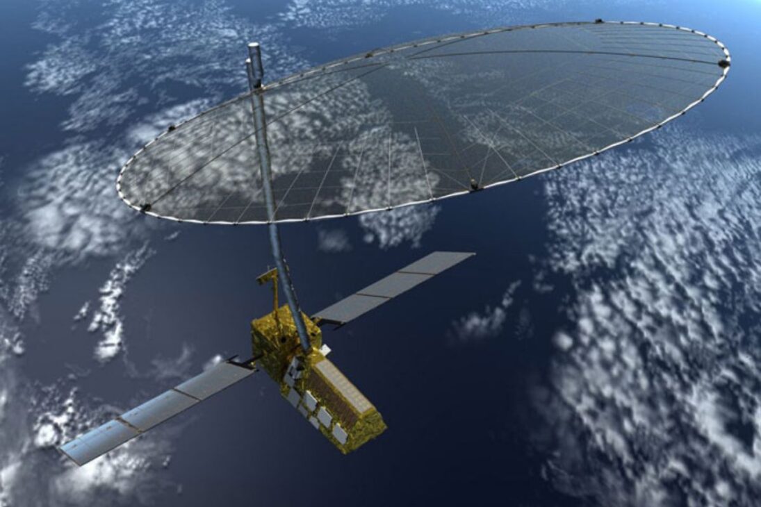
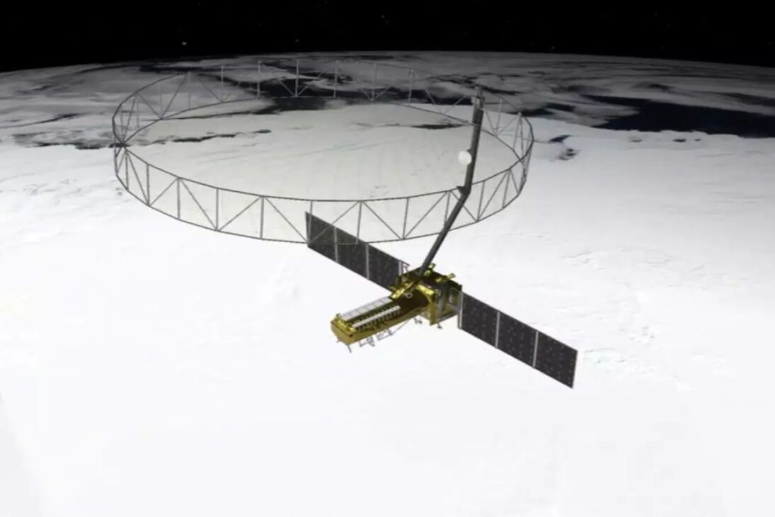
With a weight of 2,392 kg and an estimated cost of US$ 1.5 billion, NISAR was planned over 10 years of collaboration between NASA and ISRO. Its differentiator is the simultaneous use of two radar bands (L and S), which improves image accuracy and enhances analytical capacity in dense vegetation, polar ice caps, and agricultural areas.
-
Netherlands Reports First Child Euthanasia Case Since Rule Expansion for Minors

-
Brazilian Innovator Survives Homemade Submarine Dive in Paraty Despite Hatch Leak and False Oxygen Alarm

-
China Develops Custom 140-Ton Electric Mining Truck with 770 kWh Swappable Battery, Deploys 290 Units in Xinjiang’s Largest Zinc Mine
-
Meta to Launch Arena, a New Prediction App Targeting 3.56 Billion Users, Competing with Polymarket and Kalshi


According to NASA, the main objective is to understand critical environmental processes: tectonic plate movement, glacier melting, changes in groundwater levels, soil moisture, and impacts of natural disasters. The data will be openly accessible, allowing governments, scientists, and farmers to use the information in real-time.
How NISAR Will Impact People’s Daily Lives
One of the biggest gains is in agriculture. The satellite’s radar can detect soil moisture even on cloudy days or at night. This allows for better water usage, reduced losses, and increased productivity in agricultural regions worldwide, including Brazil.
In urban and risk areas, NISAR can detect ground subsidence, geological failures, and signs of landslides or earthquakes, with centimeter precision. This strengthens civil defense strategies, saving lives and reducing damages in emergency situations.
Additionally, the satellite will monitor the progress of melting in Antarctica and the Arctic, coastal erosion, wildfires, and even oil spills in the ocean — essential data for environmental preservation policies and combatting climate change.
International Cooperation and Free Access to Data
The NISAR mission is considered one of the most expensive and technically advanced ever conducted jointly by the United States and India. The investment represents the two powers’ bet on open science and the use of space technology to tackle global challenges.
The first images and reports will be available on NASA and ISRO’s websites in the coming days. The expectation is that NISAR will become a benchmark in Earth observation satellites, helping to prevent tragedies, guide public policies, and promote the sustainable use of natural resources.
Do you think Brazil should invest more in monitoring satellites like NISAR? Leave your opinion in the comments.