Portuguese
  Spanish
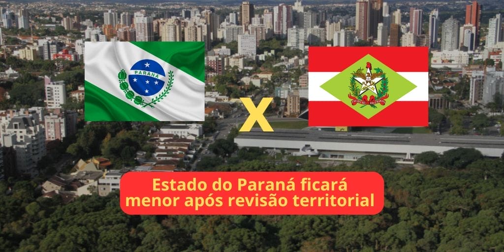
A Curious Discovery, Resulting from a Measurement Made by a Resident of Guaratuba, in the State of Parana, Revealed a Century-Old Error in the Territorial Delimitation Between Parana and Santa Catarina. The Discovery Resulted in a Review of the Limits, Resulting in the Loss of 490 Hectares of Paranaense Area to the Neighboring State.
This territory, equivalent to approximately 500 soccer fields, will officially belong to Santa Catarina starting in 2025. How can a historical error alter maps and impact the lives of local residents?
An Unexpected and Confirmed Revelation
The plot of this story began when a landowner in Guaratuba, in Parana, questioned the official demarcation made by the Brazilian Army between 1918 and 1919.
According to him, in an interview with the G1 portal this Saturday (22), his own measurement indicated that his property was located in territory belonging to Santa Catarina.
-
European Parliament Approves Digital Euro, Aiming to Challenge Visa and Mastercard’s Dominance and Transform Payments Across Europe by 2029

-
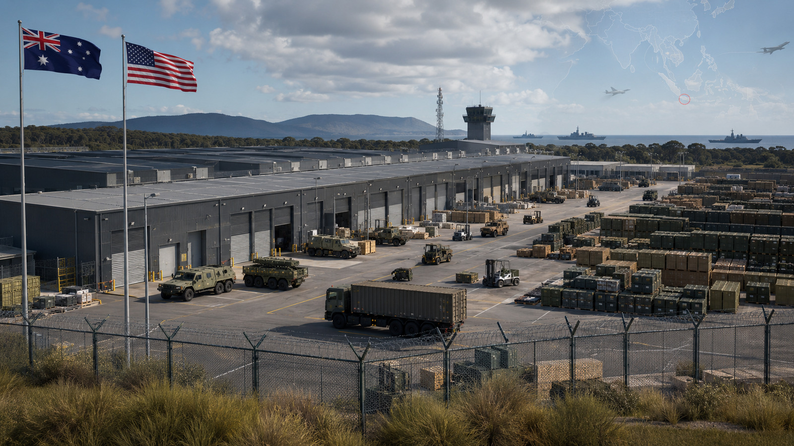
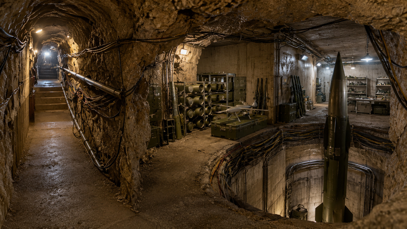
Israel finds Hezbollah militarized tunnel over 200 meters long under village, with 4 missile launch shafts, 12 chambers, anti-tank missiles, drones, and weapons depots at a depth of 25 meters.

-
Ukraine launches largest drone attack on Moscow since 2022, Russia claims to have intercepted nearly 200 aircraft near the capital, Kapotnya refinery targeted again, and offensive reignites alert about war reaching the Russian energy heart just a few kilometers from the Kremlin.

-
Truck drivers, freight, and fines from 2022 take center stage in politics: Chamber approves MP with amnesty, mandatory tracking by CIOT, million-dollar penalties, and new minimum wage for those who spend more than 24 hours on the road.


The raised doubt led the Water and Land Institute (IAT) of Parana to investigate the issue thoroughly. The IAT, responsible for territorial management in the state, conducted a detailed inspection of the site.
Technicians confirmed that, indeed, the original delimitation was incorrect. “We located the original markers and had to cross places where access is difficult. We found the correct addresses and had to correct the maps,” explained Amauri Simão Pampuch, a forestry engineer from the IAT’s Territorial Management Directorate, to the cited portal.
Impact on the Border Between Parana and Santa Catarina
The main change affects the boundaries between the municipalities of Guaratuba and Garuva, Santa Catarina. Although the alteration represents only 0.002% of the total area of Parana, it has a significant impact on the residents of the region. “If the border is adjusted, the property may be in one state, but actually belong to another,” commented Pampuch.
Review of the Borders and Necessary Adjustments
In 2022, the IAT revised the municipal limits, a process that, although rare, is essential for proper territorial management. “The border is fair today; it’s what should have always been done. But due to erroneous mappings, it was wrong. This correction helps the municipalities and both states in managing the territories,” said the forestry engineer from the IAT’s Territorial Management Directorate.
Analyses and Municipal Adjustments
The Guaratuba City Hall, which will lose the territory, still needs to analyze the impacts of the change. In a statement, the Municipal Urbanism Secretariat indicated that it will conduct a review to assess the territorial impacts, potential changes in public facilities, and tax revenue.
The Garuva City Hall in Santa Catarina reported that it is awaiting the documentation and new geographical coordinates to identify all properties in the area, inform the owners, modify the territorial map, and advance the zoning of the Master Plan.
IBGE and Territorial Updates
The Brazilian Institute of Geography and Statistics (IBGE) also reported that it is closely monitoring this territorial update. According to IBGE, “it closely monitors updates in the country’s territorial division, and if there are changes in municipal limits, the necessary updates to the population totals are implemented in a timely manner.”
This correction of a historical error in the territorial demarcation between Parana and Santa Catarina shows how geographical delimitations can be challenging and prone to mistakes.
In this sense, the story highlights the importance of accuracy in cartography and the implications that a small error can have on the lives of many people.
This adjustment not only realigns borders but also exemplifies the relevance of territorial management for public administration and the daily lives of citizens.
For those living or owning properties in the affected region, the changes can bring both challenges and new opportunities.
The revision of the borders is a reminder that, even in an increasingly digital world, physical geography still plays a fundamental role in social and administrative organization.