Portuguese
  Spanish
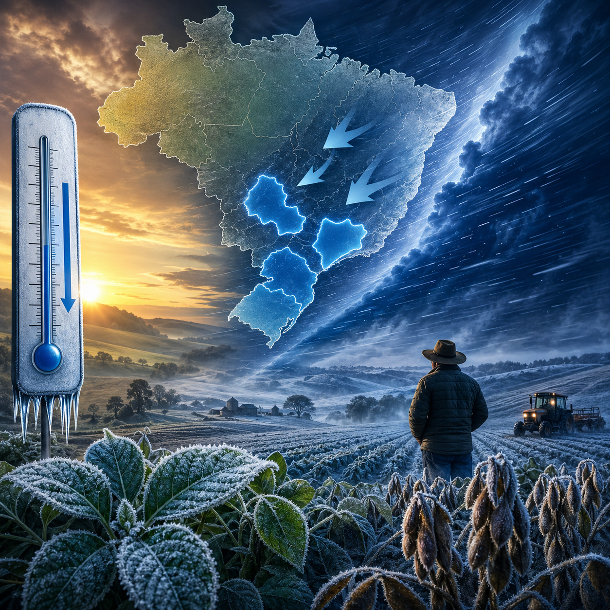
Although the highest risk of frost is expected for winter, the advance of cold at the end of May can already cause significantly cold mornings.
The scenario demands attention because the impact depends not only on the intensity, but on the moment the cold hits the crop.
Serra da Mantiqueira enhances the effect of cold due to altitude
The Serra da Mantiqueira acts as a natural amplifier of the cold. With high altitudes and rugged terrain, the region favors:
-
Over 2,000 Tons of Discarded Fishing Nets Since 2020 Repurposed into Durable Caps, Fins, and Parts

-
Seals and Sea Lions Lose Habitat and Food as Climate Change Advances, Impacting Ice, Prey, and Coastal Communities

-
Brazilian Innovator Uses 3D-Printed Device to Cool Two Rooms with One Air Conditioner
-
China Uses 432 Robots to Move a 7,500-Ton Historic Building in Shanghai, Preserving Architecture While Creating Space for Underground Center


- faster temperature drops
- formation of cold air pockets
- greater intensity during early mornings
Furthermore, the area concentrates agricultural activities, tourism, and smaller cities more exposed to the climate. Altitude transforms Mantiqueira into one of the regions most sensitive to any polar air incursion.
Lowlands increase risk and make the cold more unpredictable
A common factor in all four regions is the presence of lowland areas, which play a central role in thermal behavior.
During the night, cold air descends and accumulates in these lower points of the terrain, causing the temperature to drop more than in the surrounding areas.
This phenomenon creates microclimates that can record significantly lower temperatures. This makes the risk more difficult to predict and more dangerous, especially for rural producers.
Impacts go beyond agriculture and affect health and urban routine
Although the agricultural impact is the most evident, the thermal shift also affects the general population. Sudden temperature changes can cause:
- increase in respiratory problems
- higher energy demand
- changes in the routine of smaller cities
Regions that have been experiencing intense heat tend to feel the impact of sudden cold more. The thermal shock amplifies the effects of the event even when temperatures do not reach historical extremes.
Period between late May and early June concentrates higher risk
Projections indicate that the period between the second half of May and early June should concentrate the most significant cold episodes at the start of this season.
This period marks the transition between the warm autumn pattern and the first more consistent incursions of polar air. It is precisely in this window that the climatic contrast reaches its most critical point.
With above-normal heat preceding the arrival of cold, early mornings with sharp temperature drops, and localized frost risk, southern Mato Grosso do Sul, southern São Paulo, Sul de Minas, and Serra da Mantiqueira enter a period of climatic attention. The phenomenon stands out not only for its intensity but for the combination of factors that amplify its effects.
The direct question remains: will these regions be able to absorb the impact of this thermal shift, or will they face losses and difficulties precisely due to the rapid climate change?
Four regions go on alert with a thermal shift at the end of May, with risk of frost, sharp temperature drop, and direct impact on agriculture.
In 2026, Climatempo indicated, in a forecast published on March 18, that the first intense cold of autumn is expected to occur between May 16 and 31, with a higher probability at the end of May, reaching areas of southern Mato Grosso do Sul, southern São Paulo, south-central and southwestern Minas Gerais, and higher altitude points in the Southeast. The alert extends through June, a period when continental cold fronts and polar air masses become more likely, with a risk of frost in southern MS and southern São Paulo, while Sul de Minas and the Serra da Mantiqueira enter the radar due to their altitude, the presence of sensitive crops, and the possibility of stronger cold as winter approaches.
According to Climatempo, autumn began with above-average temperatures in much of Brazil, but the pattern change in the final stretch of the season could create a sharp thermal shift precisely in strategic agricultural areas.
The factor that raises the alert level is not just the cold, but the speed of the thermal change and the previous climatic context.
Above-average heat creates an ideal scenario for a more aggressive thermal shift
Before the arrival of polar air, these regions have been influenced by hot and dry air masses, which keep temperatures above average and reduce air humidity.
This climatic pattern generates an important effect: the soil loses moisture, vegetation accelerates growth, and the environment stabilizes under persistent heat conditions.
When cold air advances after this scenario, the thermal contrast intensifies. This rapid transition increases the impact because there is no gradual adaptation of the soil, plants, and the environment itself.
Early mornings become the critical point with a sharp drop in temperatures
With the entry of the polar air mass, temperature behavior changes rapidly, especially during the night and early morning.
The four regions exhibit characteristics that favor intense cooling:
- open areas with low heat retention
- terrain that facilitates the accumulation of cold air
- less urban coverage compared to capitals
This combination creates ideal conditions for sharp drops in minimums, even when daytime maximums do not fall proportionally.
The result is a high thermal amplitude, with early mornings potentially critical for agriculture and health.
Southern Mato Grosso do Sul combines heat, drought, and cold air entry
Among the four regions, southern Mato Grosso do Sul presents one of the most sensitive scenarios. The area comes from a period with a predominance of dry weather and high temperatures, which reduces soil moisture and favors rapid cooling when polar air arrives.

Additionally, the region has a strong presence of:
- pastures
- short-cycle crops
- open rural areas
This context increases the risk of direct impact on agricultural production right in the first cold early mornings.
Southern São Paulo enters the risk zone with possibility of localized frost
In the state of São Paulo, the main point of attention is in the south of the territory, where the terrain and proximity to the advancing polar air increase the probability of more intense cold.
Climatempo indicates the possibility of localized frost in this region between the end of May and June, especially in lowland areas.

These locations are more vulnerable because cold air tends to concentrate near the ground during the night. Even localized events can cause significant damage when they hit specific agricultural areas.
Sul de Minas raises concerns due to coffee farming sensitivity
Sul de Minas comes into focus not only for the cold, but for the potential economic impact. The region is one of Brazil’s main coffee-producing areas, a crop highly sensitive to frosts and sharp temperature drops.
Although the highest risk of frost is expected for winter, the advance of cold at the end of May can already cause significantly cold mornings.
The scenario demands attention because the impact depends not only on the intensity, but on the moment the cold hits the crop.
Serra da Mantiqueira enhances the effect of cold due to altitude
The Serra da Mantiqueira acts as a natural amplifier of the cold. With high altitudes and rugged terrain, the region favors:
- faster temperature drops
- formation of cold air pockets
- greater intensity during early mornings
Furthermore, the area concentrates agricultural activities, tourism, and smaller cities more exposed to the climate. Altitude transforms Mantiqueira into one of the regions most sensitive to any polar air incursion.
Lowlands increase risk and make the cold more unpredictable
A common factor in all four regions is the presence of lowland areas, which play a central role in thermal behavior.
During the night, cold air descends and accumulates in these lower points of the terrain, causing the temperature to drop more than in the surrounding areas.
This phenomenon creates microclimates that can record significantly lower temperatures. This makes the risk more difficult to predict and more dangerous, especially for rural producers.
Impacts go beyond agriculture and affect health and urban routine
Although the agricultural impact is the most evident, the thermal shift also affects the general population. Sudden temperature changes can cause:
- increase in respiratory problems
- higher energy demand
- changes in the routine of smaller cities
Regions that have been experiencing intense heat tend to feel the impact of sudden cold more. The thermal shock amplifies the effects of the event even when temperatures do not reach historical extremes.
Period between late May and early June concentrates higher risk
Projections indicate that the period between the second half of May and early June should concentrate the most significant cold episodes at the start of this season.
This period marks the transition between the warm autumn pattern and the first more consistent incursions of polar air. It is precisely in this window that the climatic contrast reaches its most critical point.
With above-normal heat preceding the arrival of cold, early mornings with sharp temperature drops, and localized frost risk, southern Mato Grosso do Sul, southern São Paulo, Sul de Minas, and Serra da Mantiqueira enter a period of climatic attention. The phenomenon stands out not only for its intensity but for the combination of factors that amplify its effects.
The direct question remains: will these regions be able to absorb the impact of this thermal shift, or will they face losses and difficulties precisely due to the rapid climate change?