Portuguese
  Spanish


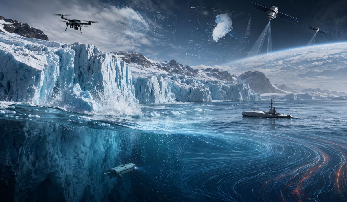

The expedition investigates how the freshwater released by Greenland’s glaciers can alter North Atlantic currents, in a process observed with robots, satellites, artificial intelligence, and unprecedented measurements.
The melting of Greenland’s glaciers is being investigated by an international team of scientists for its potential effect on North Atlantic circulation.
According to the British Antarctic Survey, the influx of large volumes of freshwater into the ocean can form a less salty surface layer, described by researchers as a kind of “cap”, capable of interfering with processes that help regulate currents linked to the climate in Europe and North America.
Some estimates cited by the institution suggest that changes in the North Atlantic Subpolar Gyre may occur as early as the 2040s.
-
Engineers Develop Fridge-Sized Machine to Produce 95-Octane Synthetic Fuel from Air and Water, Aiming to Sustain Combustion Engines Without Oil

-
Two-Armed Robot Uses AI to Reassemble Destroyed Pompeii Frescoes, Solving an “Impossible” Puzzle
-
New Law in Brazil Requires Breaks for Type 1 Diabetes Management at Work, School, and Public Exams

-
Scientists Confirm “Greening” of Antarctica: Ice on the World’s Coldest Continent Turns Green as Mosses Multiply Over Tenfold in Four Decades


The investigation is part of the GIANT project, an acronym for Greenland Ice sheet to AtlaNtic Tipping points from ice loss.
The initiative is led by the British Antarctic Survey, funded by the Advanced Research and Invention Agency, and brings together 17 partners in a five-year international collaboration, starting on April 1, 2025, and ending on March 31, 2030.
The program’s goal is to measure how glaciers located in Greenland’s fjords release meltwater, how this flow reaches the North Atlantic, and how this process relates to ocean circulation.
The topic mobilizes researchers because the interaction between coastal glaciers and the ocean is not yet accurately represented in global climate models, according to the institutions involved in the project.
How Greenland’s freshwater can change the Atlantic
Freshwater alters the ocean for a physical reason: it has less salt and tends to be less dense than seawater.
In the North Atlantic, part of the circulation depends on the cooling and sinking of denser waters, which help redistribute heat.
When Greenland’s melting increases the presence of freshwater on the surface, this mechanism can be affected, according to the hypothesis investigated by scientists.
This effect is what researchers call a “cap”.
The less salty surface layer can hinder vertical mixing in the ocean and reduce the formation of dense waters.
The assessed risk is not limited to the total volume of ice lost but includes the location, rate, and manner in which this water enters the ocean system.
The North Atlantic Subpolar Gyre is located south of Greenland and connects to important circulation areas in the ocean.
This system transports heat from the tropics to the North Atlantic and influences temperatures and weather patterns in regions of Europe and North America, according to the British Antarctic Survey.
Climate tipping point and the risk to ocean currents
In climate science, a tipping point occurs when a part of the Earth’s system surpasses a critical threshold.
Beyond this point, changes can accelerate and become difficult to reverse.
This concept is used in studies on ice sheets, forests, ocean currents, and other components of the planet.
In the case of Greenland, the central question is whether the increase of freshwater in the North Atlantic can weaken oceanic processes dependent on temperature, salinity, and density.
There is still no set date for a potential abrupt change, but researchers are seeking to identify signs that could allow for risk anticipation.
The Global Tipping Points Report describes the Atlantic circulation as an area of scientific focus due to its relation with heat transport, regional climate, and marine ecosystems.
The report also points out that current models still have limitations in predicting when certain thresholds may be crossed.
The fjords are one of the least understood points of this system.
The coast of Greenland has about 200 narrow, deep fjords that are difficult to represent in global models, according to the Alan Turing Institute and the British Antarctic Survey.
It is in these channels that glaciers release meltwater and icebergs into the ocean.
Greenland’s fjords are at the center of the expedition
GIANT focuses its field campaigns on two types of glaciers.
In southeast Greenland, the project studies glaciers near Kangerlussuaq, which run through long and narrow fjords and end in ice walls in contact with the sea.
In the northwest, the research includes the Petermann Glacier, which is wider and has an extensive floating ice tongue.
The comparison between these environments allows for the evaluation of different responses to ocean and atmospheric warming.
In some areas, the mixture of sea ice and iceberg blocks can temporarily reduce the calving of new blocks in winter.
When this material disperses in the summer, the glaciers can retreat more rapidly, as described by the British Antarctic Survey.
To record these processes, the expedition uses ships, drones, satellites, unmanned vessels, autonomous submarines, and sensors installed directly on the ice.
The research ship RRS Sir David Attenborough, operated by the British Antarctic Survey, functions as a floating laboratory and base for launching autonomous vehicles.
The measurements include fjord depth, seafloor shape, temperature, salinity, and currents.
Cracks, iceberg calving, and the entry of meltwater into the ocean are also observed.
The proposal is to connect processes occurring on a small scale to the response of glaciers and ocean circulation.
Oceanographer Pierre Dutrieux, from the British Antarctic Survey, stated that to understand how glaciers melt and fracture, it is necessary to be “where the ice meets the ocean.”
According to him, the new generation of robotic sensors is necessary because this environment is dangerous and difficult to access for conventional measurements.
Climate models still try to represent ice loss
Another front of GIANT is computational modeling.
The project aims to improve how Greenland’s fjords are incorporated into the UK Earth System Model, the main climate model used by the United Kingdom.
According to the British Antarctic Survey, current models still omit or incompletely represent processes occurring at the glacier-ocean interface.
This limitation is relevant because small local interactions can accumulate and produce effects on larger scales.
Melting at the edge of a glacier alters the entry of freshwater into the ocean; this water modifies salinity and density; and these changes can interfere with currents that operate far from the ice front.
Glaciologist Donald Slater, from the University of Edinburgh, is part of the project team and stated that modeling these systems is difficult because processes occurring on a millimeter scale can be related to ocean currents hundreds of kilometers away.
According to him, prototype models need direct observations of the fjords to be tested and refined.
The work also uses artificial intelligence to organize and combine data obtained by satellites, ships, and autonomous vehicles.
The Alan Turing Institute participates in this stage through tools capable of transforming fragmented observations into useful information to map ice sheet conditions and feed prediction models.
Artificial intelligence enters the search for early warning
In addition to measurements and climate models, GIANT is testing a prototype early warning system for rapid changes in Greenland’s glaciers.
The tool aims to combine satellite observations, field data, artificial intelligence, and statistical modeling to indicate when ice loss towards the North Atlantic might suddenly increase.
ARIA, responsible for the Forecasting Tipping Points program, states that the creation of detection and forecasting systems is a response to the current difficulty in anticipating when climate tipping points may be crossed.
Among the targets of the program are the Greenland ice sheet and the North Atlantic Subpolar Gyre.
Sarah Bohndiek, program director at ARIA, stated that the inability to predict these thresholds leaves governments, productive sectors, and society with fewer tools to deal with potentially irreversible consequences.
According to her, alert systems can support climate adaptation actions based on early information.
The effects observed in Greenland also have a local dimension.
The retreat of glaciers and changes in ice formation in fjords can affect coastal communities and traditional activities, such as travel and fishing in frozen areas.
On a global scale, ice loss contributes to the rise in average sea level and can alter ocean circulation patterns.