Portuguese
  Spanish
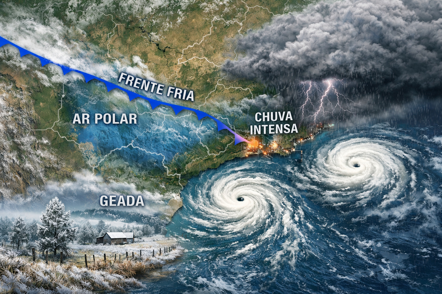
Cold front gains strength and brings climatic instability to various regions, with a significant increase in rainfall, temperature drop, and alert for typical winter phenomena
The simultaneous action of two cyclones near Brazil promises to transform the climatic scenario this weekend, bringing a combination of intense rains, a significant drop in temperatures, and an increased risk of frosts, especially in the higher regions of the South of the country. This atmospheric movement, in addition to reinforcing the arrival of a cold front, also amplifies instability in various areas, directly impacting millions of Brazilians.
The information was released by the portal “Meteored”, which monitors meteorological trends and details how the interaction between cyclones and cold air systems can rapidly alter weather conditions in several regions of Brazil, according to a recent analysis published by the specialized channel.
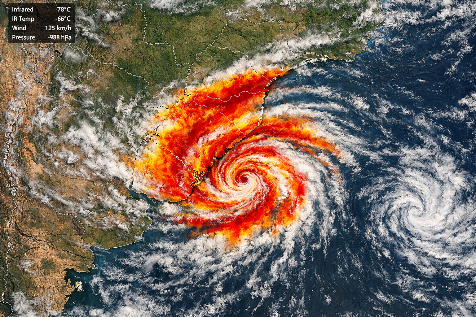
Rains advance strongly over São Paulo and Southeast, driven by cyclones
As the cyclones advance and influence the formation of the cold front, the effects begin to intensify already on Friday (17), especially in the eastern part of the state of São Paulo. However, it is on Saturday (18) that the scenario gains even more strength, with a considerable increase in precipitation.
-
Brazil Unveils Innovative Monitoring System to Prevent Abandonment of Public Works, Boosting Efficiency and Reducing Waste in Infrastructure Projects

-
AI Video Generator Automatically Creates Subtitles and Animated Captions

-
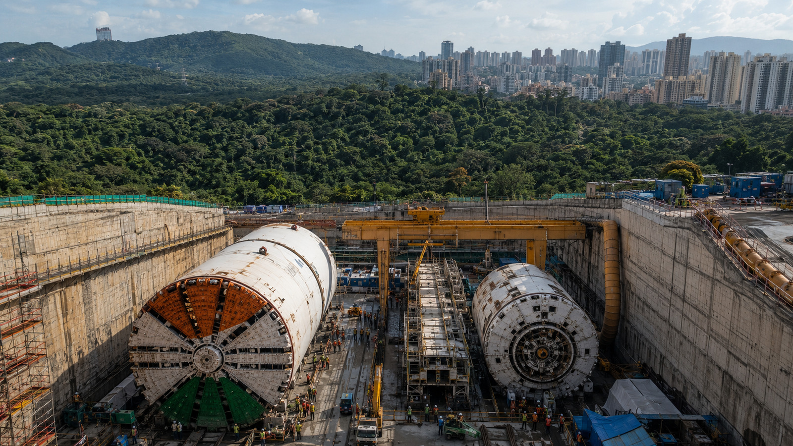
São Paulo Unveils Latin America’s Largest Underground Reservoir, Holding 900 Million Liters, in the Greater São Paulo Area

-
Chinese Teen Wins Gold in Germany for Invention Turning Air Moisture into Underground Irrigation in Drought-Stricken Areas


In this context, the rains are expected to concentrate mainly in the Metropolitan Region of São Paulo, including the capital, as well as areas near the Mantiqueira Mountains. The showers may vary between moderate to strong intensity, requiring heightened attention from the population.
On the other hand, regions of western São Paulo, near the border with Minas Gerais, are expected to register lower volumes, with light rain occurring. Still, the advance of cloudiness also reaches states like Minas Gerais, Rio de Janeiro, and Espírito Santo, where quick and isolated rains are forecasted.
These precipitations, although of low volume, may reach strategic areas such as southern Minas, the Triângulo Mineiro, and specific points in Rio de Janeiro and Espírito Santo, reinforcing the pattern of instability that dominates the climatic scenario.
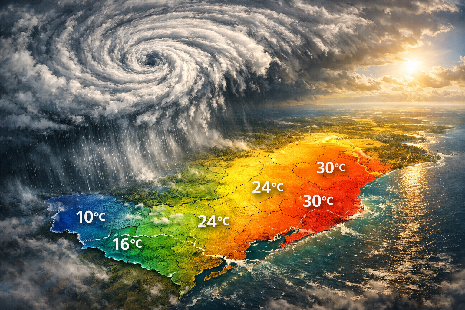
Temperatures plummet and increase the ‘chances of frosts’ in the South Region
In addition to the rains, another factor that draws attention is the sharp drop in temperatures, driven by the presence of a cold air mass associated with one of the cyclones located in the Atlantic Ocean, even though it is far from the Brazilian coast.
As a result, the weekend will be marked by significant cooling, especially in the South Region. Forecasts indicate minimum temperatures that may vary between 2°C and 4°C in the Santa Catarina mountains, a scenario that considerably increases the chances of frost.
According to specialists, frosts may reach regions such as Ausentes and Palmas, areas known for recording lower temperatures during episodes of intense cold. Meanwhile, in the eastern part of the South Region, minimum temperatures are expected to fluctuate between 13°C and 16°C.
In higher altitude regions, such as the Mantiqueira Mountains, thermometers may register around 6°C, highlighting the extent of the cold in different parts of the country.
Thermal variation persists and maintains contrast between cold and heat in some regions
Despite the entry of cold air and the drop in temperature across much of the territory, Brazil will continue to present significant thermal contrasts. In the state of Paraná, for example, there is still a forecast of elevated temperatures during the afternoon, especially between Sunday (19) and Tuesday (21).
Thus, the country remains under a typical transitional pattern, where cold and warm air masses compete for space, causing significant climatic variations over the days.
With information from: Ndmais