Portuguese
  Spanish
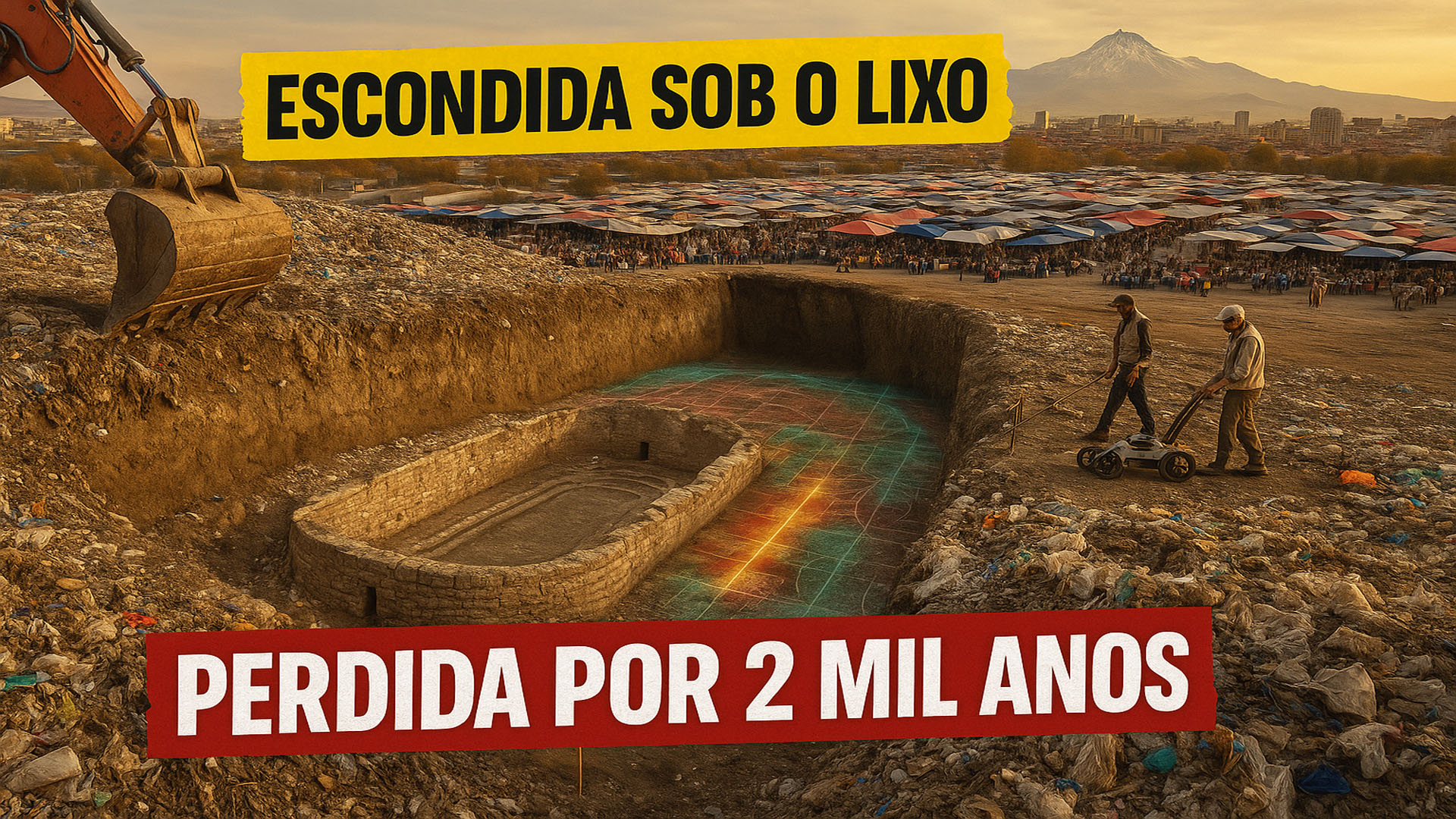
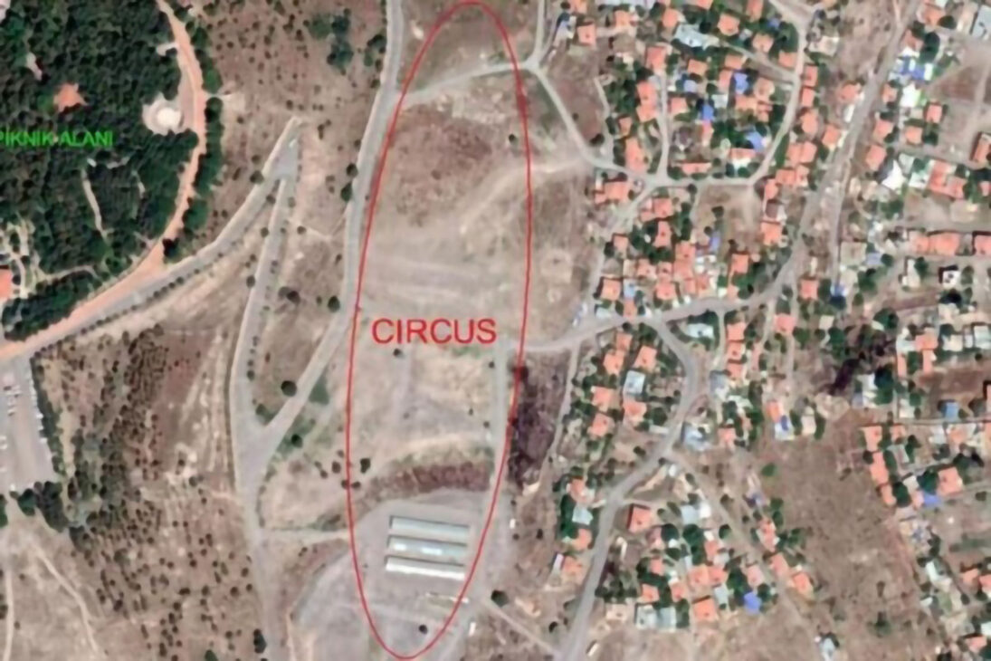
Archeologists Confirm Location of Roman Racetrack of About 450 Meters in Kayseri, the Former Caesarea. The Area Functioned as a Landfill Between 1950 and 1980 and Was Registered as an Archaeological Site on September 25, 2025.
Researchers from the metropolitan city hall crossed 19th-century maps with recent aerial images and identified an oval trace typical of a Roman circus in the urban underground of Kayseri, where it previously operated as a landfill.
Reports from travelers like Gregorios Bernardakis helped indicate the point where an ancient drawing already brought the word “Circus,” accelerating the investigations.
Subsequent archaeogeophysical surveys corroborated extensive foundations and the U-shaped layout of the enclosure, consolidating the hypothesis of a large racetrack measuring approximately 450 meters in length.
-
Bruno Guimarães, 28, Misses Crucial Penalty Against Norway in World Cup After Replacing Vinicius Jr.

-
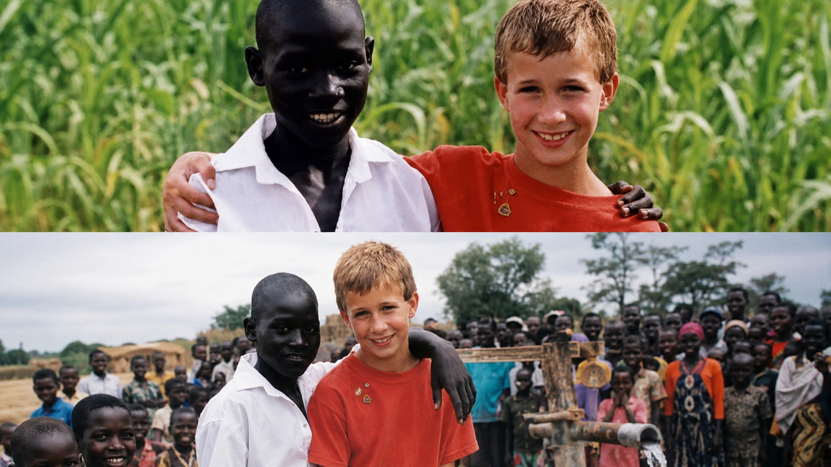
Inspired by a school lesson on Africa’s water crisis, a young boy raised money through chores to fund a well that transformed a Ugandan community.

-
Brazilian Construction Worker Moves to France, Earns Up to €2,500 Monthly with Home Renovations, Gains Social Media Attention

-
US Navy Sinks USS Oriskany with 230 kg of C-4, Creating World’s Largest Artificial Reef in 37 Minutes


Under an Ancient Landfill
Historical photos indicate land usage as a municipal dump between the 1950s and 1980s, with an approximate accumulation of 20 m of debris that kept the structure buried.
Local press reports that the site now houses the Bitpazarı, an open-air market that coexists above layers of waste and, below them, a Roman monument.
Experts believe that the unintentional burial may have preserved architectural remains by preventing modern cuts and foundations on the site.
The measured extent, of about 450 m, places Kayseri among the largest regional examples and as the third racetrack identified in Anatolia.
Kayseri: From Mazaka to Caesarea in Cappadocia
The city was known as Mazaka during the Hellenistic period and later as Eusebia under the Ariarates dynasty, reflecting local political centrality. With the Roman annexation, Tiberius (14–37 A.D.) elevated the urban status and renamed the center to Caesarea, a landmark of power and imperial culture.
In racetracks, horse and chariot races mobilized crowds and elites, besides serving imperial ceremonies and political messages.
The identification in Kayseri reinforces the network of Roman entertainment in the East and corresponds with known structures in Ephesus and Pergamon.
For Cappadocia, the finding expands the archaeological heritage beyond the rock formations, adding a highly attractive historical asset.
Legal Protection, Next Steps and Impact
On September 25, 2025, the regional council registered the area as a 3rd degree archaeological site by decision no. 9093, ensuring formal protection.
Extensive excavations require a technical plan, as the waste deposit is deep and the market remains active; for now, studies and surveys are advancing.
Municipal authorities state that new phases of dating and structural mapping will determine chronology and conservation without halting urban life.
How the Discovery Was Possible
The team combined historical cartography, orthophotos, and geophysical data to reduce uncertainties, a method gaining traction in densely populated centers.
The case of Kayseri suggests that other Roman monuments may remain hidden beneath landfills and infrastructures, calling for systematic scans. Technology, archives, and heritage management can reveal new layers of cities without major demolitions.
Vehicles such as Türkiye Today and Euronews detailed the process and extent of the racetrack, allowing for cross-checking and historical context.
What Is at Stake for Tourism and Science
The confirmation in Kayseri repositions Cappadocia also as a hub of urban archaeology, diversifying itineraries beyond the valleys and caves.
Controlled visitation programs and educational signage can connect Bitpazarı to narratives of the Roman period, generating local income.
Turkish and foreign universities are likely to compete for partnerships for excavations, bringing benefits for training, research, and cultural diplomacy.
Should the landfill be turned into an archaeological park? Or is preserving the popular market more just for the local economy? Comment if Kayseri should prioritize historical tourism, everyday commerce, or a hybrid model that reconciles both.