

 Portuguese
  Spanish
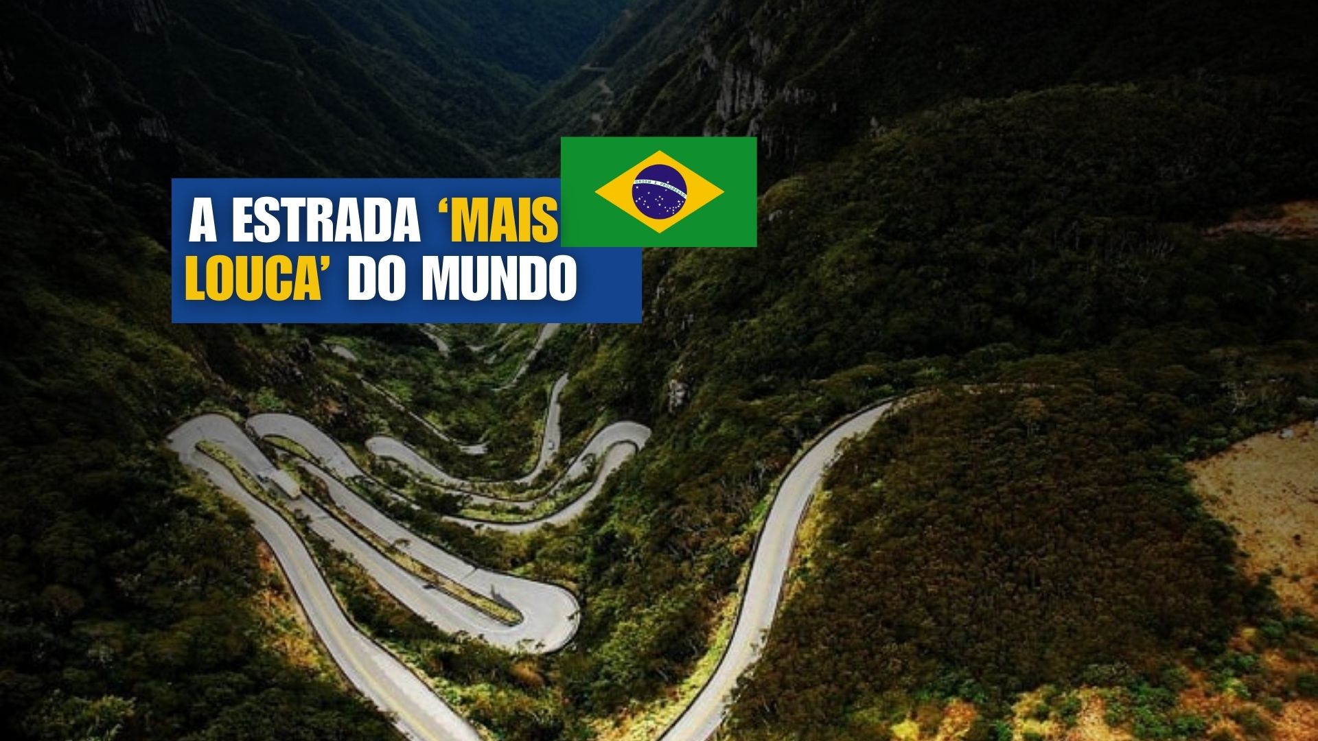
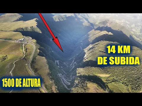
With Tight Curves, High Altitude, and Unstable Weather, Serra do Rio do Rastro Has Become One of Brazil’s Most Known Roads, Attracting Tourists with Its Combination of Lush Landscapes, Strategic Viewpoints, and Driving Challenges.
The Serra do Rio do Rastro in Santa Catarina encapsulates in just a few kilometers everything that makes a scenic road linger in the imagination of travelers.
Tight curves, steep climbs, recurring fog, and viewpoints overlooking canyons covered by the Atlantic Forest.
The stretch of SC-390 that connects Lauro Müller to Bom Jardim da Serra is about 25 kilometers long and became famous for its 284 curves, which require constant attention and justify stops along the way to contemplate the scenery.
-
Driver who “holds” the left lane can receive a hefty fine and 4 points on their driver’s license even if they think they are going at the correct speed for the road.

-
São Paulo Government puts R$ 343 million on the table and releases 31 km of duplication, 9.84 km of third lanes, 4 reinforced viaducts, and 8 grade-separated returns.

-
Volvo FH 2026 truck automatically reduces speed in risk areas in Brazil with GPS, activates engine brake without driver intervention, and combines safety with aerodynamics capable of saving up to 3% of diesel in some operations.

-
A viaduct over 40 years old in a city in Minas Gerais was closed due to the risk of collapse, blocked routes for months, exposed maintenance failures, and now requires a R$ 1.7 million project to prevent a collapse in the urban heart for decades.


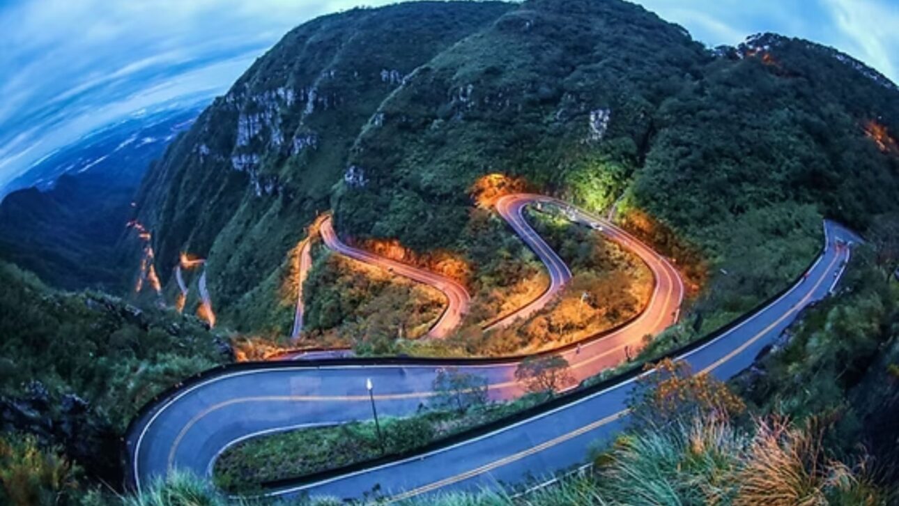
Challenging Route and Unstable Weather on SC-390
Although paved and well-signposted, the highway combines steep ramps with short-radius curves.
On humid days, traction decreases, and visibility can drop suddenly, especially at dawn and dusk.
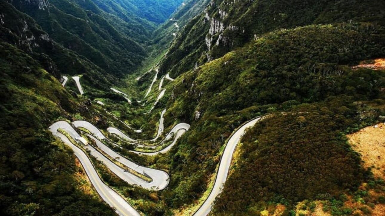
In contrast, when the clouds open up, deep valleys and rocky cliffs appear, where native vegetation clings to the slopes. In winter, there is an additional concern: the formation of ice on the road.
On June 24, 2025, for example, the Military Police needed to close the stretch for safety after freezing at critical points, with wind gusts reaching 100 km/h according to local reports.
On May 29, 2025, snowstorms and ice accumulation also led to a temporary closure. Although these occurrences are occasional, they illustrate the need to plan the ascent according to weather conditions.
Viewpoints and Altitude: What Can Be Seen from the Top
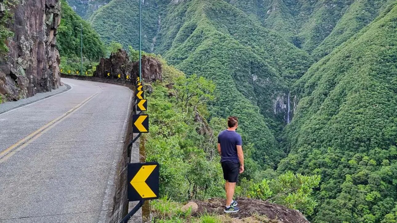
The main viewpoint, known as Mirante da Serra do Rio do Rastro, is located at the top of the plateau and exceeds 1,460 meters in altitude, from where one can see the winding road and, on very clear days, parts of the coastal plain.
The structure is simple, with parking and commerce in the surroundings, and serves as a classic spot for those wishing to observe the succession of curves on the steepest stretch.
It is common for travelers to associate the location with “Pedra Furada”, but the rock formation is actually located in the São Joaquim National Park, visible from Morro da Igreja in Urubici, and requires a free reservation through ICMBio.
Pedra Furada is not a viewpoint on SC-390, but rather an attraction in another area of Serra Catarinense.
Nearby Attractions: Canyons, Waterfalls, and Contemplation Parks
Those with time can extend the visit to the immediate surroundings.
A few kilometers from the top is the Cânion da Ronda, an edge area with a wide view and access via an internal road that passes alongside a wind farm.
The attraction operates in a private area and usually charges an entrance fee; official profiles and updated reports indicate rates starting at R$ 20 per person, which may vary depending on the season and management.
It is recommended to check operating hours and visiting conditions in advance, especially on days with strong winds.
In Bom Jardim da Serra, the Mirante Serra Parque offers contemplation structures, short trails among ferns, and decks for picnics, with entrance recently advertised at R$ 30 per person.
On days of low visibility, the space may close for safety. Another easily accessible point is the Cascata da Barrinha, by the side of SC-390, near the entrance to Bom Jardim da Serra.
Local guides inform that it is located about 7.6 kilometers from the main viewpoint of the mountain, a short distance that often provides a quick stop for photos when the weather is favorable.
For guided experiences, the Cânion do Funil is among the most sought after.
Local companies organize quadricycle tours covering about 14 kilometers in approximately two hours, starting near SC-390.
Prices vary by operator and time.
Safe Driving: Extra Attention on Cold and Foggy Days
Driving on the mountain should prioritize shorter gears for climbs and the use of engine brake for descents.
In stretches covered by fog, headlights on even during the day help increase vehicle visibility to others.
Trucks and large vehicles reduce speed on inclines, making slow traffic points frequent.
Maintaining a safe distance and avoiding overtaking in areas without visibility is essential.
Motorcyclists need to consider condensation effects on visors and the possibility of stretches with sand or moisture in the shadows of the cliffs.
Good condition tires and complete protective gear are indispensable items.
For all types of travelers, stops should only occur at official pullouts and signposted viewpoints.
Weather, Clothing, and Planning
The temperature range between the base in Lauro Müller and the top in Bom Jardim da Serra tends to be significant.
The cold is felt throughout the year, but it intensifies in winter. Warm clothing, hats, and gloves make a difference, especially when the wind blows directly in front of the viewpoint.
When planning the trip, it’s worth keeping an eye on the forecast for wind, temperature, and visibility to reduce the chance of arriving during a period of thick fog.
Since fog can form and dissipate quickly, many visitors wait for breaks in the weather throughout the day before descending the mountain or continuing their journey.
Although the road itself is an attraction, the surroundings compose a mosaic of high-altitude fields, araucaria forests, and canyons that justify one- or two-day itineraries.
With the right weather, visitors can combine the ascent and descent along SC-390 with short walks and viewpoints on private properties, respecting local access rules.
Why This Stretch Has Become a Reference for Road Enthusiasts
Few Brazilian routes offer, in such a short stretch, the transition between plateau and coastline with marked elevation changes, winding paths, and preserved landscapes.
Visibility can change in minutes, adding suspense to each curve. When the weather clears up, the reward appears in layers: the ribbon of asphalt, the canyons ahead, and the density of the Atlantic Forest all around.


-

1 person reacted to this.