Portuguese
  Spanish
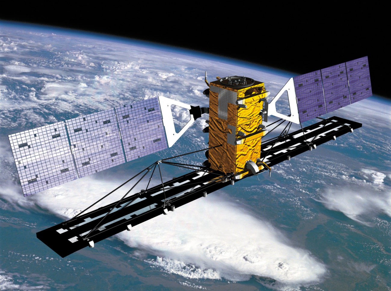
Poland has just gained a power that few countries have, changing the way it monitors its own border: it has taken control of its first radar satellite constellation in less than a year, a set of eyes in space capable of seeing the ground through clouds, smoke, and total darkness.
The detail that makes all the difference is the word radar. Most spy satellites work like a giant camera: they depend on light and clear skies to take pictures. When night falls or the weather closes in, these eyes go blind. The radar satellite does not have this problem, and that’s precisely why Poland rushed to have its own.
An eye that sees in the dark and in the storm
Instead of capturing light from the ground, the radar satellite fires its own pulses of waves towards Earth and reads what returns, creating an image from that echo. Since the technique doesn’t need the sun or clear skies, it works day or night, in good weather or under a thick layer of clouds. For a country that needs to monitor movements near its border at any time, this is worth gold.
This technique has a name: synthetic aperture radar, or SAR, in English. It uses the satellite’s own movement along its orbit to simulate a much larger antenna than what fits in the device, extracting details from the ground that a small antenna could never achieve alone. It’s a family of technology that few countries master in space, and Poland has just joined this short list.
-
Europe Opens Military Satellite Hub in Cologne, Transforming Continental Defense

-
The United States launches autonomous drone ship capable of hunting submarines and firing missiles
-
Poland’s Massive Tank and Artillery Purchases Make It Europe’s Largest Land Army Overnight
-
Indonesia Recovers Underwater Spy Drone, Sparking Debate: Is It a Machine or a Warship?


This ability to revisit the same area repeatedly, without depending on the weather, allows for comparing images from different days and catching what has changed: a convoy that appeared, equipment that was moved, a construction that grew overnight. It’s true, continuous surveillance, not just a snapshot every now and then. A constellation of several satellites multiplies this power because while one passes over a region, another is already on its way to the next, closing the time gaps when no one would be watching.
Less than a year from signing to control
What impresses engineers and military personnel the most is not just the technology, but the speed. Poland went from signing the contract to operational control of the constellation in less than twelve months, a lightning-fast timeline for a space system, which usually takes years between ordering and actual operation. This pace can only be explained by the urgency of living next to a conflict.

Poland is on NATO’s eastern flank, bordering war-torn Ukraine and the militarized enclave of Kaliningrad, on the Russian tip of the Baltic. In this neighborhood, knowing what happens on the other side of the line in almost real-time has stopped being a luxury and has become a basic security necessity. Having its own satellite means not relying on the image an ally decides to share or not, nor on their schedule.
In recent years, the country has been the biggest investor in defense in the entire alliance in proportion to the size of its economy, allocating nearly 4% of its GDP to military re-equipment, more than double the target NATO sets for its members. The radar satellite constellation is the space piece of this larger effort, which also includes hundreds of tanks, fighter jets, and anti-aircraft defense systems hastily ordered from allies like the United States and South Korea. Everything points in the same direction: a country that looked at the war next door and decided not to be caught off guard in any way.
The silent race of war neighbors
The Polish move is not happening in isolation. Across Europe, several medium-sized countries are rushing to have their own eyes in space, precisely because satellites have become smaller, cheaper, and faster to put into orbit than they were a decade ago. Sweden, newly joined NATO, has just launched its first military satellite. Now it’s Poland taking its leap, and the logic is the same in both cases: not being dependent on anyone to see their own backyard.
In practice, this means that even on a winter night covered with clouds, when a reconnaissance plane would be practically blind, the Polish satellite continues mapping what moves on the other side of the line. For commanders who need to decide in minutes, this difference between seeing and guessing can determine the outcome of a crisis before it even turns into a confrontation. It’s a silent advantage that doesn’t appear in military parades but changes the calculation of those on the other side.
I imagine the map of Europe in a few years, with each sensitive border country maintaining its constellation spinning up there, all watching the same movements from different angles. Space, which was once the domain of superpowers, has become a defense tool within reach of medium-sized nations, and the war in Ukraine accelerated this shift in a way that no one predicted with such urgency.
For Poland, the message is clear: the country wants to see on its own, whenever needed, rain or shine, day or night. And in a region where every movement counts, this kind of autonomy can weigh more than many weapons on the ground.
Do you think these own eyes in space help prevent wars or just increase distrust among neighbors? Leave your opinion below.