

 Portuguese
  Spanish
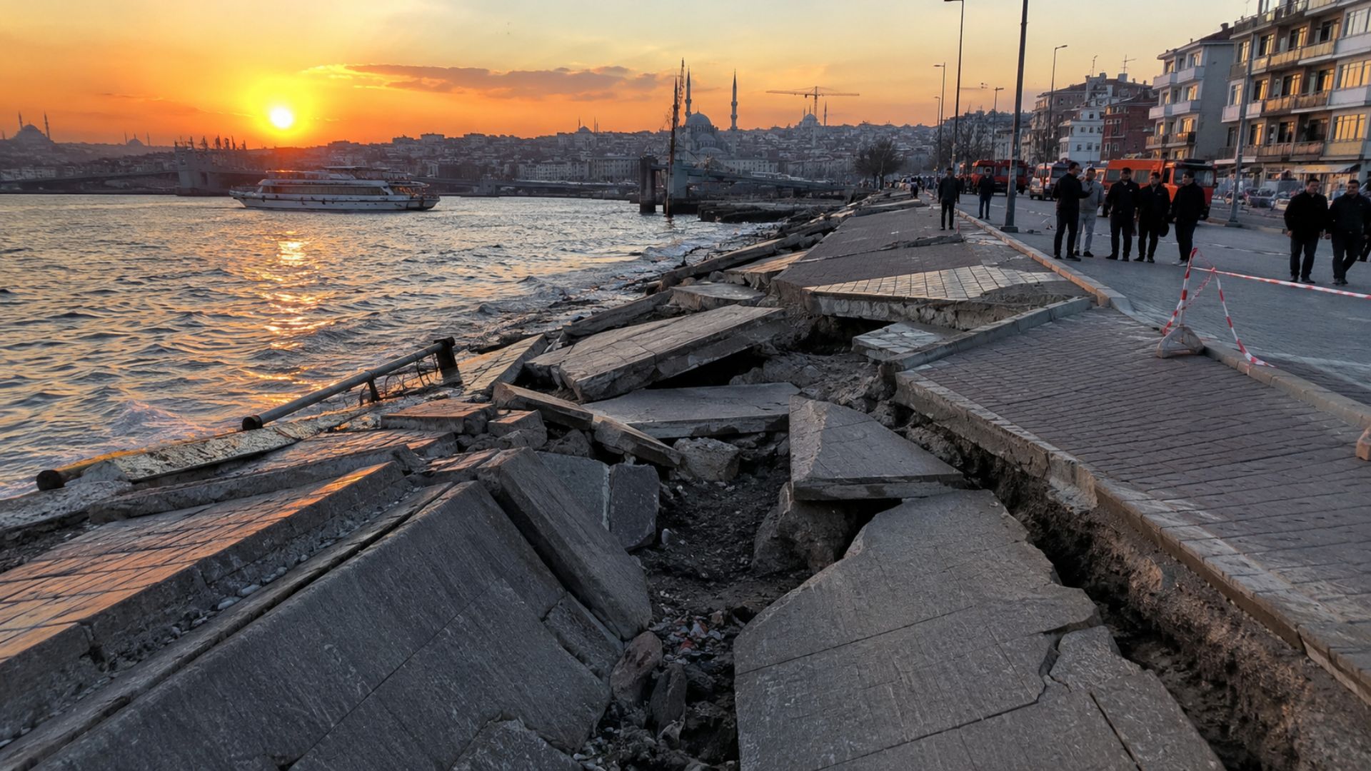
Orbital monitoring identified areas of Istanbul with gradual ground subsidence associated with landfills, fragile sediments, and intense urban expansion, revealing how invisible changes in the subsurface can affect infrastructure, coastal regions, and historical zones of Turkey’s largest city.
Distributed between Europe and Asia, Istanbul began to attract researchers’ attention after satellite radars detected gradual ground subsidence in specific areas of the city, with rates reaching approximately 15 millimeters per year, according to a study published in the scientific journal Remote Sensing.
By analyzing accumulated deformations between 1992 and 2017, scientists concluded that the phenomenon does not occur uniformly across the Turkish metropolis, concentrating mainly in regions associated with fragile soils, coastal landfills, modified banks, and increasing urban pressure.
To achieve this result, the team used 291 radar images obtained by different satellites and processed using the PS-InSAR technique, a tool aimed at monitoring millimeter-scale displacements in urban environments densely occupied by buildings, roads, and large structures.
-
They wanted artificial intelligence, but they drained the water from a village in Mexico: the water consumption of data centers caused a hepatitis outbreak, and big tech companies Amazon, Microsoft, and Google were forced to halt billion-dollar projects.

-
System created to save lives in disasters turned ‘against’ Brazilians overnight: a hacker attack sent out a false alert from Civil Defense with the word “misantropia” that went off on the phones of half the country, even in silent mode, and took down the Cell Broadcast.
-
In the cold desert of Ladakh, where it hardly rains, engineer Sonam Wangchuk created the ice stupa, a tower that freezes winter water and stores it for irrigating crops in the spring, a simple engineering feat that mimics nature.
-
For the first time in history, solar and wind energy generated more electricity than natural gas worldwide in a single month, April 2026, a milestone in the energy transition that shows renewable sources taking the lead in the global electric system.


Regions of Istanbul where the ground shows greater subsidence
In the west of the city, the Haramidere region and the Avcilar peninsula appear among the most sensitive points identified by the survey, with subsidence of up to 10 millimeters per year in areas historically marked by geological instability and intense urban occupation.
According to the researchers, the combination of less consolidated superficial layers, previous records of landslides, and continuous real estate expansion helps explain the persistence of ground lowering over the years in parts of this metropolitan region.
Also in the western part of Istanbul, the banks of the Ayamama river showed deformations associated with shallow alluvial deposits, where orbital radar recorded subsidence rates of up to 10 millimeters per year during the analyzed historical series.
With the progress of environmental recovery and flood prevention works carried out in the local river system, scientists observed a gradual reduction in the affected area, although the ground’s behavior continues to be monitored due to the region’s geological sensitivity.
Coastal landfills and skyscrapers enter the radar
In addition to inland areas, reclaimed coastal sections have been added to the deformation map monitored by satellites, especially in Yenikapi and Maltepe, where rates close to 10 millimeters per year were recorded in terrains formed by fill material and alluvial clays.
On the banks of the Golden Horn, researchers identified similar behavior in sectors modified by urban interventions and coastal redevelopments, a scenario that altered the natural dynamics of the subsurface over the past decades.
In Levent, a neighborhood known for its concentration of tall buildings and business centers, the team detected a very localized case of subsidence associated with the vicinity of a skyscraper and other vertical constructions.
Since 2016, the monitored point has shown an average subsidence of approximately 15 millimeters per year, with an initial acceleration considered significant by the authors during the first months observed in the time series.
According to the study, the deformation may be related to changes in subsurface conditions around the foundations, although the data do not indicate a homogeneous process or a generalized risk for the entire city.
Historical heritage coexists with ground transformation
Even though it presents lower rates than those observed in some of the most subsidence-affected cities in the world, Istanbul raises concern due to its historical importance, high population density, and infrastructure distributed across two continents.
Recognized by UNESCO as a World Heritage site, the city concentrates areas linked to Byzantine and Ottoman histories, including mosques, walls, palaces, churches, cisterns, and architectural ensembles preserved for centuries.
At the same time, verticalized neighborhoods, transport corridors, coastal landfills, and regions subjected to intense urban expansion coexist on terrains that respond unevenly to transformations accumulated over time.
The researchers emphasize that there is no single explanation for the subsidence detected by satellites, as each monitored area presents quite different geological and urban characteristics.
While some sectors suffer predominant influence from the sedimentary composition of the soil, others reflect effects associated with drainage, urban works, landfill consolidation, and the concentration of heavy structures.
Satellites reveal invisible changes beneath the city
Through orbital radar, specialists can monitor deformations practically imperceptible to the naked eye, creating historical series capable of indicating relevant trends for urban planning, infrastructure maintenance, and geotechnical risk monitoring.
Instead of revealing uniform subsidence across the entire metropolis, the images show a mosaic of distinct behaviors, shaped by the continuous interaction between local geology, accelerated urban growth, and human interventions accumulated over decades.
Long-term analysis also allows differentiating punctual movements from persistent patterns, an aspect considered fundamental in a city marked by successive layers of urbanization, coastal landfills, altered margins, and intense metropolitan expansion.
More than an exclusively geological phenomenon, the case of Istanbul highlights how silent changes in the subsoil can directly influence heritage conservation, urban infrastructure, and the planning of densely populated cities.


-

-

-

-

7 people reacted to this.