Portuguese
  Spanish
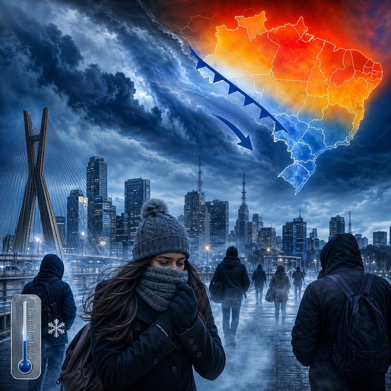
Polar air mass could drop São Paulo to near 10 °C while North and Northeast exceed 36 °C, creating one of the year’s biggest thermal contrasts.
In April 2026, the state of São Paulo enters a period of meteorological change, but with an important adjustment: the polar air mass advancing through Southern Brazil at the end of the month is not expected to immediately drop the São Paulo capital to near 10 °C. The most current information indicates a different scenario for the state: before the stronger cold, São Paulo experiences low humidity, isolated rain showers, risk of isolated storms, and indirect influence from the extratropical cyclone acting in the South of the country.
According to CNN Brasil, in a report published on April 25, 2026, the Civil Defense of the State of São Paulo warned of changes in weather conditions on Sunday, the 26th, with sun across much of São Paulo’s territory in the morning and a forecast of isolated rain showers in the afternoon, accompanied by lightning and wind gusts. INMET also issued low humidity and storm alerts for areas of the state.
Low humidity and isolated storms put São Paulo on alert before the arrival of stronger cold
The São Paulo scenario at the end of April is marked by a typical irregular autumn combination: heat for part of the day, low humidity in areas of the state, and a change in weather caused by the approach of atmospheric systems.
-
NASA Plans to Repurpose Mars Rover for Lunar Mission, Sending a 1-Ton Nuclear-Powered Vehicle to Explore the Moon’s South Pole Without Solar Dependence
-
NASA Plans to Repurpose Mars Rover for Lunar Mission, Sending a 1-Ton Nuclear-Powered Vehicle to Explore the Moon’s South Pole Without Solar Dependence
-
Expanded Polystyrene Gains Ground as a Lightweight Alternative to Traditional Masonry in Construction
-
Expanded Polystyrene Gains Ground as a Lightweight Alternative to Traditional Masonry in Construction
The CNN report states that Sunday begins with sun across much of São Paulo, but the condition changes throughout the day, with isolated showers and the possibility of lightning and gusts.
On Monday, the 27th, instability intensifies and may affect the entire state, with rain throughout the day and periods of moderate to strong intensity.

This is the safest focus for the agenda: São Paulo goes on alert for a weather shift, not for immediate extreme cold.
The most intense cold is initially concentrated in the South, while the state of São Paulo experiences a transition period, with an unstable atmosphere and a gradual drop in temperatures after the rain areas pass.
Cold near 10 °C in São Paulo appears as a trend for May, not as a direct effect of this April shift
The forecast for lows near 10 °C in the city of São Paulo is linked to a later episode. In a report published on March 19, 2026, Santa Portal, based on meteorologists and extended projections, informed that the first large polar air mass strong enough to drop temperatures below 10 °C in the São Paulo capital should only reach the Southeast starting from the second half of May.
The same report cites Climatempo as indicating that the first intense polar mass of autumn could occur at the turn of May to June, with lows around 10 °C in São Paulo.

This interpretation also appears in an analysis published by Conexão Safra, which states that April would still have characteristics similar to summer, with heat and isolated rain episodes in the Central-South, while a more consistent drop in temperature would be expected from May.
The publication states that, according to Climatempo’s analysis, the first more intense polar air mass of autumn is expected to arrive at the turn of May to June, potentially bringing Southeast capitals, such as São Paulo, to lows near 10 °C, but emphasizes that this is a long-term projection subject to adjustments.
Cyclone in the South influences the Southeast, but São Paulo feels more instability than extreme cold
The influence of the extratropical cyclone occurs indirectly over São Paulo. The system acts more strongly in Southern Brazil, helping to organize the change in atmospheric patterns, but in the state of São Paulo, the most relevant impact appears in the form of instability, rain showers, wind gusts, and a subsequent drop in temperatures, and not as frost or widespread severe cold.
Climatempo made it clear that the core of the late April cold snap is in the South, with lows between 0 °C and 2 °C in high-altitude areas of Rio Grande do Sul and Santa Catarina, in addition to the risk of isolated frost in these regions.
For São Paulo, the correct interpretation is different: the state is entering a turning point period, but the truly significant cold still depends on the polar air mass forecast for May.

São Paulo is expected to experience an autumn of fluctuations, with heat, rain, and localized cold
The forecast for São Paulo indicates an autumn with fluctuations. April still maintains characteristics of heat and rain showers, while May tends to make way for more frequent and stronger cold air masses.
This means that the population of São Paulo may face muggy days, a drop in humidity, rapid weather changes, and, subsequently, colder mornings.
The main alert for São Paulo, at this moment, is the meteorological shift at the end of April, with low humidity and isolated storms, while cold temperatures near 10 °C should be treated as a trend for May, still dependent on model updates.
Is São Paulo prepared for a rapid shift between dry weather, rain, and cold?
The state of São Paulo enters late April under a typical autumn transition pattern, but with ingredients that require attention: low humidity, isolated showers, wind gusts, and the possibility of moderate to heavy rain in parts of the state. The most intense cold is not yet the main element of this shift, but it already appears on the horizon of projections for May.
The question is whether São Paulo is prepared to deal with this increasingly common sequence of dry weather, rapid rain, temperature drops, and new fluctuations within a few days.