Portuguese
  Spanish
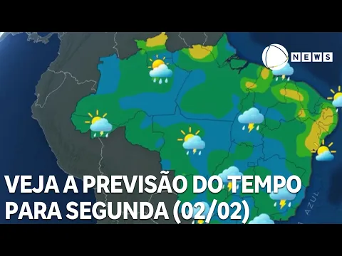
Heavy Rains Put Southeast and Midwest on Alert. Forecast Indicates High Accumulations, Risk of Storms and Disruptions Until Wednesday.
A sequence of heavy rains is expected to put areas of the Southeast and Midwest on alert over the next few days. The weather forecast indicates that states such as São Paulo, Paraná, Mato Grosso do Sul, and Minas Gerais may record high volumes of precipitation until Wednesday (4), with totals that, in specific locations, may reach 200 millimeters in just three days.
The scenario raises concerns about risks such as flooding, flash floods, and urban disruptions.
Rainfall Volume Above Average Concerns Authorities
Unlike isolated episodes, what stands out in this event is the persistence of the rains.
-
Scientists Confirm “Greening” of Antarctica: Ice on the World’s Coldest Continent Turns Green as Mosses Multiply Over Tenfold in Four Decades

-
2,000-Year-Old Gold Rings Found with Human Bones in Thailand Reveal Rare Burial and Feature Ancient Indian Inscription

-
Lenovo Unveils Legion Y700 Tablet with RGB Backlighting, 5G, and SIM Card Support

-
World’s First Nuclear Hydrogen Unit Begins Operation: Copper-Chlorine Technology with Initial Capacity of 150 Liters per Hour, Aiming for 3,000 Liters per Hour


The atmospheric instability is expected to act continuously, favoring significant accumulations in a short period.
This pattern increases the vulnerability of urban areas, especially where the soil is already saturated from recent precipitation.
Therefore, the alert extends not only to new rains but also to secondary impacts.
Where Should the Rains Be More Intense?
The regions with the highest risk of significant accumulations are concentrated between the South, Southeast, and Midwest. The most affected states include:
- Paraná, mainly the east and north
- São Paulo, with a focus on the interior and west
- Mato Grosso do Sul, in much of the state
- Minas Gerais, especially the Triângulo Mineiro
In these areas, the rain forecast indicates frequent episodes, which may vary from moderate to strong.
Monday Marks the Start of the Most Critical Period
Monday (2) already begins with heavy rains over Mato Grosso do Sul, accompanied by the risk of severe storms during the early morning and the start of the day.
Throughout the day, the instabilities will advance towards Paraná and São Paulo, where the rain is expected to gradually intensify.
Meanwhile, the Triângulo Mineiro will also begin to record increased cloud cover and more frequent precipitation.
Rains Spread and Gain Strength on Tuesday
On Tuesday (3), the scenario becomes even more widespread.
The rains remain intense in Mato Grosso do Sul and advance more organized over the western São Paulo and the central-north of Paraná.
During the afternoon and evening, the instability will intensify and reach other areas of the Southeast, maintaining the alert for storms and high rainfall volumes in a short time.
Extreme Accumulations Increase Risk of Flooding
With the persistence of precipitation, the rain accumulations may reach significant levels by the middle of the week.
The forecast indicates that some locations may exceed 200 mm, a value considered high even for summer.
This volume significantly increases the risk of urban flooding, river overflow, and landslides, especially in areas with a history of problems during rainy periods.
Wednesday Still Requires Attention in Southeast and Midwest
On Wednesday (4), although there will be a brief decrease in the intensity of the rains during the morning, the risk does not disappear completely.
Throughout the afternoon, new areas of instability may form, keeping the rain alert for São Paulo, Mato Grosso do Sul, central-south of Mato Grosso, and Minas Gerais, especially in the Triângulo Mineiro.
In Paraná, the trend is for a gradual reduction in precipitation.
Trend Indicates Shifting of Rains in the Coming Days
For the following days, weather models indicate that the area of instability should shift toward the central-north of Brazil.
As a result, the Southeast and Midwest are expected to experience a gradual decrease in the most extreme volumes.
Nevertheless, the recommendation is for constant attention to weather alerts, especially in vulnerable areas.
With information from O Tempo