Portuguese
  Spanish
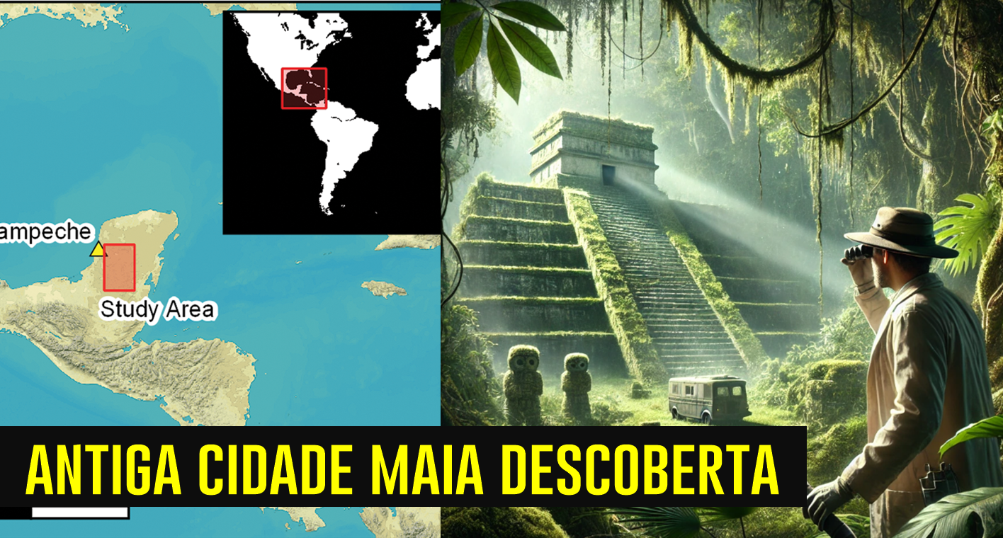
During Online Research, Scientist Identifies Ruins of a Lost Maya City, Revealing an Unexpected Archaeological Find
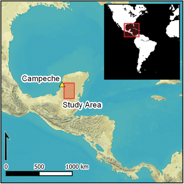
An archaeologist from Tulane University, Luke Auld-Thomas, made a remarkable discovery while analyzing LiDAR three-dimensional maps of densely vegetated areas in southern Mexico. During an online search, Auld-Thomas accidentally found evidence of an ancient Maya city, named Valeriana, hidden in the jungles of the Campeche region.
The Unexpected Discovery of the Maya City
The team of scientists led by Auld-Thomas was studying an area equivalent to the size of the city of Edinburgh, Scotland.
As described in a study published in the journal Antiquity, the discovery was based on data from 2013 collected by a Mexican environmental monitoring organization.
-
Bruno Guimarães, 28, Misses Crucial Penalty Against Norway in World Cup After Replacing Vinicius Jr.

-
Inspired by a school lesson on Africa’s water crisis, a young boy raised money through chores to fund a well that transformed a Ugandan community.

-
Brazilian Construction Worker Moves to France, Earns Up to €2,500 Monthly with Home Renovations, Gains Social Media Attention

-
US Navy Sinks USS Oriskany with 230 kg of C-4, Creating World’s Largest Artificial Reef in 37 Minutes


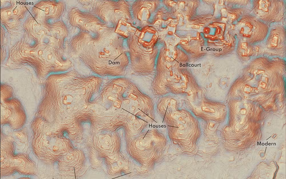
“I was on page 16 of a Google search when I found this laser research,” Auld-Thomas explained in a statement. The archaeologist and his colleagues from the Department of Anthropology found over 6,500 pre-Hispanic structures, including impressive stone pyramids.
Implications and Surprises
What is most surprising is that this large Maya city is located near a current highway and in an area where local farmers have been cultivating among the ruins for years. “Neither the government nor the scientific community was aware of this city,” Auld-Thomas stated. “This proves that we still have much to discover about the Maya civilization.”
LiDAR Technology: The Secret Behind the Discovery
LiDAR (Light Detection and Ranging) technology was key to this discovery. By firing laser pulses from aircraft towards the ground, scientists were able to create detailed three-dimensional models of densely forested areas. This enabled them to identify subtle differences in the terrain that revealed structures that would otherwise go unnoticed.
The findings are just a 15-minute walk from a main road near the town of Xpujil. For reference, Calakmul, a famous archaeological site with impressive pyramids, is only 100 kilometers away.
Dense Urbanization and Abandonment
Studies indicate that urbanization may have been more common than previously thought during the peak growth period of the Maya, between 250 and 900 A.D. However, experts disagree on whether these findings represent a pattern for the entire region or just some specific urban centers.
One of the points that still intrigues scientists is what led to the decline of these cities. According to the BBC, some theories suggest that climate change was a decisive factor. “The landscape was fully occupied at the onset of dry conditions, with no remaining flexibility,” Auld-Thomas noted. This may have led to the disintegration of the Maya system.
“I have to visit Valeriana at some point,” the archaeologist said. “It’s so close to the road, how could I not go?”