
 Portuguese
  Spanish
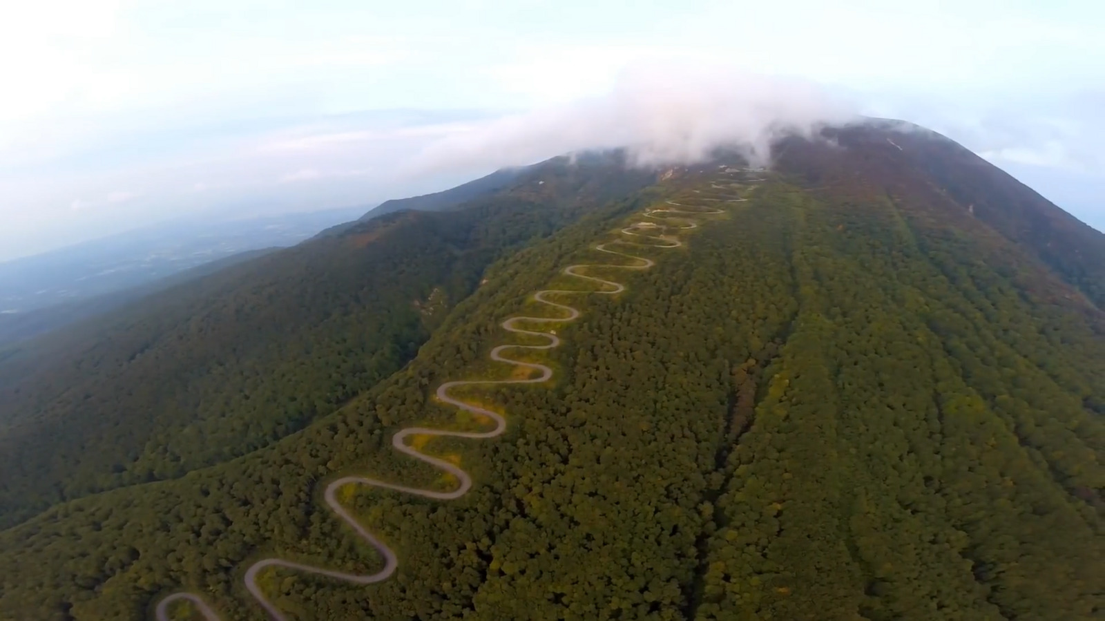
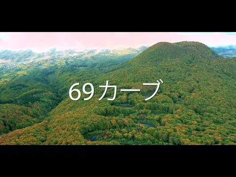
Mountain Route in Hirosaki Features 69 Curves, Eight Hundred Meters of Elevation, and Narrow Sections That Require Constant Attention, Creating One of the Most Challenging and Impressive Routes in the Aomori Region
The Tsugaru Iwaki Skyline is known for challenging drivers because it combines sharp curves, steep inclines, and unpredictable weather. The road is located in Hirosaki, Aomori Prefecture, and follows part of Mount Iwaki, which dominates the entire region. The scenery grabs attention right at the beginning of the route, as the road forms a long zigzag along the slope.
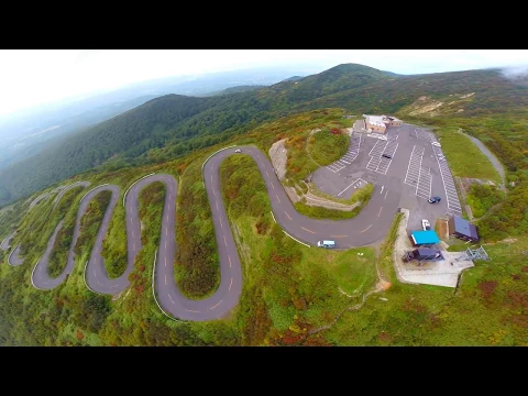
Overall, there are 69 curves spanning about 10 kilometers. This number has turned the route into one of the most difficult mountain paths in the country.
Steep Ascent to the Upper Station
The route begins on the outskirts of Hirosaki and ascends through an area covered with beeches. The total elevation reaches 806 meters, so the slope requires constant attention.
-
Brazilian Entrepreneur Turns Door-to-Door Jewelry Sales into a Family Business Empire with Over 70 Stores

-
$75 Million Bridge in Brazil Opens to Connect Cities, Create Jobs, and Cut Travel Time from 30 to 2 Minutes; Spanning 1.24 km, It’s Among the Country’s Largest and Ends Decades of Ferry Queues.

-
Brazilian Farmer Builds 8-Ton Tractor from Army Truck Engine, Plants Over 100 Hectares of Soybeans
-
11-Year-Old Entrepreneur Turns Fear of Bees into Honey Lemonade, Wins $60,000 on Shark Tank, Secures Whole Foods Deal, and Expands Brand Across U.S. Stores


In some parts, the angle approaches 10%, which forces the driver to carefully control their speed.
The road also narrows in several sections and presents very tight curves. This means that every directional change relies on quick reactions, especially when fog suddenly appears. This phenomenon is common due to the altitude.
Seasonal Road and Access by Cable Car
The route ends at the eighth station of Mount Iwaki. From there, a cable car departs to the ninth station, offering a broad view of the region when the weather is favorable.
Both the road and the cable car belong to Iwaki Skyline Co., Ltd., a company associated with Kōnan Bus Company.
Access is paid and varies depending on the type of vehicle. As the area receives heavy snowfall in winter, the road operates only between spring and autumn.
During the rest of the year, ice takes over the road and prevents safe circulation.
Construction and Modernization of the Road
The creation of the Tsugaru Iwaki Skyline began in April 1958 when Japan sought new alternatives to boost tourism.
Two years later, in August 1960, the road became the first toll road in Aomori Prefecture.
The cable car would only be added later, in 1972, expanding access to the higher stations.
In 1993, the system underwent modernization and began operating in both directions, increasing the flow of visitors. In 1999, the route’s administrator officially adopted the name Iwaki Skyline Co., Ltd.
Competition and Technical Difficulty
The road was not restricted to tourism. Over time, it became a stage for mountain ascent competitions.
These events put athletes face-to-face with the sixty-nine consecutive curves, creating a contest marked by physical and technical demands.
The combination of altitude, incline, and constant deviation makes the race exhausting.
Additionally, many participants highlight that the rapid change of pace wears them out just as much as the ascent itself.
Regional Symbol and Tourist Attraction
Today, the Tsugaru Iwaki Skyline represents more than an engineering feat. It has become a symbol of Hirosaki because it brings together a striking landscape, local history, and a route that demands respect.
The road continues to attract tourists, cyclists, and drivers who wish to tackle one of the most challenging routes in Japan.
Information from Wikipedia.


