






 Portuguese
  Spanish


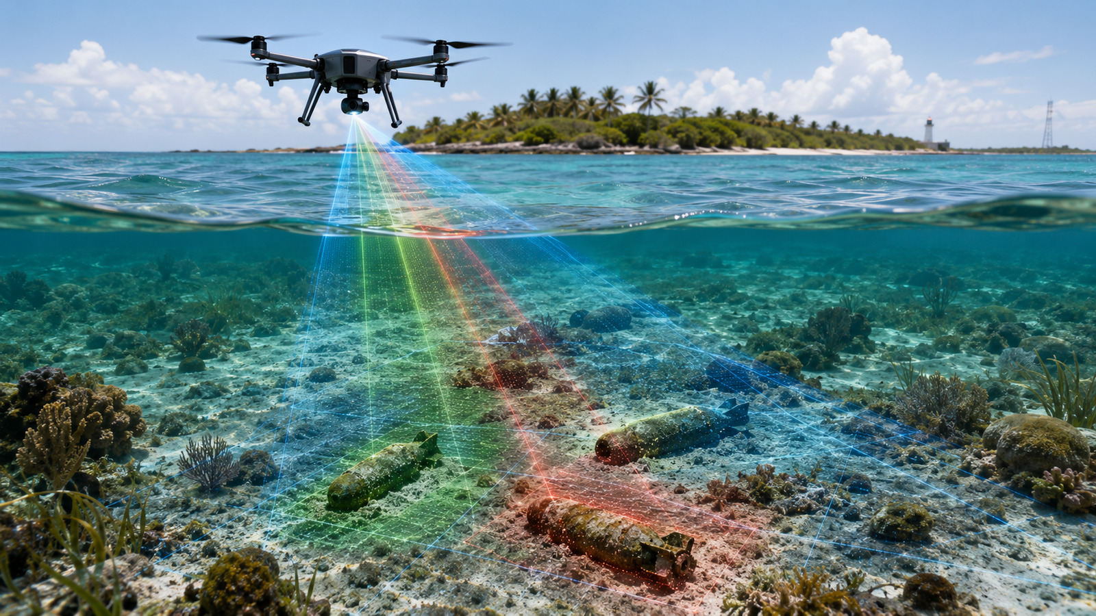

Researchers from the Rosenstiel School of the University of Miami have unveiled an aerial technique capable of detecting undetonated underwater bombs in shallow waters with high precision. The system combines drones, multispectral sensing, artificial intelligence, and technologies developed by NASA to make coastal mapping safer and more efficient.


Underwater bombs still pose a risk in coastal areas
Bombs, mines, and artillery shells that have not detonated remain hidden in shallow ocean regions after decades of conflicts. These artifacts can threaten tourists, marine life, and navigation routes.
The detection of these objects is usually expensive, slow, and risky. In shallow waters, standard sonar may fail, while regular cameras struggle with sand movement and wave-induced distortion.
-
Helicopters Drop “Green Rain” of Seeds Over Remote U.S. Forests to Reforest 19 Hard-to-Reach Areas in Minnesota, Reviving Pine Trees Where Ground Teams Struggle to Access

-
Brazilian Man Builds Homemade Welding Machine Using Parts from Old Microwaves, Achieving Over 100 Amperes

-
Canada Sinks Six Giant Balloons in Lake Ontario to Test Underwater Battery That Stores Compressed Air 60 Meters Deep
-
Astronauts Returning from Space Develop Early Cataracts Due to Eye Lens Radiation, Highlighting Risks for Future Mars Missions


The central problem is the water itself. The waves act as moving lenses, distorting the light and making it difficult to clearly view the seabed.
Drones used two advanced NASA technologies
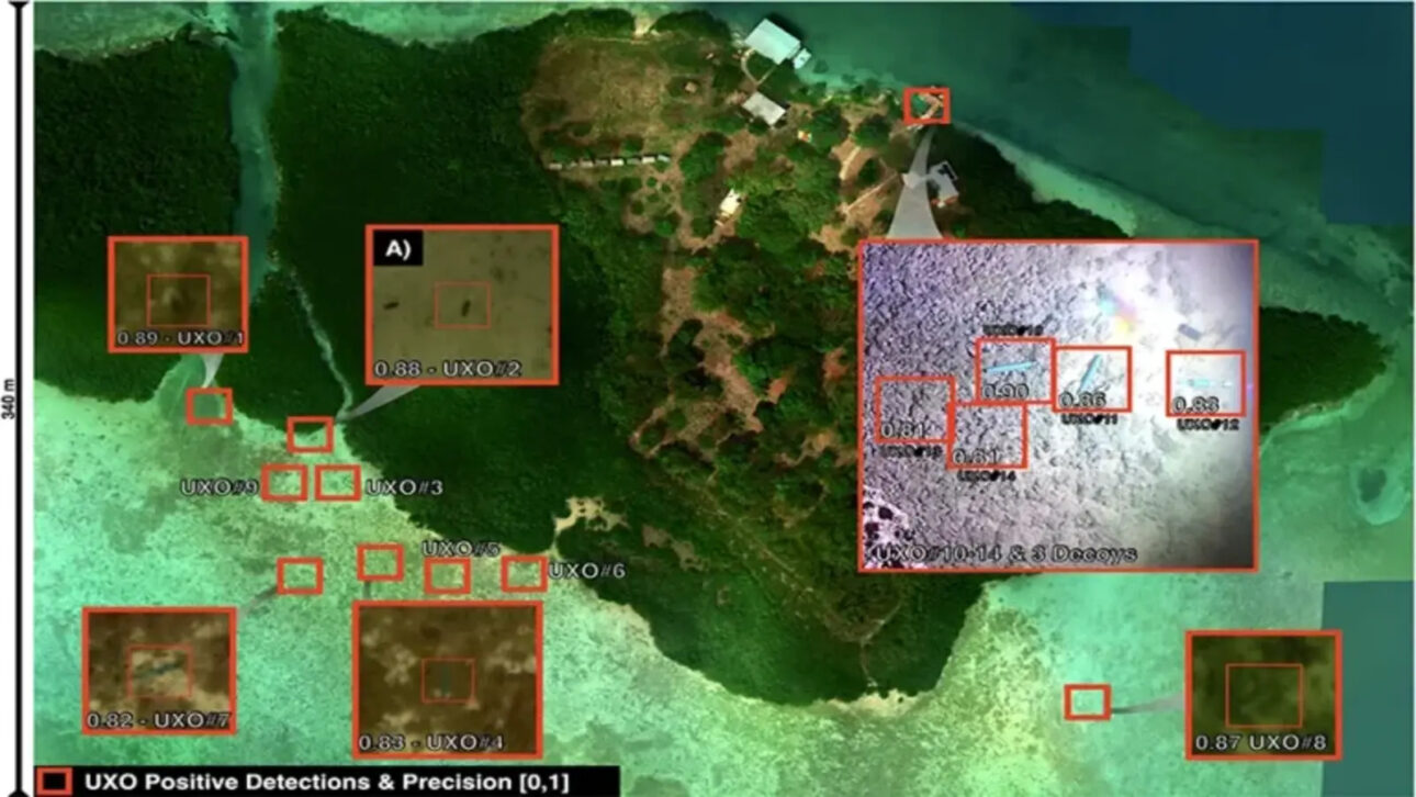
To tackle this obstacle, the team led by Ved Chirayath from the University of Miami deployed drones over the Florida Keys. The experiment used two advanced NASA technologies: Fluid Lensing and MiDAR.
Fluid Lensing is an algorithm created to remove, in real-time, the distortion caused by waves. With this, the system can generate clearer and high-resolution images of the ocean floor.
MiDAR, on the other hand, is an active multispectral sensing system. It emits multiple wavelengths of light through the water column, illuminating submerged areas that would normally be difficult to observe clearly.
The combination of these tools allowed researchers to map the seafloor with less interference from the surface, even in an environment subject to movement, sediments, and biological coverage.
Test was conducted in Broad Key, in the Florida Keys
In the experiment, researchers placed inert test munitions and decoys on the seafloor around Broad Key, a research island in the northern Florida Keys.
Detecting a newly submerged bomb is simpler. The greater challenge is locating an artifact that has been in the marine environment for decades, covered by sediments, algae, and other organisms.
Over time, tides move sand around the objects. At the same time, marine life grows over the metallic surface, camouflaging the munitions in the ocean’s natural scenery.
To overcome this difficulty, researchers trained a machine learning model with high-resolution drone images. The artificial intelligence learned to identify the geometric characteristics of the munitions.
With this, the system was able to differentiate the targets from natural formations of corals, rocks, and debris. Even after weeks of biological growth and sediment accumulation, all test weapons were successfully identified.
Technology can make coastal operations safer
According to Ved Chirayath, unexploded explosive artifacts in shallow waters remain a serious global challenge.
He stated that the results demonstrate a scalable aerial solution to improve detection accuracy and promote safer coastal environments.
The application of the technique can go beyond Florida. Undetonated underwater bombs still exist in former European battlefields and forgotten disposal sites in the Pacific.
These artifacts can also release toxic chemicals into fragile ecosystems and disrupt important coastal infrastructure projects.
Current methods have significant limitations. Divers face high risks, while acoustic vessels cannot operate safely in waters less than ten meters deep.
In this scenario, aerial drones can offer a faster and safer alternative, with the ability to cover large coastal areas in a single flight.
Despite the initial high-precision results, researchers still need to test the system in a wider variety of marine environments, including the murky channels of the Atlantic and the deep bays of the Pacific.
This article was prepared based on information from the Rosenstiel School of the University of Miami and the material provided about the study led by Ved Chirayath, with data, numbers, and statements preserved as per the consulted material.


