

 Portuguese
  Spanish
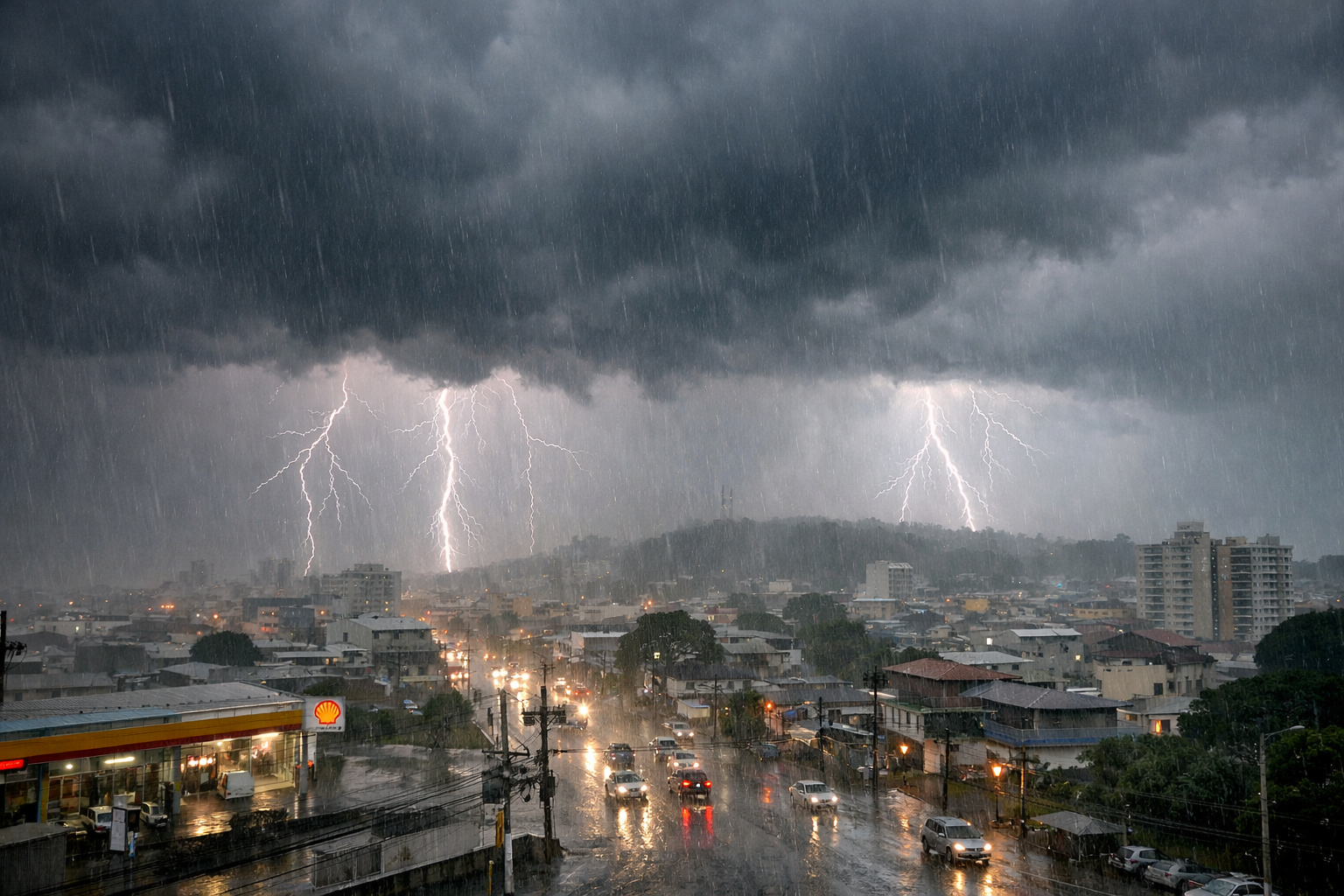
Cold Front Over The High Sea Intensifies Instabilities, Maintains Heat, and Puts Santa Catarina on High Alert for Thunderstorms, Floods, and Disruptions Between Saturday and Sunday

The weekend in Santa Catarina with risk of thunderstorms mobilizes authorities and puts the population on alert. Since the beginning of Saturday (17), the presence of a cold front over the high sea intensifies atmospheric instabilities, favoring heavy rain, lightning, strong winds, and possible hail in various regions of the state. Additionally, despite the rain, the heat persists, increasing the feeling of stuffiness and enhancing storm formation.
The information was released by g1 Santa Catarina, based on data from the state Civil Defense, which reinforced warnings for flooding, landslides, roof damage, and damage to the power grid throughout the weekend.
-
Going to travel and leave your pet alone? Brazilian city creates strict rule, targets temporary abandonment, and can fine dog and cat owners up to R$10,000.

-
Traffic jammed between BH and Nova Lima may get significant relief with the Viaduto Ferradura, a R$ 48 million project that promises to connect MG-30 and MGC-356 without passing through the Belvedere junction.

-
Rio Pinheiros catches the attention of those passing by the bike path with less strong odor, more capybaras and birds on the banks, a reduction of up to 55% in organic matter, and a record removal of trash in São Paulo.
-
Heavy metals in the sea, fishermen without income, and concerned residents: chemical contamination in São Tomé de Paripe leads Salvador to declare an environmental emergency for 90 days and mobilize municipal agencies.


Thunderstorms Gaining Strength on Saturday with High Heat and Humidity
During the morning of Saturday (17), the sun still appears in a large part of Santa Catarina. However, as the afternoon progresses, the combination of heat, high humidity, and the cold front at sea favors the development of thunderstorms. These events occur mainly from the early afternoon onwards.
Furthermore, the thunderstorms may be accompanied by frequent lightning, gusty winds, heavy rain in a short period, and localized hail. According to the Civil Defense, the risk of occurrences such as flooding, falling branches, and power outages significantly increases during this period.
Despite this, throughout the night, the instabilities tend to weaken. Nonetheless, isolated areas may continue to experience moderate rain, especially along the coast and in the Itajaí Valley.
Sunday Maintains Instability and Increases Flood Risk on the Coast
On Sunday, the scenario changes little. Since the morning, the sky shows more clouds and fewer openings of sun, allowing for rain to occur in the early hours of the day. Nonetheless, it is in the early afternoon that new thunderstorms start to form again in Santa Catarina.
Unlike Saturday, these storms are expected to occur in a more isolated manner. Still, they maintain the potential for heavy rain, lightning, strong winds, and localized hail. Additionally, at night, instability increases in the North Coast and the Itajaí Valley, raising the risk of flooding and urban flash floods.
Meteorological maps released by the Civil Defense indicate areas with moderate to high risk for structural damage, especially in coastal and hillside regions.
Civil Defense Reinforces Safety Guidelines for the Population
In light of the thunderstorm scenario in Santa Catarina, the Civil Defense reinforced a series of preventive recommendations. The goal is to reduce risks and avoid accidents during periods of heavy rain and strong winds.
Among the main recommendations are:
- Never cross flooded streets or submerged bridges
- Avoid driving in places with water accumulation
- Avoid direct contact with floodwater
- Avoid walking or biking along the shore when waves reach the street
- During strong winds, seek safe shelter
- Stay away from trees, poles, signs, windows, and loose objects
In emergency situations, the population should contact the Fire Department at phone number 193 or the Civil Defense at 199.
Have you ever faced flooding or disruptions caused by thunderstorms in Santa Catarina? How was the experience?


Be the first to react!