
 Portuguese
  Spanish
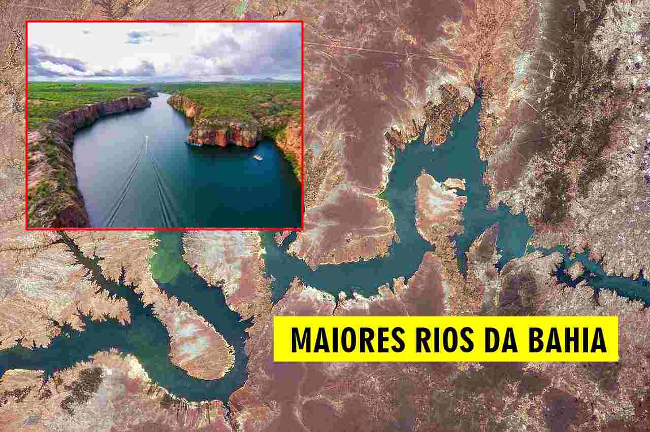
From the Hinterland to the Coast, the Rivers That Cross Bahia Reveal the State’s Natural Diversity. Paraguaçu, de Contas, Jequitinhonha, and São Francisco Form Waterways That Connect Biomes, Supply Cities, and Sustain Lives. Understand Where They Rise, Where They Flow, and Where They Discharge.
Bahia, the largest state in Brazil’s Northeast, is traversed by various rivers that connect its regions and sustain ecosystems, cities, and economic activities.
Among the main waterways, four stand out: Paraguaçu, de Contas, Jequitinhonha, and São Francisco.
Each of them has a unique trajectory, with sources and mouths distributed between Bahia and neighboring states, but all have significant importance for the Bahian territory.
-
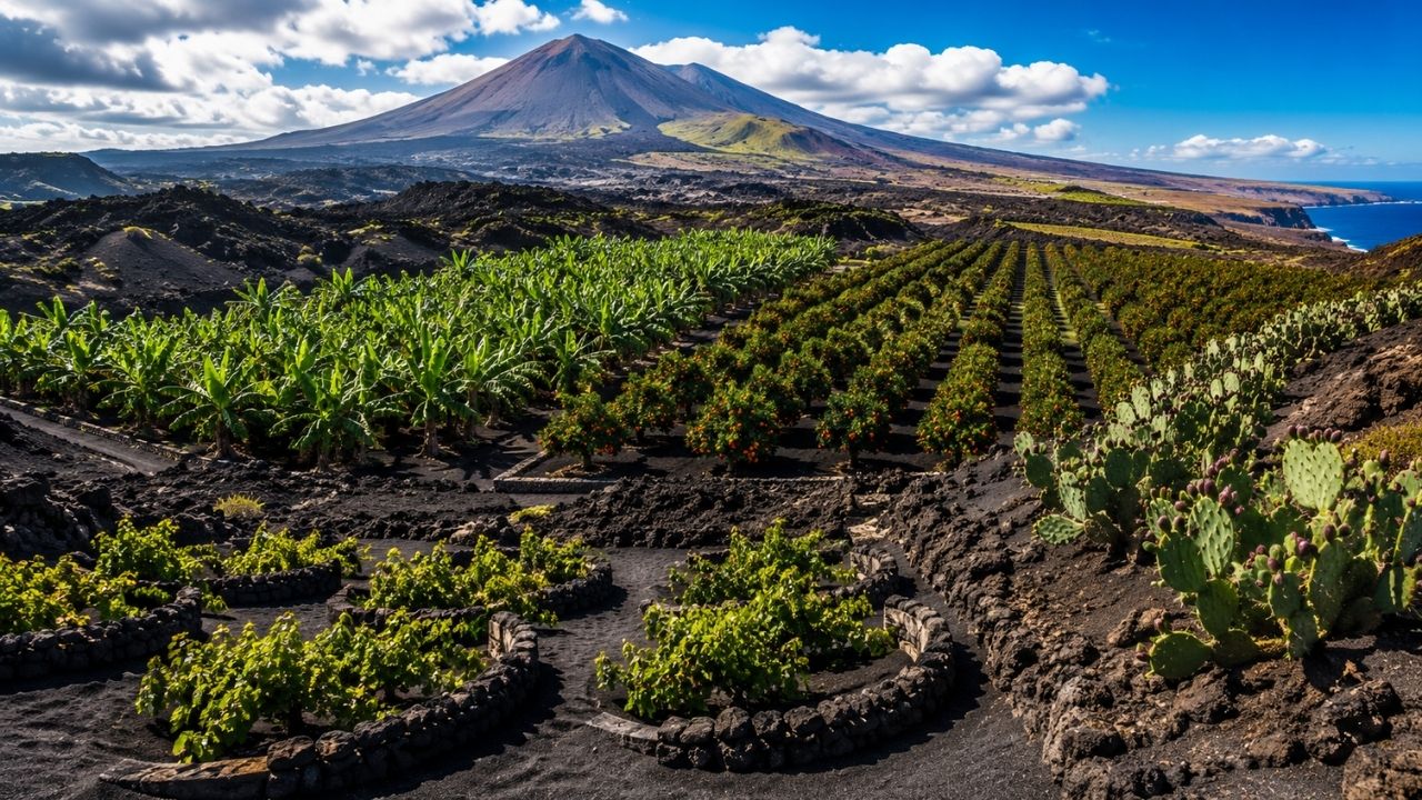
Volcanic Soils from Destructive Eruptions Turn into Million-Dollar Crops: Ashes Nourish Grapes in Lanzarote, Bananas in the Canary Islands, Blood Oranges on Mount Etna, and Cacti in Mexico, Showcasing How Lava-Formed Lands Sustain Rare Harvests in Seemingly Barren Regions

-
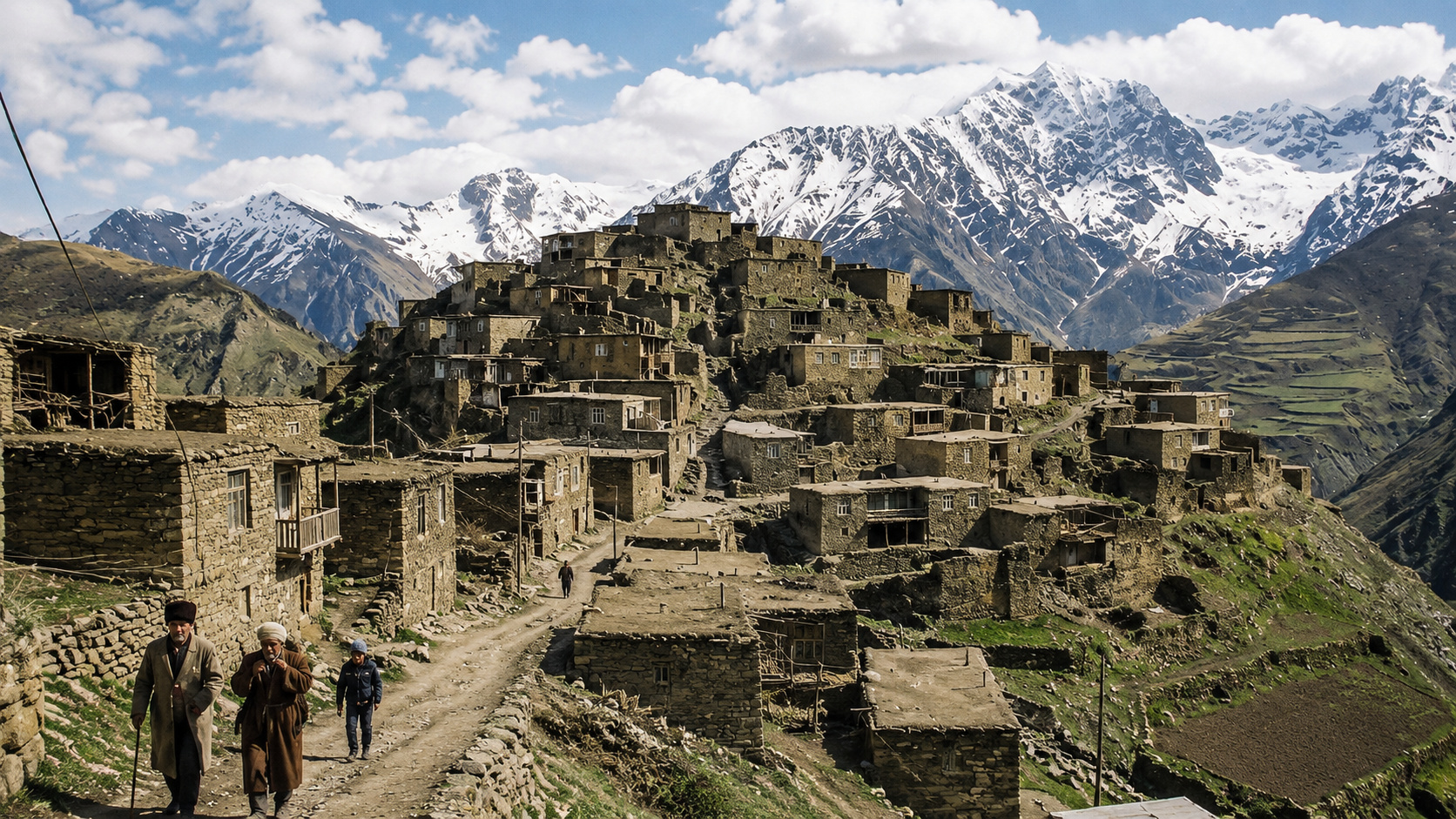
In the Caucasus Mountains, a Community Preserves a Language So Rare Few Outsiders Can Understand It

-
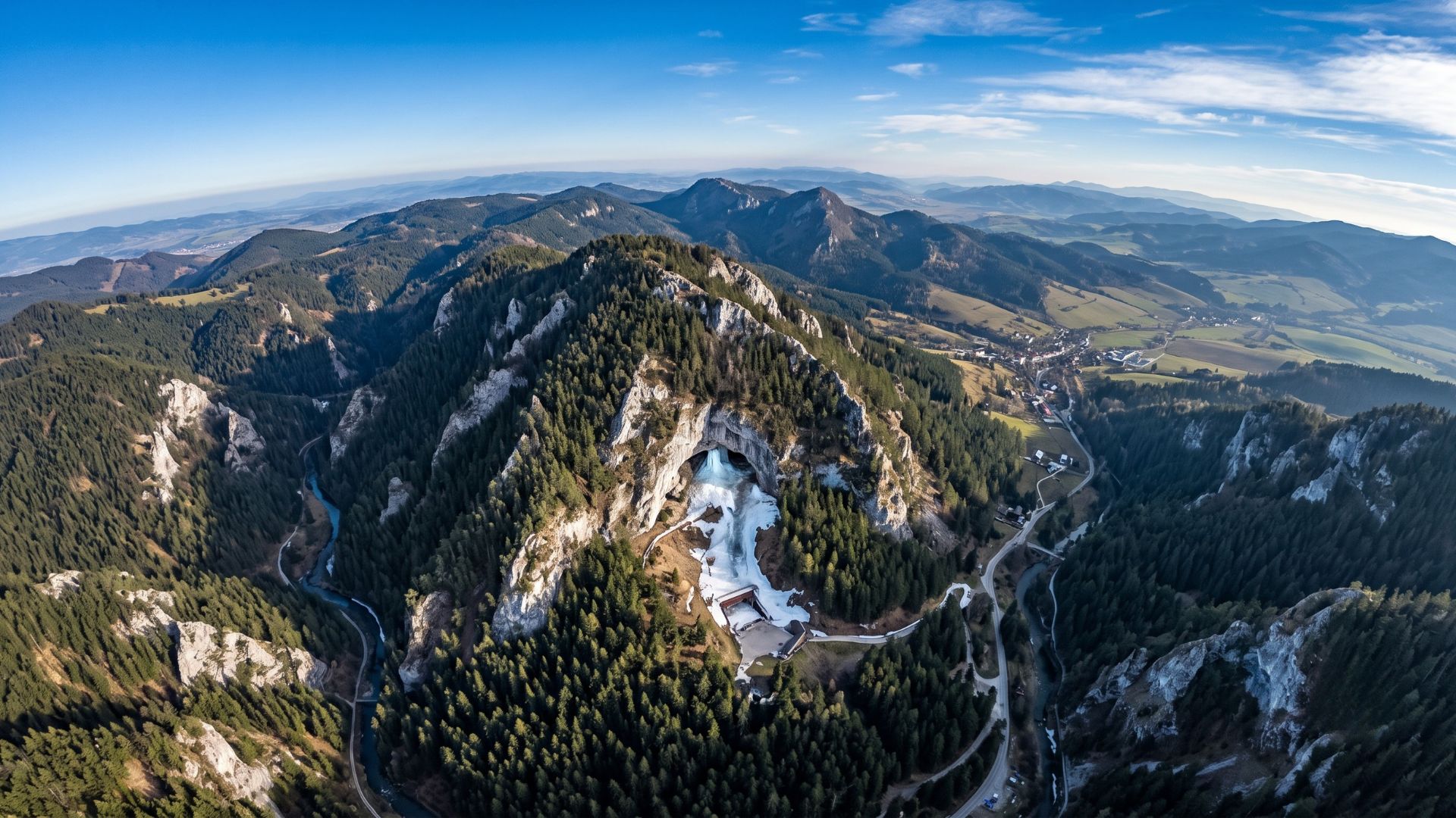
Slovakia’s Ice Cave Holds Over 110,000 m³ of Frozen Wonders, Boasts Walls Up to 27 Meters Thick, and Was Among the First Electrified Caves Globally

-
Street Cleaner Accidentally Receives $200,000 Transfer, Returns Unexpected Fortune to Rightful Owner
Paraguaçu River: From the Chapada to All Saints Bay
The Paraguaçu River rises in the municipality of Barra da Estiva, in the Chapada Diamantina region, more specifically on Morro do Ouro, a high point of the range.
With a course of about 500 km, the river crosses the state towards the northern coast, where it discharges into All Saints Bay, near the municipality of Maragogipe.
The Paraguaçu plays a historical, environmental, and economic role. It supplies important cities such as Cachoeira and Santo Amaro and was essential during the colonial period when it served as a transport route for sugar and gold.
De Contas River: From the Mountains to the Southern Coast
The De Contas River rises in the Serra da Tromba, between the municipalities of Piatã and Abaíra, also in the Chapada Diamantina.
Its course extends for approximately 620 km, crossing areas of mountains, caatinga, and Atlantic Forest, until it discharges into the Atlantic Ocean, in the tourist city of Itacaré.
Along the way, the river is used for human supply, irrigation, and energy generation. The Pedra Dam, near Jequié, is one of the strategic points of the basin.
It is also important for tourism and recreational activities in the medium and lower course regions.
Jequitinhonha River: From the Espinhaço Mountains to the Sea of Belmonte
The Jequitinhonha River has its source in the municipality of Serro, in Minas Gerais, in the Espinhaço Mountains, but part of its course ends in the extreme south of Bahia. It flows for about 920 km, with the last 160 km within Bahian territory. Its mouth occurs in the municipality of Belmonte, already on the Atlantic coast.
Known for crossing historically vulnerable areas, the Jequitinhonha still faces challenges of water scarcity and environmental degradation. Nevertheless, its importance is vital for riverine populations and agricultural activities.
São Francisco River: The Giant of the Hinterland
The most well-known of the rivers that cross Bahia is the São Francisco River, also called Velho Chico. It rises in the Canastra Mountains, in Minas Gerais, and flows for more than 2,800 km until it discharges between the states of Alagoas and Sergipe into the Atlantic.
Although its source is outside the state, Bahia holds the longest stretch of the São Francisco, with over 1,000 km of extension within its territory.
The river crosses from the western region to the north of the state, serving as a basis for irrigation projects, energy generation (like the Sobradinho Dam), and the supply of various cities.
It is also a cultural symbol, inspiring songs, festivals, and popular traditions related to riverine and rural life.
Strategic and Environmental Importance
These four rivers play fundamental roles for the water, economic, and social sustainability of Bahia.
In addition to supplying cities and enabling agribusiness, they are responsible for feeding aquifers, sustaining fauna and flora, and ensuring ecological connectivity among distinct biomes such as the Caatinga, the Atlantic Forest , and the Cerrado.
Moreover, many of them are linked to the history and formation of Bahian territory.
The Paraguaçu, for instance, is directly associated with the colonial development of the Recôncavo region.
The São Francisco, in turn, shapes the landscape and identity of the semi-arid region.
The Last Relevant Information
Among all, the São Francisco River has the longest stretch within Bahian territory, with over a thousand kilometers cutting through the state.
Its presence ensures life in arid regions and supports large urban centers and agricultural hubs.
Even though it does not discharge into Bahia, it is undoubtedly the most important river for the state’s water structure.


