Portuguese
  Spanish
The other 72% of the ocean floor are just satellite estimates. The Seabed 2030 project has increased from 5% in 2017 to today’s 28%, with a goal of 100% by 2030. For Brazil, the topic is key to expanding the Blue Amazon from 3.6 to 5.7 million km².
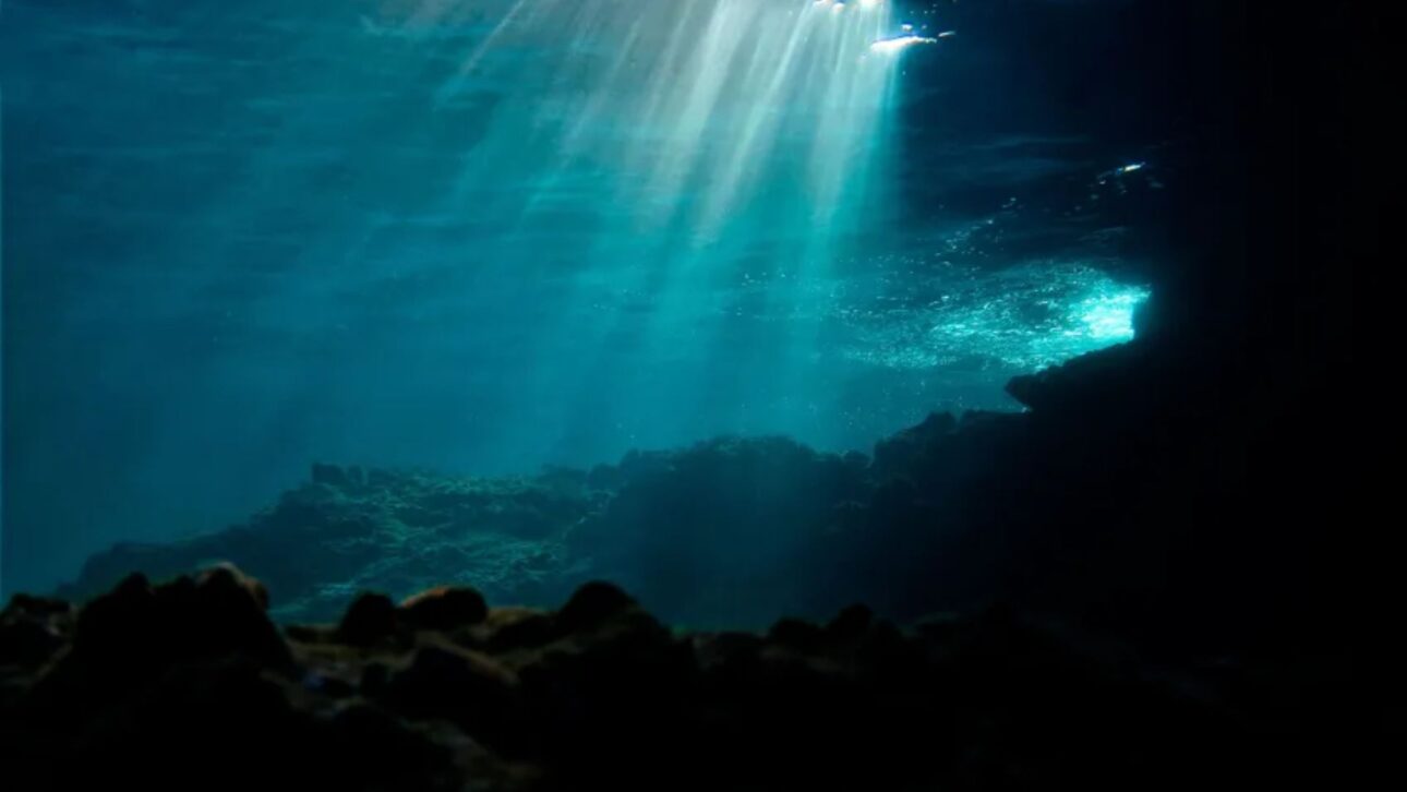
Only 28% of the ocean floor has been mapped with acoustic precision, less than what is already known about the surface of Mars and the Moon, and scientists point to the topic as strategic for Brazil, with the global goal of mapping everything by 2030. According to the analysis published in June by the portal R7, the other 72% are estimates based on satellite data, insufficient to understand what happens at the bottom of the sea. It is a problem that seems distant, but it is not.
According to the material, even centuries after the great navigations, the ocean floor still holds more mysteries than the surface of other planets. There are maps of Mars and the Moon with a resolution of a few meters, while most of the seabed remains unmeasured with precision. Knowing this bottom, according to researchers, is crucial for navigation, sovereignty, climate, biodiversity, and natural resources.
Why only 28% of the oceans have been mapped with precision
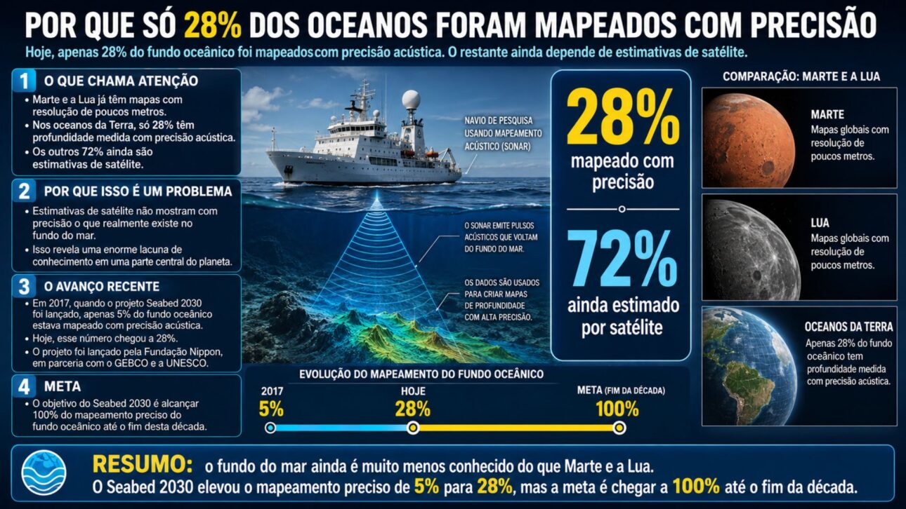
The difference compared to other planets is striking. According to the analysis, there are maps of Mars and the Moon with a resolution of a few meters, but only 28% of the oceans have their depth measured with acoustic precision, while the other 72% are satellite estimates, insufficient to know what actually occurs at the bottom. It is a huge gap in a central part of the planet.
-
In Andradina, in the interior of SP, a tannery transformed tilapia skin that slaughterhouses used to throw away into exotic leather for bags, shoes, and even wedding dresses, producing about 2,000 pieces per month and exporting to seven countries, proving that fish waste has become high-value fashion.

-
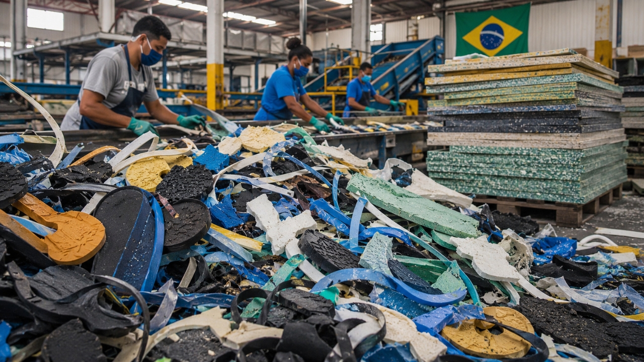
The industrial waste that even recyclers didn’t want has gained value in the interior of Bahia: two entrepreneurs invested R$ 2.8 million to transform 350 tons per year of foam, rubber, and plastic into boards that can replace wood and MDF.

-
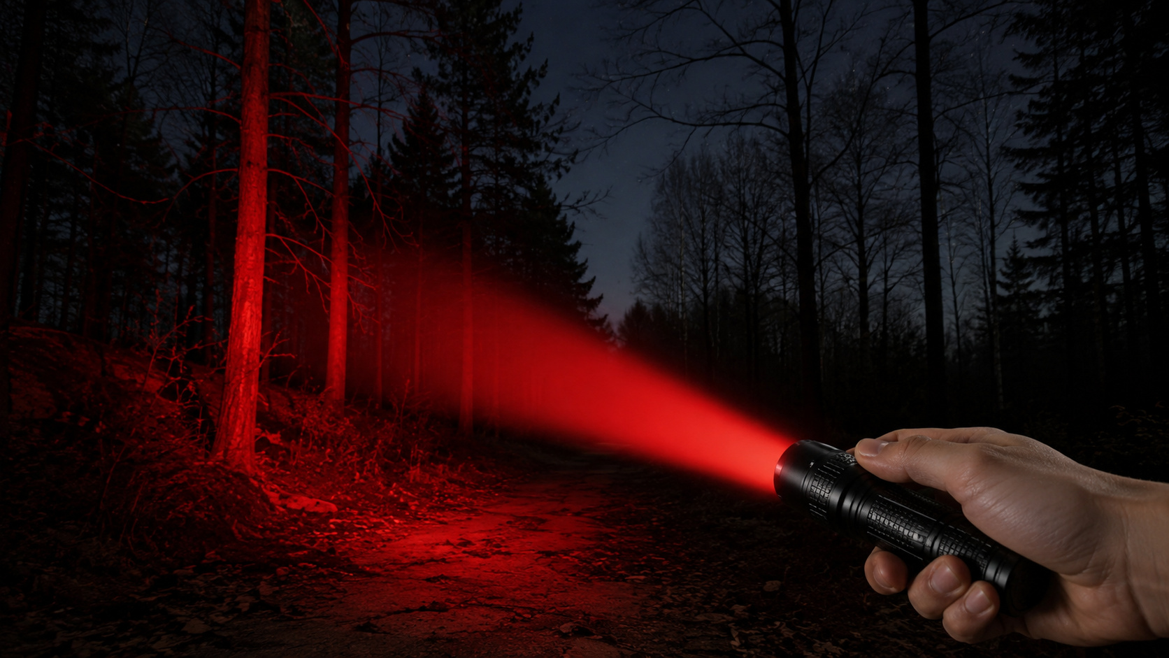
What is a red flashlight used for, after all? See why it is so commonly used at night.

-
He has never read a line of code, but he already knows how to work: the French company UMA presented in Paris the Northstar, its first AI-powered humanoid robot designed for factories and warehouses, capable of copying tasks just by observing an employee in action.

The recent progress has a name and a deadline. According to the material, when the Seabed 2030 project was launched in 2017, initiated by the Nippon Foundation in partnership with GEBCO and UNESCO, only 5% of the ocean floor was mapped with acoustic precision. Today, this number has reached 28%, and the goal is to reach 100% by the end of this decade.
From the Plumb Line to Sonar and Artificial Intelligence
The history of mapping is a long technical journey. The first measurements were a weight attached to a rope thrown into the sea, slow and imprecise. In 1855, Matthew Fontaine Maury published one of the first maps of the Atlantic, and the Challenger Expedition, from 1872 to 1876, covered 70,000 nautical miles, about 130,000 kilometers, with more than 500 measurements, marking the birth of modern oceanography.
In the 1970s, Marie Tharp, Bruce Heezen, and Maurice Ewing from Columbia University created the first detailed map of ocean physiography, and Tharp’s work, which faced decades of resistance for being a woman in a male-dominated field, was central to the Plate Tectonics Theory.
Today, mapping is no longer just about measuring depth. According to the material, modern multibeam echosounders also capture backscatter, the intensity of the reflected acoustic signal, which shows if the seabed is rock, mud, sand, algae, or reef.
Combined with the relief, this information creates maps of marine geodiversity, which has a strong relationship with biodiversity, as more varied seabeds tend to host more species. Artificial intelligence algorithms are trained to classify seabed types and help predict species, fishing areas, and mineral resources.
Why Mapping the Oceans is a Strategic Issue
Knowledge of the seabed touches on everyday issues. According to the analysis, in the context of the UN’s Sustainable Development Goals, knowing what is on the ocean floor is essential for navigation safety, sovereignty, climate and geological risk models, biodiversity, and fishery, mineral, and energy resources. Ports, submarine internet cables, trade routes, and oil platforms depend on accurate nautical charts, and marine sediments help regulate the climate by accumulating carbon for millennia.
Mapping also protects against disasters. According to the material, knowing the submarine relief in detail is essential to anticipate risks, model tsunami propagation, and guide the installation of cables and offshore structures. Deep-water corals, hydrothermal vents, and seamounts host unique ecosystems, many still unknown, and on World Ocean Day, the UN warned of the urgency of sustainable exploration of the seas.
Brazil, the Blue Amazon, and the Window of 2026 and 2027
The country has scientific capability, but is hindered by a lack of resources. In the last fifteen years, Brazilian researchers, almost always with scarce resources, have described submerged reefs on the Abrolhos Platform, drowned rivers in Espírito Santo, and reef structures at the Amazon River mouth, showing that there is much to discover. Brazil is in the process of requesting the UN to expand its Exclusive Economic Zone, the Blue Amazon, from 3.6 million to 5.7 million km², with 80% of this area being more than 200 meters deep, which requires knowledge of the seabed.
The coming years present a rare opportunity. According to the material, 2026 and 2027 represent a historical window because the Schmidt Ocean Institute has brought the Falkor ship to the Western South Atlantic, where it will conduct expeditions with Brazilian and international researchers, at no direct cost, with an autonomous vehicle that maps up to 6,000 meters and another, remotely operated, that dives up to 4,500 meters. Still, according to researchers, taking advantage of this opportunity requires the State to treat the oceans as a strategic priority, especially since some of the data already collected, mainly by companies, remains confidential. The ocean economy generates about 6.4% of the GDP and 4.5% of employment in the country, numbers that vary according to methodology, with estimates up to 19%.
Only 28% of the ocean floor has been mapped with acoustic precision, less than what is known about Mars and the Moon, and the Seabed 2030 project aims to reach 100% by the end of the decade. The gap matters for navigation, climate, biodiversity, and resources, and for Brazil, it is linked to sovereignty over the Blue Amazon, whose expansion from 3.6 to 5.7 million km² is a request in progress at the UN, in a sector that accounts for about 6.4% of the GDP. The Falkor ship expeditions in 2026 and 2027 present a rare opportunity, but according to researchers, taking advantage of this window depends on the country treating the ocean as a priority.
And you, do you think Brazil should invest more in ocean mapping and treat the issue as a strategic priority, or are there more urgent demands? Share your opinion and exchange ideas with other readers about the future of the Blue Amazon, respecting different views.