Portuguese
  Spanish


Submarine eruption in the Bismarck Sea exposed a little-mapped region of the Pacific, with plumes visible by satellites, pumice on the surface, and scientific doubts about the relief forming underwater.
A submarine volcano erupted in the Bismarck Sea, north of Papua New Guinea, and began to be monitored by satellites after plumes of steam, ash, discolored water, and bands of pumice appeared on the ocean surface.
The activity began on May 8, 2026, and occurs in a geologically complex area where scientists still do not have high-resolution maps of the seafloor.
The eruption is associated with the Titan Ridge region in the Pacific, about 16 kilometers southeast of the approximate point where another submarine eruption was detected by instruments in 1972.
-
Chicago transforms colossal quarry into an “underground bathtub” of nearly 13 billion liters, sees the reservoir fill up six times in 2026 alone, and digs the hole to nearly 38 billion liters to create one of the largest water and sewage vaults in the U.S.

-
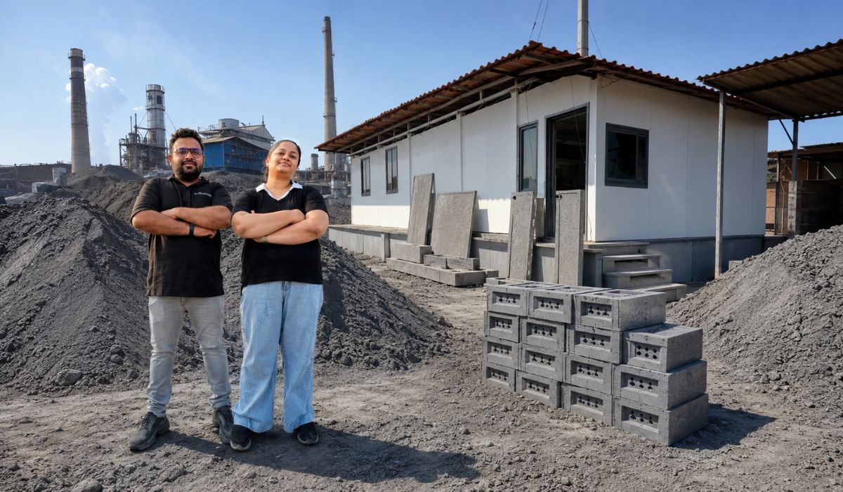
A couple who grew up surrounded by factory waste transforms ash and silica sludge into cement-free blocks, builds houses in up to 30 days, keeps interiors cooler in India’s heat, and claims to have already helped build homes for 450 families.
-
The oldest crime of humanity is 100,000 years old: a Homo sapiens was stabbed in the face with a stone blade in a cave in Israel, survived the blow, and became the oldest record of violence between people.

-
Walking with hands in pockets is not just shyness, says psychology: the gesture can hide signals that almost no one notices, involve at least 6 silent behaviors, and completely change your interpretation of those who do it.


There is still no consensus, according to NASA, on which volcanic structure is active, what the original depth of the eruptive opening was, or when this area last erupted.
Submarine eruption in the Bismarck Sea
The lack of detailed maps is one of the central points for researchers monitoring the case.
Although satellites can record changes on the surface, such as plumes, thermal signals, and changes in water color, the relief below the sea still depends on specific surveys.
In the Bismarck Sea, this limitation is amplified by the presence of faults, subduction zones, seafloor spreading areas, escarpments, and volcanic structures at depths that hinder high-resolution sonar mapping.
NASA states that the region exemplifies a known gap in oceanography: parts of the Moon and Mars have more precise mapping than large areas of Earth’s ocean floors.
Jim Garvin, chief scientist at NASA’s Goddard Space Flight Center, said that satellites already in orbit offer “enormous opportunities to explore and learn” about the event.
Satellites record steam, ash, and discolored water
The first clues of the activity came from a small sequence of earthquakes recorded on May 8.
Shortly after, satellite observations confirmed signs of a submarine eruption in the Pacific.
Starting from May 9, NASA’s Aqua and Terra satellites captured optical images of white plumes rich in vapor rising from the ocean.
The PACE satellite, also from the American space agency, recorded discolored and agitated water around the eruption site.
Higher resolution images obtained by the European Space Agency’s Sentinel-2 satellites and Landsat 9, operated by NASA and the United States Geological Survey, showed details of the activity near the surface.
On May 12, the VIIRS instrument aboard the Suomi NPP satellite detected thermal anomalies over approximately seven square kilometers.
According to Simon Carn, a volcanologist at Michigan Tech, the number of thermal anomalies indicates the presence of hot material near the surface.
He stated that this data suggests a relatively shallow eruptive opening, closer to the surface than the available bathymetric data for the area indicated.
Floating Pumice Spreads in the Pacific
In addition to the plumes, the images showed large patches of discolored water and extensive bands of floating pumice being carried by the currents.
Pumice is a light and porous volcanic rock, capable of remaining on the surface after being expelled in eruptions.
In large concentrations, it can form natural “rafts” that drift across the ocean and pose a risk to vessels.
Reports from the Smithsonian’s Global Volcanism Program, based on information from the Rabaul Volcanological Observatory, indicated that the activity continued in the following weeks, although with reduced intensity between May 21 and 28.
During this period, vapor plumes were still visible in satellite images, emerging from two opening areas and moving west and northwest.
The pumice continued to reach the surface, but in smaller concentrations, according to the same report.
Possible New Island Monitored by Scientists
The possibility of forming a new island began to be monitored by researchers from NASA and other institutions.
Garvin stated that scientists were waiting to see if an island was “about to be born,” a process that, according to him, can rarely be observed by satellites as it occurs.
If the structure reaches and remains above sea level, it could form a tuff cone with an active crater.
Another possibility described by NASA is that the newly formed material could collapse or undergo rapid erosion by wave action.
The agency also reported that the eruption could become more explosive if seawater reached the shallow magma chamber associated with the growing underwater structure.
Up to the moment described by the available reports, however, the event was less explosive than recent underwater eruptions, such as those of Hunga Tonga-Hunga Ha’apai in 2022 and Fukutoku-Okanoba in 2021.
According to Carn, the likely lower explosiveness is related to the geological context of the region, which seems to involve a volcanic ridge near the junction of a transform fault with a seafloor spreading zone.
“Spreading centers are associated with less explosive activity, while the most explosive eruptions are usually along subduction zones and involve large stratovolcanoes,” stated the volcanologist.
Risks for vessels in the eruption area
Authorities in Papua New Guinea have warned navigators about risks in the area, including pumice fall, ash, unpredictable swells, and turbulent currents.
Australia’s ABC News reported that fishermen observed the eruption at sea.
Kennedy Masis told the broadcaster that he was looking for tuna when he saw “smoke coming out of the sea.”
“It sounds like thunder and the sea smells like metal burning,” said Masis.
Steve Saunders, principal geodetic surveyor at the Rabaul Volcanological Observatory, told ABC that more explosive activity could generate small localized tsunamis.
He added that the area is at least 100 kilometers from the nearest land and that the ocean depth in the region varies from about 500 to 800 meters.
The Rabaul Volcanological Observatory reported that, in mid-May, the activity was occurring in two vent areas separated by about 2.5 kilometers.
There was also a recorded earthquake of magnitude 5.4 on May 15 and another of magnitude 5.7 north of the eruptive point on May 22, with no apparent change in the characteristics of the eruption.
Duration of the eruption is still uncertain
The duration of the activity has not yet been defined by scientists.
The 1972 event in the same general region lasted four days, according to NASA.
Another underwater eruption recorded about 100 kilometers away, in the St. Andrew Strait, began in 1957 and lasted almost four years.
This difference helps explain why experts avoid making definitive predictions about the volcano’s behavior.
Underwater eruptions can quickly subside, maintain low intensity for weeks or months, or change patterns as magma interacts with seawater and with the structure forming below the surface.
Garvin and researchers from other institutions are monitoring the development of the case with satellite data.
According to NASA, he intends to analyze radar information from the NISAR mission, a partnership between NASA and the Indian space agency, and from the RADARSAT constellation, from Canada, to map any emerging land portions and track shape changes over time.
If a permanent island forms, Garvin also sees the possibility of field studies on colonization by plants and animals, rainfall, chemical weathering, and other erosive processes.
NASA compares this type of monitoring to what occurred after the eruption of Hunga Tonga-Hunga Ha’apai, when scientists studied the transformation of a newly formed volcanic island.
In the Bismarck Sea, the episode brings together underwater volcanic activity, space observation, and uncertainties about a poorly mapped area of the Pacific.