
 Portuguese
  Spanish
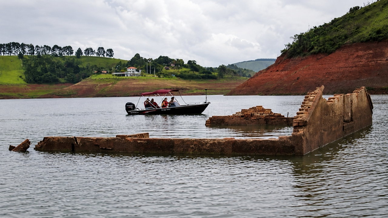
With the drop in the Jaguari Dam level, the old headquarters of Igaratá has re-emerged, rekindling the memory of a city that was flooded to make way for the reservoir and today attracts curious visitors.
With the low level of the Jaguari Dam, in Igaratá, in the interior of São Paulo, the old submerged city has reappeared. A 12-meter-high wooden cross weighing hundreds of kilos began to emerge at the site where the old municipal headquarters was located, along with ruins that have been hidden by water for years.
The scene has attracted the attention of residents and visitors who go to the region to see up close the vestiges of the old Igaratá. The area is about 5 kilometers from the current city center and, during periods of low water, offers a kind of living portrait of a history that was interrupted by the formation of the dam.
According to the Igaratá City Hall itself, the cross was fixed by residents in the Church Square, erected in honor of Our Lady of Sponsorship. Very close by, the old cemetery of the Old City also appears.
-
Elderly Man in His 70s Spends Nearly 30 Years Digging 3 km Canal to Transform Arid Land into Farmland in Rural India

-
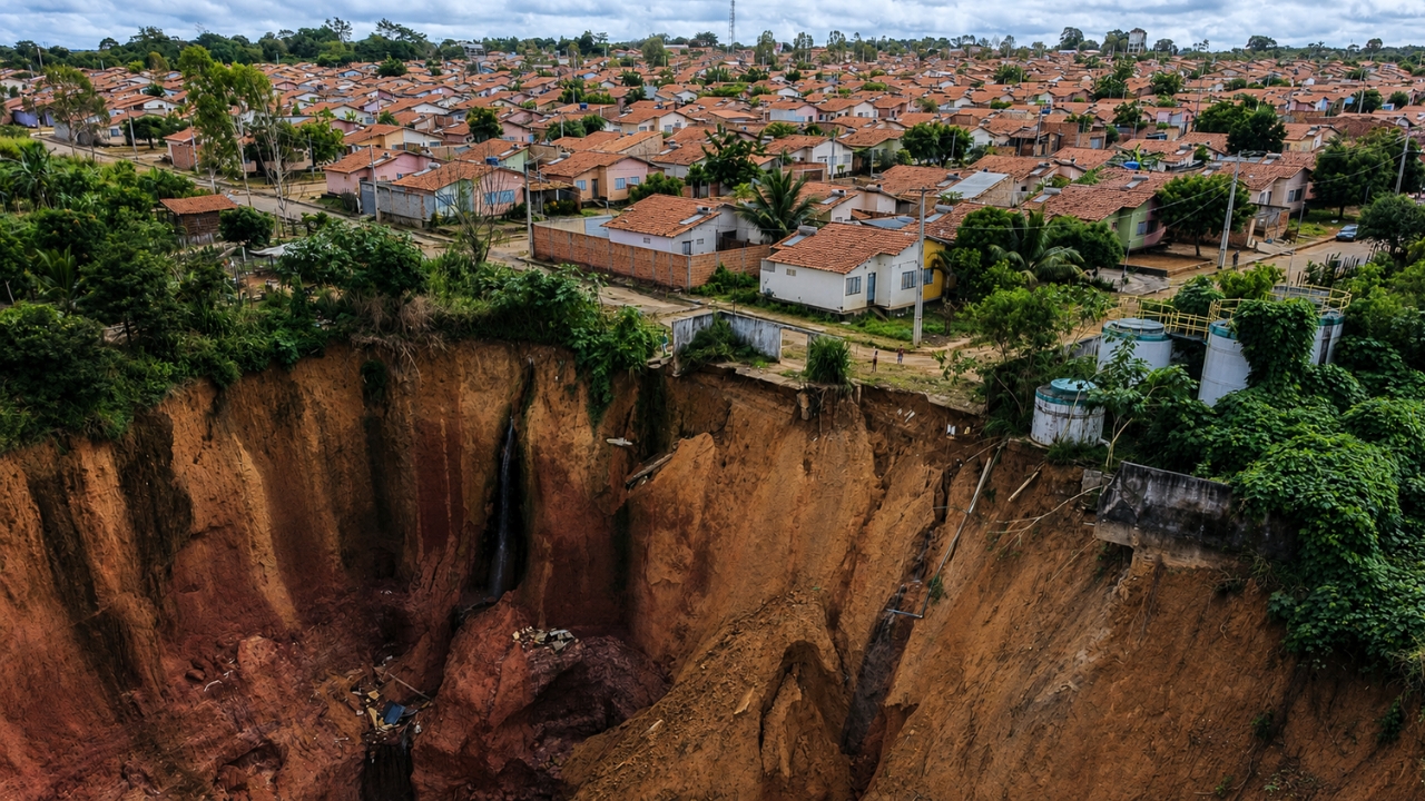
In Northeastern Brazil, 1,200 Residents Face a Silent Nightmare as Giant Sinkholes Threaten Entire Neighborhoods
-
Astronauts Returning from Space Show Altered Gut Bacteria and Loss of Protective Microbes, Highlighting Potential Risks for Mars Missions

-
São Paulo to Convert Historic Downtown Building into Affordable Housing for Low-Income Families


The city that disappeared under the water
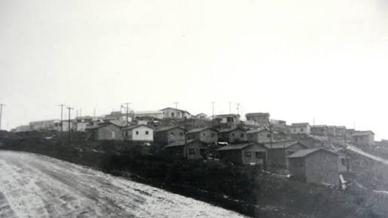
The old municipal headquarters had to be sacrificed with the formation of the Jaguari Dam. In the process, the urban area was moved to another location, where the city is today. What remained of the original Igaratá was submerged for decades and only reappears when the water level drops enough.
The place has become a visitation point for adventurers, divers, fishermen, former residents, and people interested in learning more about the city’s history. Instead of a traditional tourist spot, what you see there is a memory exposed by the dam itself.
7,000 hectares were submerged and about 200 families were affected
At the time of the flooding, about 7,000 hectares were taken by water. The change affected approximately 200 families who lived in the area that would be covered by the reservoir.
On April 24, 1969, the first machines arrived for the construction of New Igaratá, a milestone that opened the second phase of the municipality’s history. From then on, the city began to reorganize at another location, while the old headquarters was left behind, buried under the water sheet.
The reservoir that shaped the landscape of the Paraíba Valley

The Jaguari Reservoir is 22 kilometers long and has an area of 120 km². It passes through Santa Isabel, Igaratá, São José dos Campos, and Jacareí, influencing the landscape and routine of several cities in the region.
When the level drops, the reservoir returns to the surface pieces of history that have been hidden for years. In Igaratá, this means seeing again ruins, memories, and marks of a city that had to leave the map to make way for water.
If you are from the region or have visited the area, it is worth following these level changes and what they reveal about the history of Igaratá.


