Portuguese
  Spanish
China announced the creation of an environmental monitoring network with about 150 satellites that cover the spatial, aerial, terrestrial, and maritime domains. The system includes the world’s first satellite capable of detecting greenhouse gases actively and passively using LiDAR technologies and hyperspectral sensors. The network can revisit 3.3 million km² every two months and monitor 21 thousand km of coast and 100 thousand km² of coastal waters quarterly.
China has just put into operation the world’s most advanced satellite for environmental monitoring, and it is not alone. The complete network gathers about 150 satellites equipped with multispectral sensors that, combined with more than 140 additional civil systems, aircraft, terrestrial and maritime stations, form a high-precision environmental surveillance apparatus that covers practically the entire Chinese territory and has global reach. China’s Ministry of Ecology and Environment confirms that the system considerably reinforces national ecological protection capabilities.
What makes this network different from anything that existed before is the ability to sniff greenhouse gases directly from space. The newly launched satellite is the first in the world to combine active and passive detection of gases using LiDAR technology (laser that measures distances and atmospheric compositions) and hyperspectral sensors that identify air components with molecular precision. In practice, the system can measure ozone, nitrogen dioxide, formaldehyde, and methane, tracking emissions directly to their source, whether it’s an oil refinery, a coal mine, or a landfill.
What the 150 satellites can see and how often

According to information released by the TV Brics portal, the satellite network is equipped with multispectral sensors that allow revisiting the same areas with a programmed frequency. The system covers approximately 3.3 million km² every two months, conducting detailed checks in protected natural areas and zones with strict environmental regulations. To put it in perspective: this area is equivalent to more than one-third of Brazil’s territory being scanned from space every 60 days.
-
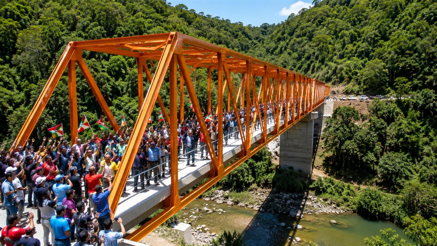
China Builds World’s Largest Power Grid, Generating Enough Energy to Supply 15 Times Brazil’s Needs, Surpassing the US, EU, and India Combined

-
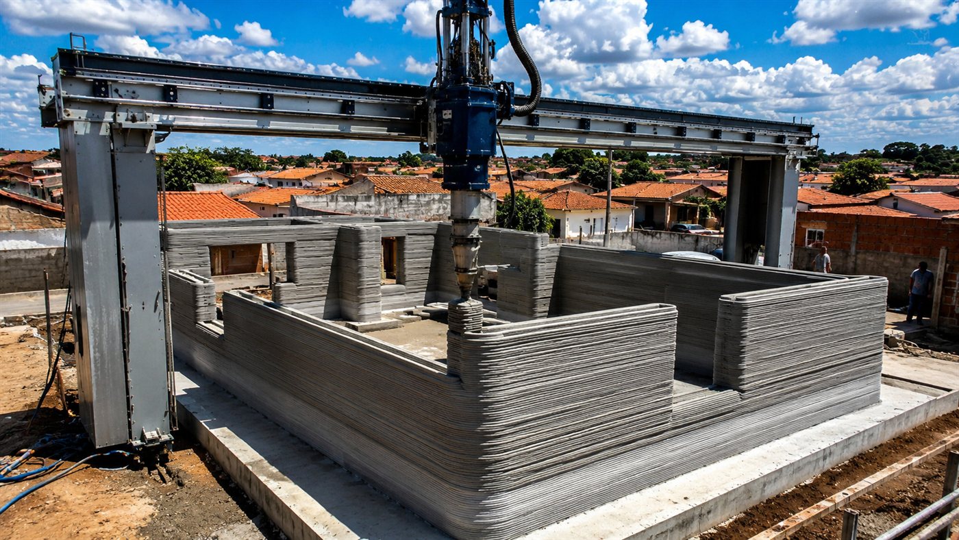
Brazil’s First 3D-Printed House Built in 30 Hours with Two Operators and 20% Lower Costs

-
Parker Solar Probe Discovers High-Speed Dust Grains Near the Sun, Offering New Insights into Solar Corona’s Mysteries
-
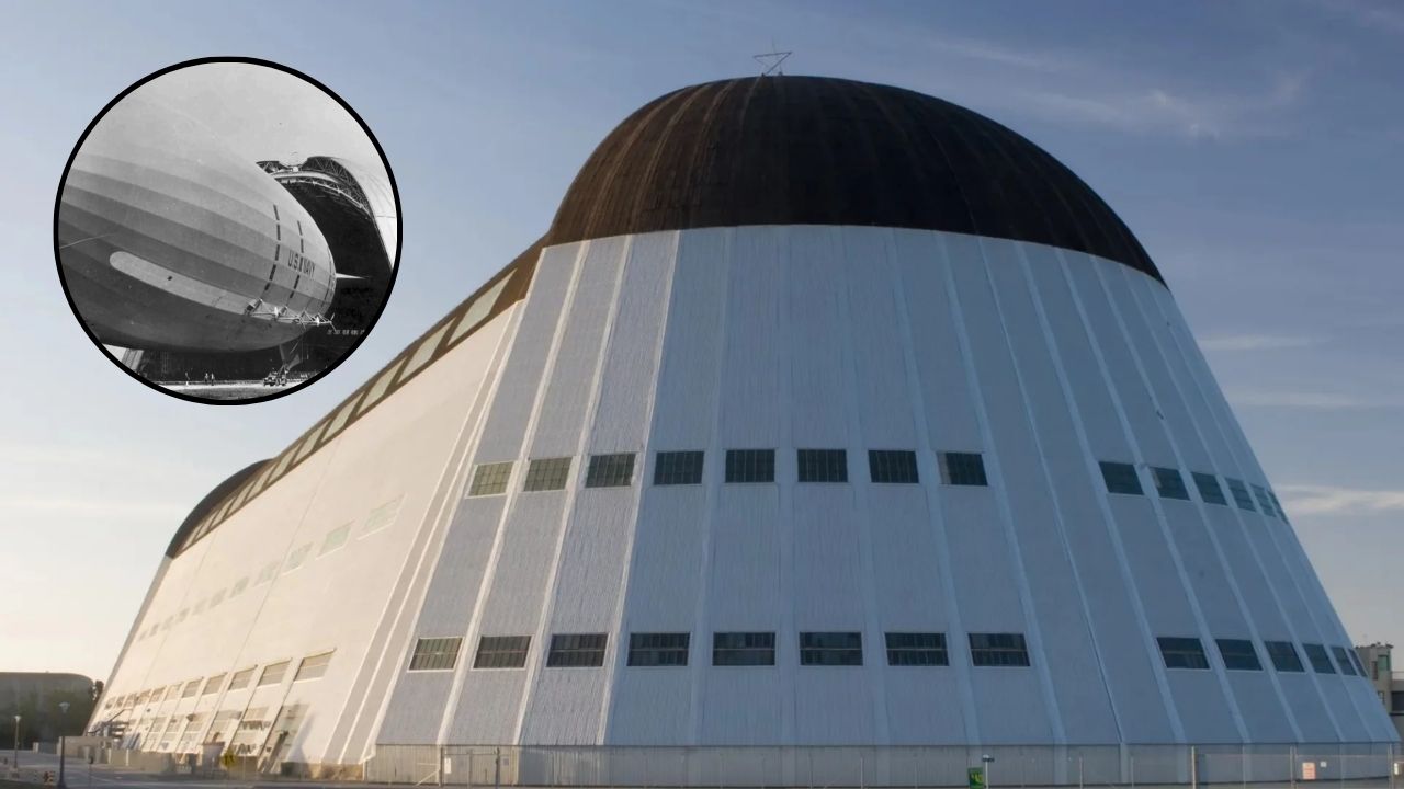
Google Revives Historic Hangar for Cutting-Edge Tech in Silicon Valley: Once Built for a “Flying Aircraft Carrier,” Now a Hub for Drones and Robotics


Simultaneously, the network enables regular monitoring of about 21 thousand km of continental coast and 100 thousand km² of coastal waters each quarter. The ability to simultaneously cover land and sea allows detecting environmental damage and illegal activities ranging from deforestation and irregular occupation of protected areas to oil spills and illegal waste disposal in coastal waters. The revisit frequency ensures that changes in the environment are captured in weeks, not years.
The LiDAR and hyperspectral technology that did not exist before
The main satellite of the network uses two technologies that had never been combined in a single orbital monitoring device. LiDAR emits laser pulses that pass through the atmosphere and return to the sensor with information about the composition of gases present in each air layer, allowing the measurement of greenhouse gas concentrations with precision that conventional passive sensors do not achieve.
Hyperspectral sensors complement LiDAR by capturing hundreds of bands of the electromagnetic spectrum simultaneously. This capability allows scientists to identify not only which gases are present, but in what concentration and at what altitude, creating a three-dimensional map of atmospheric pollution that can be updated with each satellite pass. The combination of the two technologies makes the system capable of distinguishing between a natural emission and one caused by industrial activity, a difference that is crucial for assigning responsibility for environmental crimes.
How the system catches methane emissions at the source
Methane is one of the most potent and difficult-to-track greenhouse gases because its sources are dispersed and often located in remote areas. The Chinese satellite network is capable of identifying methane emissions from oil and gas infrastructure, coal mining, and landfills, tracing leaks directly back to the facility producing them.
The ability to attribute emissions to specific sources is a game-changer for environmental enforcement. Before this technology, governments relied on self-reported data from companies regarding their emission volumes, a system that allowed widespread underreporting. With satellites measuring from space what comes out of every chimney and every well, independent verification becomes possible on a global scale, and no facility can hide its real emissions.
Radar satellites that see through clouds
In addition to optical and hyperspectral sensors, the network includes satellites equipped with radar that continuously monitor regardless of weather conditions. Radar technology is not affected by clouds or low light, meaning the system operates 24 hours a day, 365 days a year, even in tropical regions where cloud cover is permanent for months.
For monitoring areas like the Brazilian Amazon, Southeast Asia, and the Congo basin, where clouds prevent optical observation for much of the year, radar capability is what differentiates a functional system from a limited one. China equipped its network precisely so that no region of the planet remains out of reach, making responses to disasters and environmental crimes faster and more reliable.
What the network means for global environmental surveillance
The construction of a network of 150 environmental monitoring satellites places China in a leading position in an area that until recently was dominated by Western agencies like NASA and ESA. The Chinese system is more comprehensive in coverage and more advanced in gas detection than any individual network operated by Western countries, and its continental-scale scanning capability can be offered as a service to developing countries that do not have their own satellites.
For the international climate debate, the network adds a layer of independent verification that can pressure all countries to meet their emission reduction commitments. If China can measure from space how much methane comes out of a landfill in Europe or how much CO₂ a power plant in the United States emits, the argument that it’s not possible to verify climate targets loses strength. The technology exists, it’s in orbit and it works, and the planet now has a sleepless guardian that doesn’t rely on self-reported data.
Do you think a satellite network capable of catching any emission from space will help combat environmental crimes or will it only be used for geopolitical purposes? Tell us in the comments if you trust Chinese technology to monitor the environment and what you think about spatial surveillance of the planet.