 Portuguese
  English
  Spanish
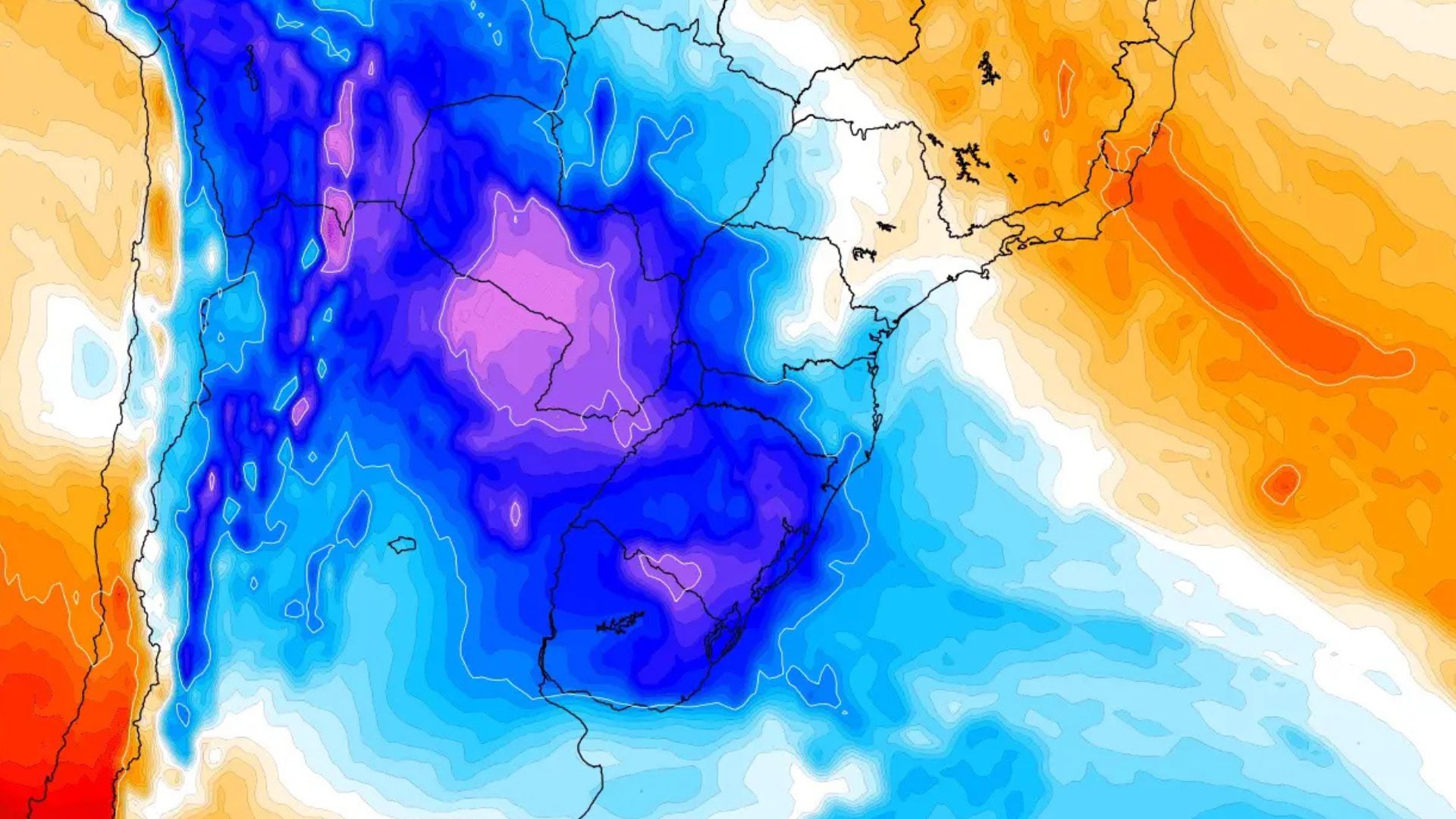
Polar mass advances through the interior of the continent and changes the weather pattern in various regions, with freezing dawns, risk of widespread frost in the South, and temperature drop associated with cold snap in areas of the Amazon during the week.
A new cold air mass of polar origin advanced from Argentina to Brazil and is expected to keep the South under winter conditions during the week, with freezing dawns, risk of widespread frost, and negative minimums in areas of Rio Grande do Sul and Santa Catarina.
According to a report published by MetSul Meteorologia, the cold air mass began to advance through Rio Grande do Sul over the weekend, following the passage of a cold front that caused an increase in clouds and rain in part of the Southern Region.
The system is associated with a high-pressure center of 1035 hPa in the South Pacific, near the coast of Chile, while another core of 1030 hPa is expected to act over the Northeast of Argentina and favor the advance of polar air through the interior of the continent.
-
The brute force of the waves turns into clean energy with almost no waste, as promised by a gyroscopic converter created in Japan that, in simulations, couples with the sea’s sway and reaches the maximum limit of 50% efficiency, leaving old marine generators behind.

-
NASA’s space telescope already has 73% of its images contaminated by satellite trails, and scientists warn that the problem could reach 100% if millions of objects are launched into low Earth orbit.

-
From discarded uniform to blanket for those sleeping on the streets: Brazilian initiative transforms tons of corporate fabric into shelter, reduces textile waste, and creates a chain of social impact that starts in companies and ends in the hands of those who need it most.

-
Engineers from Norway develop a submersible barge to lift structures of 2,500 tons without relying on the world’s largest crane ships, aiming to reduce the costs of offshore wind turbine installation.


Cold air mass gains strength in Southern Brazil
The temperature drop began in the gaucho territory and is expected to continue throughout this week, especially between Tuesday (20) and Friday (23), when much of the interior of Rio Grande do Sul may record minimums between 0°C and 5°C.
In areas more prone to nighttime cooling, such as lowlands, valleys, and higher altitude points, thermometers may fall below zero, with forecasts of readings between -2°C and -3°C in Campos de Cima da Serra and the Southern Plateau of Santa Catarina.

At the beginning of the event, the lowest temperatures tend to occur in the Campanha and the Southeast Serra, in the South of Rio Grande do Sul, before the more intense cold reaches the Northeast of Rio Grande do Sul and the mountainous areas of Santa Catarina.
Porto Alegre and the Metropolitan Region will also experience a sequence of cold dawns, with models indicating minimums close to 7°C in the capital and lower values in neighborhoods further South and East, especially in open and less urbanized areas.
Frost is expected to hit hundreds of cities in the South
Frost formation is expected to occur in the three southern states, with greater coverage in Rio Grande do Sul, especially in the early mornings of Wednesday, Thursday, and Friday, when clearer weather and weak winds favor cooling near the ground, according to MetSul newspaper’s investigation.
Unlike the previous polar incursion, which brought frost to areas of São Paulo and Mato Grosso do Sul, this episode tends to concentrate the phenomenon mainly in the South Region, although the cold air mass also reaches parts of the Midwest and Southeast. The MetSul newspaper also pointed out that Paraná should experience less intense cold compared to the polar wave recorded days ago.

In Rio Grande do Sul, frost may appear in a large number of municipalities, especially in the interior, where lowlands and valleys present a higher risk due to the accumulation of cold air during clear nights with little wind circulation.
In Santa Catarina, the risk will be greater in the Southern Plateau and mountainous areas, while Paraná should also feel the cold, although the trend indicated by MetSul is of lower intensity compared to the episode recorded the previous week.
Cold Snap Reaches Areas of the Amazon
The continental trajectory of the cold air mass should allow the system to advance beyond southern Brazil, with a drop in temperature in parts of São Paulo, Mato Grosso do Sul, and western Mato Grosso throughout the week.
The cold air is also expected to reach Peru and the southern Amazon, with a forecast of cold snap in Rondônia, Acre, and southern Amazonas, a phenomenon where the arrival of polar air causes an atypical drop in temperatures for the region’s standards, according to a report published by MetSul Meteorology.
Before advancing over Brazil, the cold air mass had already caused very low temperatures in Argentina, with minimums of -8.5°C in Chapelco, -8.4°C in Maquinchao, -7.6°C in Uspallata, -7°C in Esquel, and -5.3°C in Bariloche.
With the combination of high pressure, dry air, and clearer nights, the cold is expected to persist for several days and make the week have typical winter characteristics, even still in May, especially in areas of central-southern Brazil.


Be the first to react!