Portuguese
  Spanish
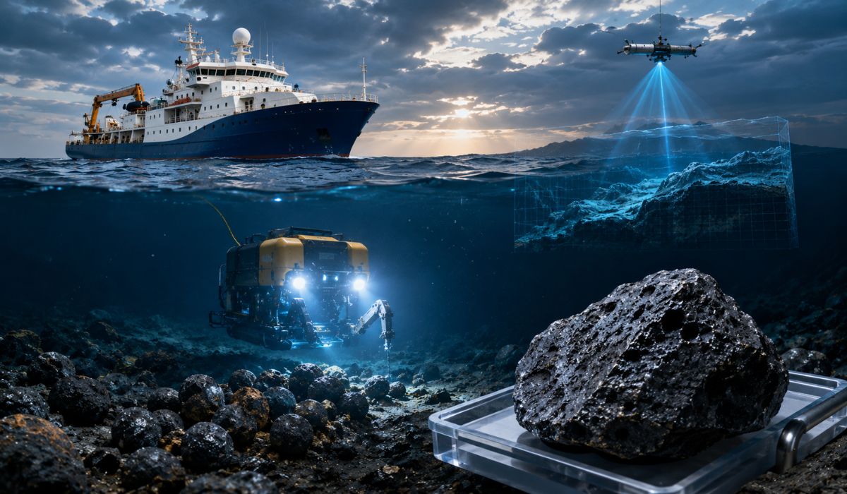
Chinese expedition to the Pacific gathers mineral samples, volcanic rocks, and tests technology at great depths, expanding data on little-explored ocean regions and equipment aimed at submarine geological research.
China has released new data from a scientific expedition to the Pacific Ocean floor, where researchers collected polymetallic nodules, rock samples, and water near the seabed, as well as tested an electromagnetic system designed to operate at depths of up to 10,000 meters.
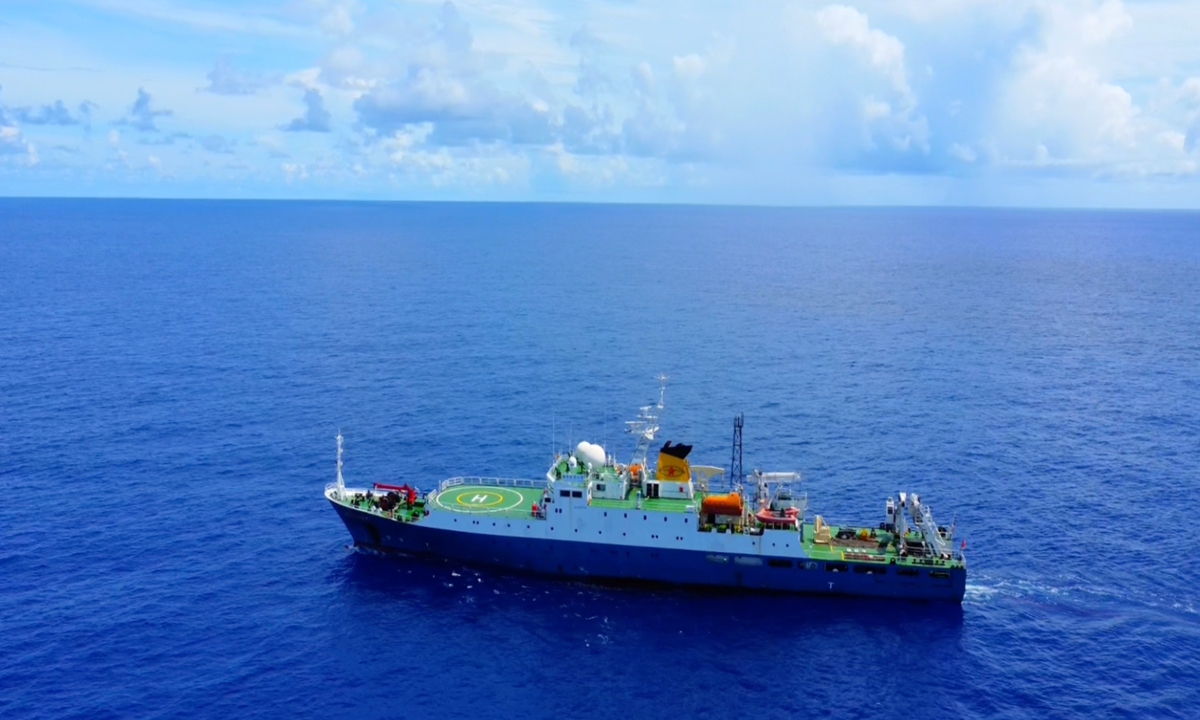
The mission was carried out by the research vessel Haiyang Dizhi-6, also known as Ocean Geology-6, which completed its 16th deep-water geological survey expedition.
The operation involved sample collection, geological mapping, and testing of equipment developed to function under extreme pressure.
-
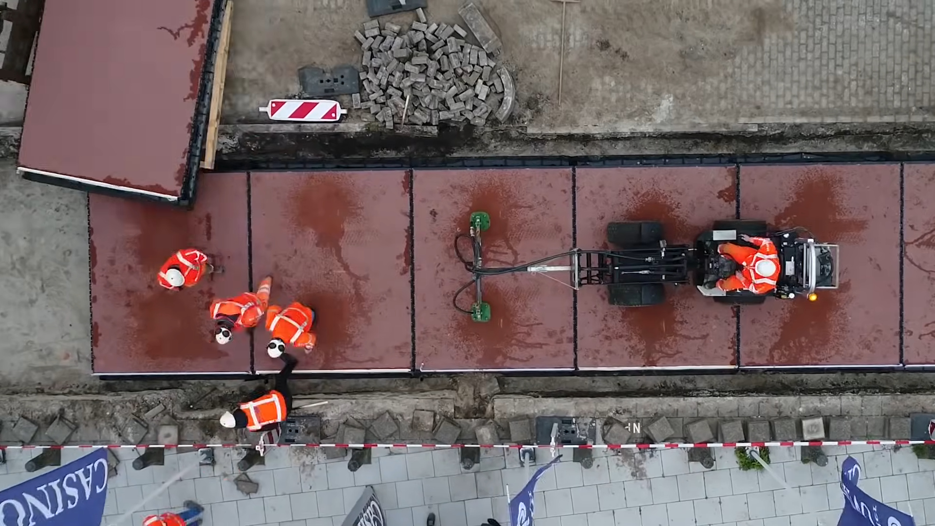
Human Waste in Kenya is Solar-Treated and Turned into Fuel Briquettes, Tackling Open Sewage, Charcoal Use, and Deforestation

-
Bolivian Teen Builds Functional Robots from Scrap Materials in High-Altitude Rural Town
-
Student Creates 3D-Printed Prosthetics from Recycled Plastic, Turning Waste into Affordable Custom Arms
-
Climate Scientist Who “Proved” Humanity Is Warming the Earth


This type of mission seeks to expand knowledge about the formation of the ocean floor and the physical conditions of areas where sunlight does not reach and direct human presence is not feasible in routine research activities.
According to the state agency Xinhua, the expedition departed on April 3, 2026, lasted 52 days, and covered almost 13,000 kilometers.
The results were presented after the ship’s return to Guangzhou, in southern China, in June 2026, with information released by the China Geological Survey Administration and the Guangzhou Marine Geological Survey.
Samples collected from the Pacific floor
Among the materials collected are polymetallic nodules, cobalt-rich crusts, seabed rocks, sediments, interstitial water, and water samples near the ocean floor.
These elements are used by researchers to analyze geological processes in deep regions, especially in ocean basins and rift zones in the Western Pacific.
Polymetallic nodules are rounded formations that grow slowly on the ocean floor over millions of years.
In general, they can contain manganese, nickel, cobalt, and copper, metals associated with different industrial chains.
According to the International Seabed Authority, deposits with this type of composition appear mainly in abyssal plains, at depths that usually range from 4,000 to 6,000 meters.
In the Chinese expedition, researchers reported identifying an area with a high abundance of polymetallic nodules.
Approximately 90 kilograms of basalt, a common volcanic rock in the oceanic crust used in studies on the origin and evolution of the seabed, were also recovered.
Qin Pengbo, deputy director of the Institute of Applied Marine Geology of the Guangzhou Marine Geological Survey, told CGTN that the team found nodules in high concentration and collected approximately 90 kilograms of basalt samples.
According to him, the material can contribute to studies on the characteristics of the mantle source region in that area and on processes related to the deep evolution of the Earth.
Electromagnetic system to explore the deep ocean
In addition to sample collection, the expedition tested a 10,000-meter class electromagnetic acquisition system.
Chinese state vehicles described the equipment as the first of its kind capable of operating at full ocean depth.
The system was developed by the Guangzhou Marine Geological Survey and underwent acceptance tests at sea.
The equipment operated in an abyssal rift zone in the Western Pacific, at a depth of 7,737 meters, where it obtained electromagnetic data classified as high quality by the researchers involved.
According to reports published by the Chinese state press, the performance indicators met the criteria set for the test.
Electromagnetic surveys are used to indirectly analyze structures below the seabed.
By measuring natural or induced signals in the environment, scientists can infer physical properties of rocks, such as electrical conductivity, structure, and composition.
This information helps map buried formations, fracture zones, and processes related to the dynamics of the oceanic crust.
At great depths, the operation of this type of instrument requires resistance to pressure, stability during data collection, and the ability to accurately record information during deployment, stay on the seabed, and recovery of the equipment.

Geology of the Deep Ocean and Hadal Zone
The deepest part of the ocean still holds significant gaps for science.
The hadal zone, which begins around 6,000 meters and can reach almost 11,000 meters in ocean trenches, is marked by cold, darkness, and high pressure.
The NOAA, a United States agency dedicated to oceans and atmosphere, describes this zone as the deepest region of the ocean.
Areas of this type interest geology because they preserve records associated with tectonic plates, volcanism, fluid circulation, crust formation, and interaction between the Earth’s mantle and the seafloor.
Samples collected at depth can complement data obtained by satellites, remote sensors, and surveys conducted from the surface.
The basalt collected on the mission can be analyzed to investigate how certain portions of the oceanic crust were formed and altered over time.
Sediments and fluids associated with the seafloor can also contain information about environmental changes and chemical processes that operate on long geological scales.
Polymetallic Nodules and Research in Extreme Areas
The interest in polymetallic nodules is also related to the presence of metals used in sectors such as batteries, metal alloys, and electronic equipment.
At the same time, potential deep-sea mining is discussed in international forums due to possible environmental impacts and the lack of accumulated knowledge about deep-sea ecosystems.
The Chinese expedition announced in June 2026 was presented as a scientific and technological mission, not as a commercial mining operation.
The available information covers the collection of samples, obtaining geophysical data, and testing sensors capable of operating in deep areas of the Pacific.
The Haiyang Dizhi-6 has been used by China in geological and geophysical surveys.
According to Chinese state media, the ship entered operation in 2009, was designed and built in the country, and has already carried out more than 80 missions in areas such as the South China Sea, the Western Pacific, and the Antarctic Peninsula region.
The combination of physical samples and geophysical data can also support international ocean drilling projects.
In these programs, scientists extract cores of sediments and rocks below the seafloor to study climate history, the evolution of ocean basins, and processes that shape the Earth’s surface.

Even with the advancement of robots, sensors, and specialized ships, the deep ocean continues to require instruments adapted to extreme environmental conditions.
The Chinese mission adds new data to this field of research and shows how scientific exploration of the seabed depends both on sample collection and on the development of technologies capable of operating at depths close to the known limits of the oceans.