Portuguese
  Spanish
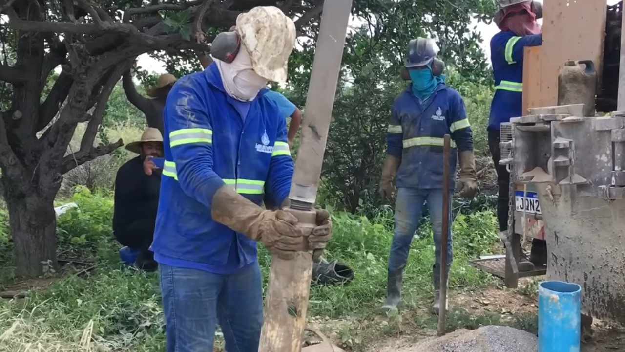
Before drilling an artesian well, some signs of the terrain need to be observed carefully. Sinkholes, very steep hills, clayey soils, reservoirs that never dry up, areas near the beach, flood-prone locations, and points close to landfills, gas stations, or industries can compromise water quality and cause damage
The choice of location for drilling an artesian well can determine whether the investment will result in quality water or in damage. Although many people only observe the appearance of the terrain, hydrogeology specialists warn that some points should be avoided because they indicate a low chance of recharge, risk of poor water, contamination, or problems during drilling.
The evaluation of the terrain does not depend solely on what appears on the surface. In many cases, signs such as circular depressions, excess mud, flood-prone areas, proximity to the sea, or pollution sources may indicate that the well will have low productivity or water unsuitable for consumption and other activities.
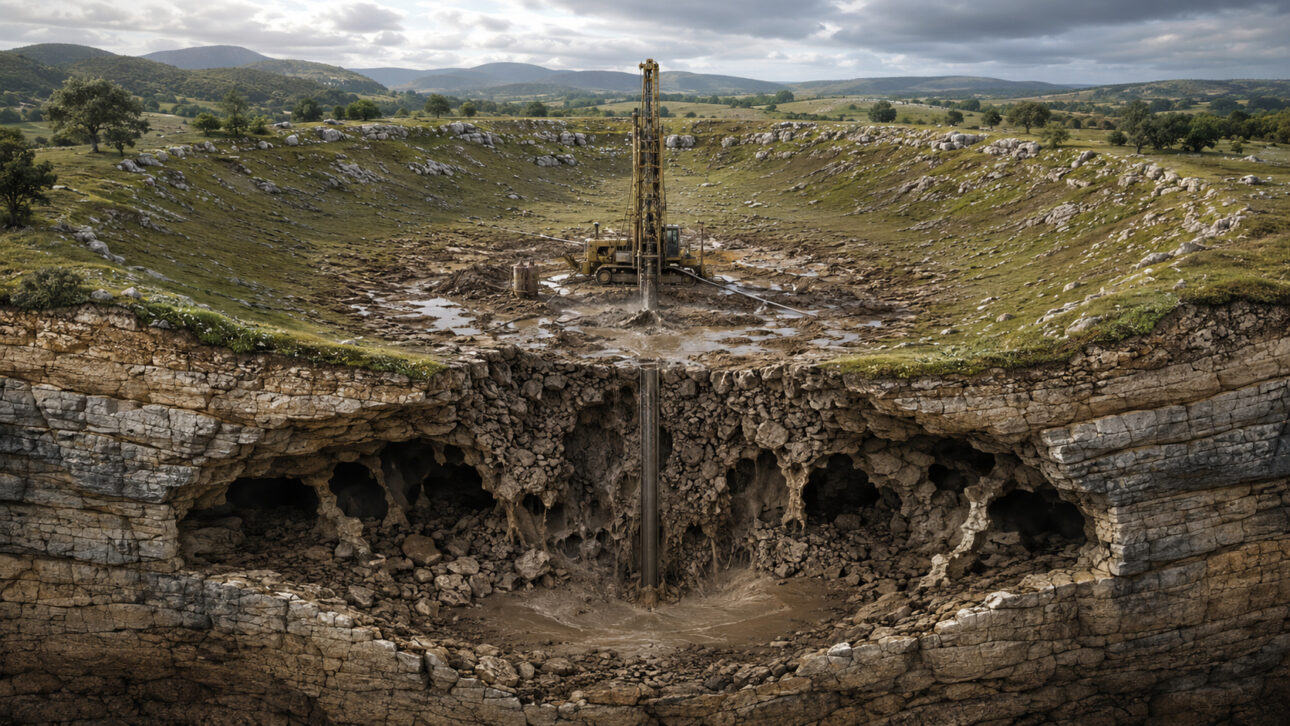
Center of sinkholes should be avoided in drilling
One of the most well-known locations among professionals in the field as a risk point is the center of a sinkhole. A sinkhole is a circular or oval depression common in karst terrains and usually indicates that there has been a collapse at depth.
-
90 Years Before Disney, an “Original Moana” Made History in Cinema by Depicting Life in Samoa and Shaping the Documentary Genre

-
Study in Barcelona Reveals Giraffes Can Add Quantities and Memorize Changes, Surprising Scientists
-
After Losing 16-Year-Old Son in Accident Caused by Pothole, Merchant Takes Action by Mapping Road Defects and Filling Around 1,500 Potholes in Mumbai Area

-
Dinosaurs Spark Children’s Curiosity, Boost Cognitive and Emotional Development, and Build Essential Future Skills


When drilling in the center of this structure, the equipment may hit an area with a lot of loose material. Instead of clean and usable water, the result may be mud. Furthermore, the instability of the terrain increases the operational risk, including the possibility of losing tools during drilling.
Therefore, in areas where there are sinkholes, mapping these features is important. They may indicate underground cavities, but the central point is generally not the most suitable. In many cases, the safer alternative is to evaluate the edges of the structure, rather than the center of the depression.
Tops of steep hills may have little infiltration
Another point that requires caution is the top of very steep hills. The high slope hinders the infiltration of rainwater, even when the soil has some absorption capacity. The tendency is for the water to flow over the surface, driven by gravity, instead of replenishing the subsoil.
This does not mean that every hill is unsuitable. There are situations where fractures in the terrain can favor water storage, especially when they form small depressions or structures perpendicular to the main direction of the relief. Still, in the absence of these signs, drilling in very steep areas is usually a risky choice.
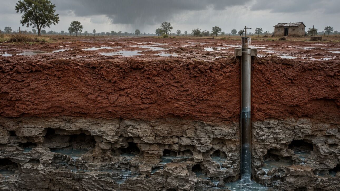
Tanks that do not dry up may indicate impermeable soil
Locations near permanent tanks and reservoirs should also be analyzed carefully. When an area accumulates water for a long time and does not dry even after the rainy season, this may indicate that the soil has low infiltration.
In other words, the water remains on the surface because it cannot efficiently penetrate the terrain. This behavior may reveal the presence of impermeable layers, which hinder the recharge of the aquifer.
The same logic can apply to certain permanent watercourses. In some cases, rivers that do not dry up may be associated with poorly permeable soils. In these scenarios, the presence of water on the surface does not necessarily mean that there is good availability in the subsoil.
Very clayey soils reduce the chance of recharge
Areas with a large amount of mud or thick clayey soils are also considered unfavorable in many cases. When the clay layer exceeds several meters, water infiltration tends to be limited.
In fissural or karstic terrains, where recharge usually occurs locally, this blockage can hinder the supply of fractures and cavities that would store water. Therefore, wells drilled in regions with thick clay layers often have low flow rates.
There are exceptions, especially in sedimentary basins, where recharge can occur at more distant points and supply the aquifer from below. Even so, the presence of thick clay is a warning sign before drilling.
Near the beach, the risk is of brackish or saline water
Proximity to the sea is another important factor. In coastal areas, especially in sedimentary aquifers, the influence of the so-called saline wedge can occur. In this process, seawater advances laterally underground and compromises the quality of the groundwater.
The well may produce water, but it can come out brackish or saline, making it unsuitable for various uses. Even so, this situation is not an absolute rule. Impermeable layers or rocky masses can prevent the advance of seawater in certain regions.
Besides these points, areas near landfills, sanitary landfills, gas stations, and industries also require attention, as they may pose a risk of contamination. Lands that flood during rainy seasons are also problematic, as the well can be damaged or buried.
Another warning sign appears in rock slabs with fractures filled with clay, quartz, or other materials. When the fracture is occupied, there is little space left for water storage. Therefore, before drilling, it is ideal to carefully observe the land and consider that not every seemingly favorable point truly offers safety, flow, and quality.