Portuguese
  Spanish


Satellite images helped archaeologists identify circular and oval stone structures linked to ancient nomadic peoples who lived by herding
The discovery of 260 new funerary monuments in the Atbai desert, in Sudan, is drawing attention for revealing traces of a pastoral society forgotten for more than 5,000 years.
The structures were identified with the support of remote sensing tools, including Google Earth, which allowed researchers to observe ground marks invisible to those walking in the region.
Technology revealed monuments hidden beneath the desert landscape
The research showed that the Atbai desert holds a much broader archaeological set than previously imagined.
-
65-year-old man lived in Arizona forest for 8 years, built illegal campsite, and accumulated half a ton of trash before being discovered by U.S. Forest Service agents

-
Former Biology Teacher Turns Financial Education App into a $1.2 Million Success in Brazil

-
Brazilian Entrepreneur Launches Staff-Free Laundry Chain with 636 Locations Nationwide, Generating $5 Million in Revenue
-
From Painting Houses in the U.S. to Producing Beyoncé and Paul McCartney Shows, Entrepreneur Opens Luxury Hotel in Brazil’s Trancoso with $8 Million Revenue Goal


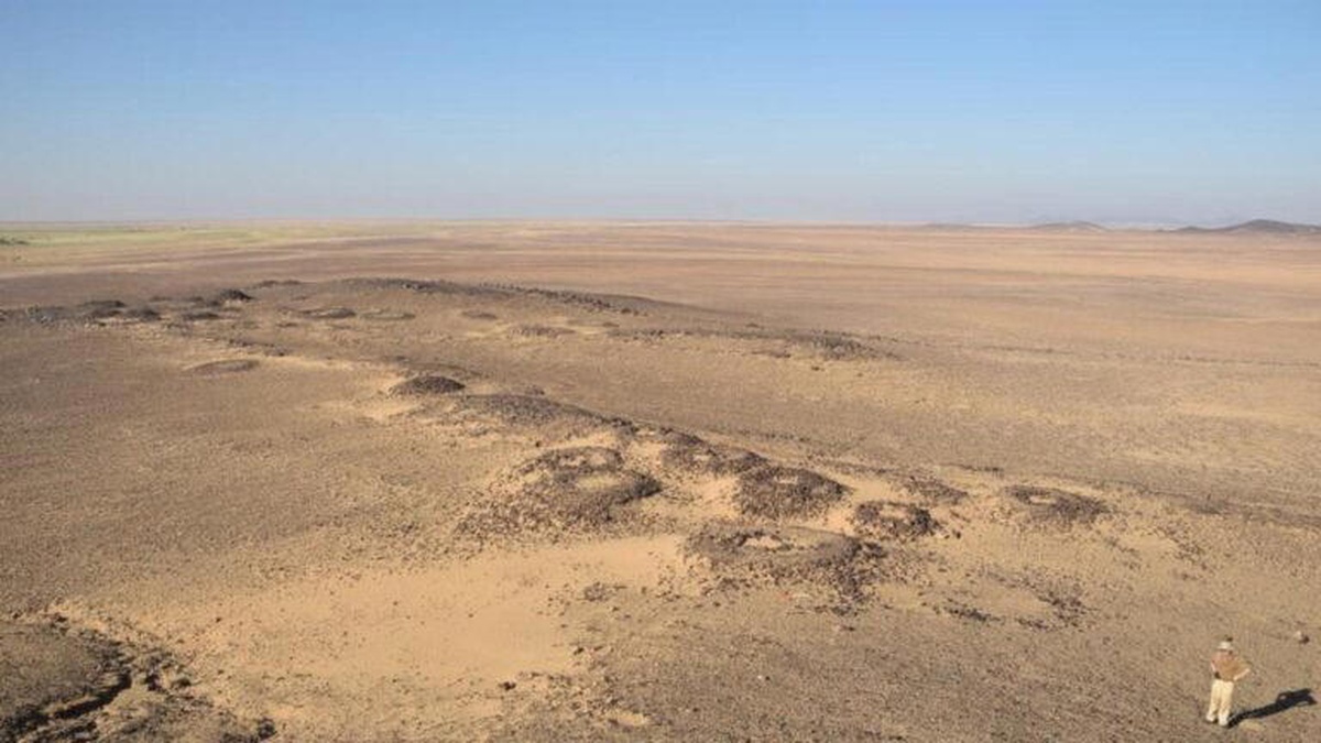
Through satellite images, archaeologists managed to map stone enclosures with circular and oval shapes, erected in areas close to ancient seasonal watercourses.
The survey, associated with the Atbai Survey Project and published in the journal African Archaeological Review, recorded thousands of heritage elements in the region between the Nile and the Red Sea.
Among the findings, researchers highlighted structures with varied dimensions, some of them up to 82 meters in diameter.
What were the constructions found in Atbai like?
The funerary monuments are noteworthy for their size, spatial organization, and the collective effort required for their construction.
Among the main identified characteristics are:
- 260 new funerary monuments;
- stone walls in circular or oval shapes;
- structures with 5 to 82 meters in diameter;
- works erected near ancient riverbeds;
- enclosures associated with funerary practices and territorial memory.
These elements indicate that the region was occupied by nomadic groups capable of organizing large collective works.

Who were the people that built these structures?
Unlike the Egypt of the pharaohs, this ancient society did not leave behind large cities, monumental temples, or urban walls.
Even so, the remains point to organized human groups, primarily dedicated to animal herding in an increasingly dry landscape.
These communities erected stone tombs as a way to mark their presence in the territory.
Moreover, the monuments also served as signs of identity, family memory, and possible dominance over strategic areas.
Cattle played a central role in wealth and social prestige
Excavations revealed human remains buried alongside bones of cows, sheep, and goats.
This detail shows that animals occupied a central role in the economic, social, and symbolic life of those peoples.
In practice, large herds represented wealth, influence, and authority within the nomadic communities.
Additionally, the presence of animals in the graves indicates that the status of the owners remained important even after death.
Secondary graves around main tombs also suggest social differences among the buried individuals.
Climate changes influenced the life of this civilization
The monuments were built mainly between the 4th and 3rd millennium BC.
This period coincided with the end of the African Humid Period, when rains began to decrease in the region.
As the drought advanced, the herders had to adapt their routes, camps, and survival strategies.
Therefore, many tombs appear near ancient dry rivers, rocky pools, and areas where water could temporarily accumulate.
Archaeological heritage is threatened by gold mining
Despite having withstood the extreme desert conditions for millennia, part of these monuments faces recent threats.
According to researchers, at least 12 structures have been damaged by modern gold mining activities.
Due to this risk, the exact coordinates of the sites have been kept secret.
The measure aims to prevent looting, vandalism, and destruction before new excavations can deepen the study of this ancient society.
Do you think satellite images can still reveal other forgotten civilizations in isolated regions of the planet?