Portuguese
  Spanish
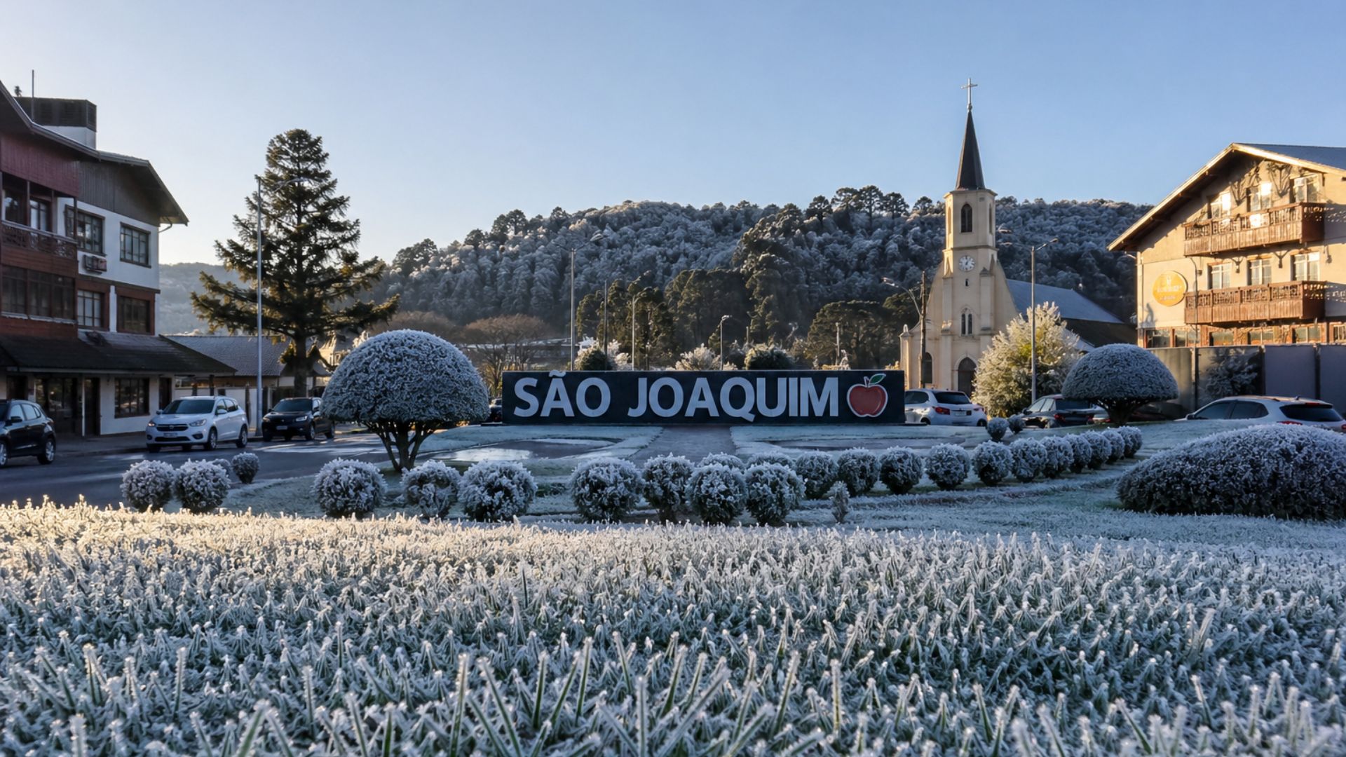
Polar air mass retreats after causing negative lows and frosts in the South, while the advance of instabilities and stable weather in the Southeast highlight a significant thermal contrast between Brazilian regions over the past few days.
The polar air mass that dropped temperatures in Southern Brazil and led cities in Santa Catarina to record negative marks began to lose strength this Wednesday (29), after causing intense frost and forming ice in areas of the Serra Catarinense.
The episode drew attention due to its intensity and scope, with simultaneous records of extreme cold in different municipalities in the South region.
The strongest cold was concentrated between the early morning and dawn of Tuesday (28), when São Joaquim recorded -3.33°C, according to records attributed to Epagri/Ciram.
-
Esperanza’s Bamboo Barrier in Oaxaca Redirects River and Reduces Erosion by 85% in Five Years

-
Family Builds Homemade Wind Turbine to Power Off-Grid Home, Video Reaches 555,000 Views on Ngô Thị Huyền’s Channel
-
Indian Brand Creates Sneakers from Recycled PET Bottles and Discarded Tires, Repurposing Over 1 Million Bottles and Raising $4 Million for Expansion

-
Brazilian Innovator Uses 3D-Printed Device to Cool Two Rooms with One Air Conditioner


There were also temperatures below zero in Urupema, Bom Jardim da Serra, and Urubici, locations known for the recurrence of intense cold during winter.
Cold loses intensity throughout the week in the South
The trend observed by meteorologists indicates a gradual rise in temperatures, with the coldest core of the polar mass moving towards the ocean and ceasing to directly influence the continent.
With this change in atmospheric dynamics, the South should still experience cold early mornings, but without repeating the extremes observed at the beginning of the week.
By Friday (1st), the most severe cold tends to concentrate in the early hours of the day, especially in higher altitude areas of Rio Grande do Sul and Santa Catarina.
In most of the region, the minimums will vary at less severe levels, ranging between 10°C and 15°C in several cities.
This behavior occurs because the advance of the polar air loses intensity over the continent, while areas of instability begin to increase cloudiness.
With more clouds, there is less heat loss during the night, which makes it difficult for new sharp temperature drops, although the feeling of cold still persists in the mornings.
Intense frost hits cities in the Serra Catarinense
In the Serra Catarinense, the combination of clear skies, dry air, and weak wind favored the formation of widespread and visible frost in different parts of the region.
In some locations, residents recorded lawns, vehicles, and surfaces completely covered by ice in the early hours of the day.
Besides São Joaquim, municipalities like Urupema, Bom Jardim da Serra, and Urubici appeared among the coldest spots in the country during the episode.
These cities have geographical characteristics that contribute to this scenario, such as high altitude and greater exposure to cold air masses.
Despite the visual impact and extreme records, the cold is not expected to maintain the same intensity in the coming days.
The forecast indicates gradual warming, without a sudden transition to heat, but enough to eliminate the risk of new negative lows in most locations.
Southeast has sun, less rain, and rising temperatures
While the South faced the peak of the polar wave, part of the Southeast showed opposite conditions, with predominantly clearer weather and atmospheric stability.
Rio de Janeiro, São Paulo, and Minas Gerais recorded the presence of sun, cloud variation, and slightly rising temperatures throughout the afternoon.
The possibility of rain exists, especially on the coast of São Paulo and Rio de Janeiro, but occurs in an isolated manner and without significant volumes.
In the interior of the Southeast and in areas of the Midwest, the trend is a reduction in precipitation, with predominantly dry weather and less cloud cover.
“The areas of the Midwest and Southeast are becoming less favorable for rain. It is not as present or intense as in the South,” said meteorologist Cesar Soares.
Thermal contrast between regions draws attention
The contrast between the intense cold in the South and the relative heat in areas of the Southeast drew attention for occurring in a short time frame.
While mountain cities recorded negative temperatures at dawn, regions further north experienced afternoons with a higher thermal sensation.
This type of thermal difference is common in transition periods, when cold air masses advance across the national territory but lose strength before reaching all regions with the same intensity.
Nevertheless, the abrupt change in climatic conditions requires attention, especially in sectors such as agriculture, transport, and public health.
In the South, the recommendation is to follow meteorological updates, especially in rural areas more vulnerable to the effects of frost.
In mountain towns, the cold during dawn can still affect sensitive crops, as well as impact animals and make travel difficult in the early hours of the day.
This scenario reinforces the need for constant monitoring of climatic conditions, especially during periods marked by rapid variations and sharp contrasts between different regions of the country.