






 Portuguese
  Spanish
  3 min of reading
  1 comment


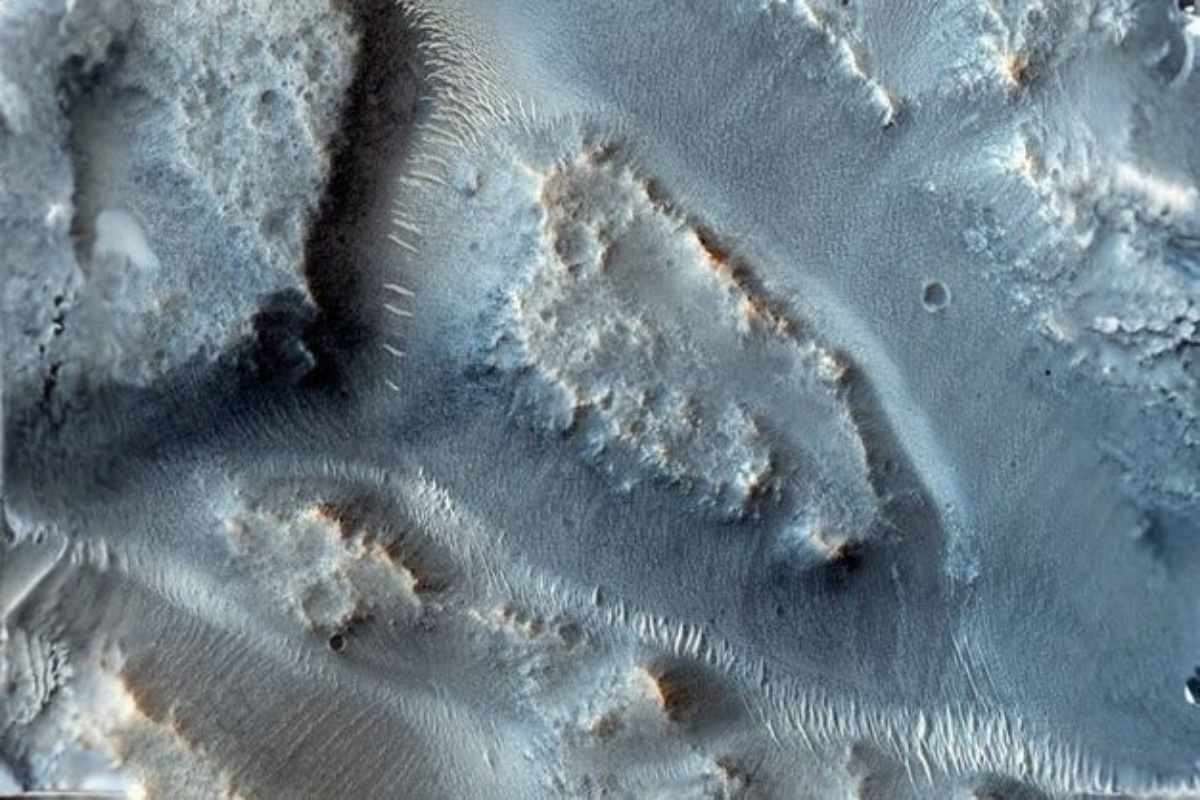


A New Study Indicates That These Formations Occupied 5% of the Primitive Martian Surface and Helped Redesign the Planet’s Relief.
The NASA identified 16 ancient waterways on Mars, expanding the evidence that water circulated intensely on the planet’s surface in the past.
The finding helps explain how the Martian terrain was sculpted and why some regions may have brought together favorable conditions for chemistry associated with habitability.
The structures were reconstructed using global maps that gather valleys, lakes, canyons, and sedimentary deposits, using data from various orbital missions.
-
Research reveals evidence that autism may represent several different conditions instead of a single disorder, transforming medical strategies, accelerating advances in neuroscience, and increasing the precision of interventions for millions of people.

-
Neanderthal genes still live in you and may influence the viral load of common infections, reveals genetic study on human immunity.
-
Technology using saliva: A new method based on biomarkers present in saliva can raise safety standards in traffic and at work, helping to recognize signs of fatigue and drowsiness with the potential to prevent accidents before they happen.
-
First vaccine created by artificial intelligence is tested on humans and opens a new era in medicine





What Happened and Why It Caught Attention
The detection of 16 river networks indicates an ancient and extensive drainage system, active about 3.7 billion years ago.
These channels would have shaped extensive areas, with the capacity to transport a large volume of sediments and transform the planet’s relief.
The result also draws attention as it shows that water did not appear only in isolated events but rather in prolonged episodes of runoff.
How the Study Reconstructed the Ancient Waterways

The analysis is based on a paper published in PNAS, with reconstruction based on global maps of landforms and sediment records.
Maps of valleys, lakes, canyons, and deposits were combined, organized from data collected by different orbital missions.
The lead author, Abdallah Zaki, emphasizes that these networks occupied 5% of the primitive Martian surface and concentrated about half of the sediment mobilized by the planet’s rivers.
What the Numbers Reveal About the Primitive Martian Surface
The value of 5% suggests that the networks occupied a limited fraction of the surface but had a disproportionate influence on material transport.
This helps understand why certain regions show marks of erosion and sediment accumulation on a large scale.
The presence of large deposits linked to these basins also reinforces the idea of water circulation long enough to produce persistent changes in the terrain.

Images from the Mars Reconnaissance Orbiter Show Erosion Similar to That of Earth
Records obtained by the HiRISE camera on the Mars Reconnaissance Orbiter display channels crossing impact craters and branching into multiple paths.
In some cases, the flows divide within the crater and reunite upon exiting the structure, a pattern indicating sustained runoff.
This behavior points to the capacity for continuous erosion, even breaking through rocky barriers, in dynamics comparable to large rivers on Earth.
Why the Absence of Plate Tectonics Did Not Prevent Large Basins
Even without plate tectonics, Mars managed to form basins with magnitude similar to terrestrial basins.
This data is important as it shows that excavation and accumulation processes can occur through other mechanisms, with water acting as a central agent.
The prolonged interaction between water and minerals favors chemical reactions relevant for assessing potentially habitable environments.
What May Happen From Now On in Exploration Missions
The deposits associated with these basins may hold clues about the ancient climate of Mars and possible biogeochemical signatures.
The trend is for these regions to gain priority in selecting study areas and sample collection, seeking to understand how long the planet retains its water.
The identification of the 16 networks also helps define where the sediment transported by the rivers may have accumulated with higher probability.
The discovery of the 16 ancient waterways reinforces the role of water in transforming Martian relief about 3.7 billion years ago.
With this, the focus grows on areas that may preserve valuable sedimentary records, accelerating the search for signs that help clarify whether Mars ever had conditions to harbor life at some point.






A perda do campo magnético, secou e esterelizou o Marte velho de guerra.
Enquanto isso, aqui …