Portuguese
  Spanish
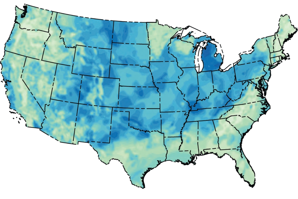
The new geological mapping of the United States expands the search for natural hydrogen, accelerates research in other regions of the planet, and reinforces interest in Brazilian basins with energy potential.
The subsurface of the United States has gained new weight in the global energy competition with the publication of the first national map of natural hydrogen on a continental scale. The survey covers the 48 contiguous states and shows where geology offers favorable conditions to generate, conduct, and store this gas underground, opening a new front for exploration of a resource that until recently was treated as a niche hypothesis.
The hook that circulated most outside the technical community was that 30 states have entered the radar of natural hydrogen. This interpretation helped push the topic into the news and gave territorial dimension to the issue, although the official USGS study does not present a closed list of proven reserves by state. What exists, in fact, is a prospectivity map, meaning a geological screening of areas where it is worth looking further.
This detail is what separates a good headline from a factual error. The map does not confirm ready commercial production nor closed volumes in dozens of states. Still, it changes the debate because it creates a technical roadmap for large-scale exploration and shows that natural hydrogen has ceased to be a set of isolated cases to become a concrete agenda for energy, mining, and industry.
-
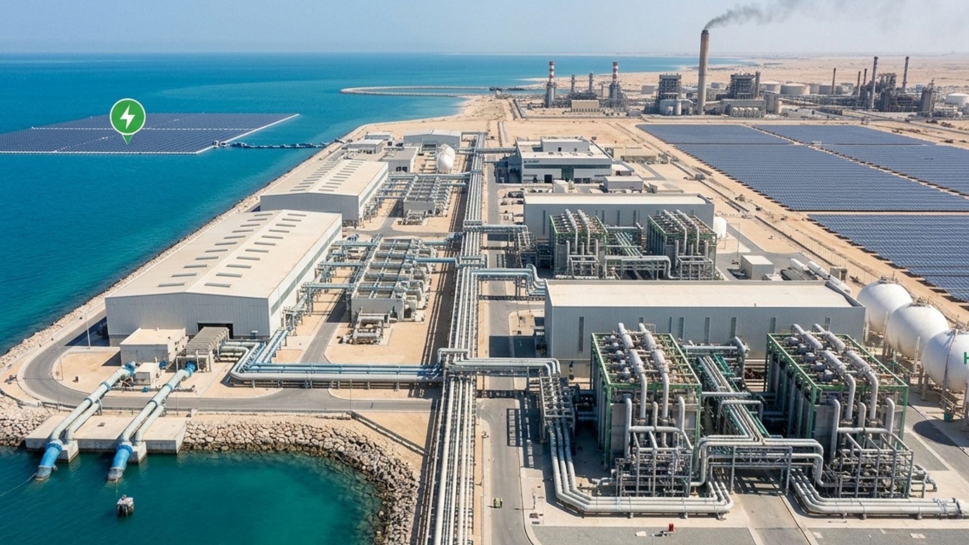
Brazilian scientists are simultaneously advancing two research projects on clean hydrogen and driving solutions that could transform the energy matrix, enhance industrial competitiveness, and accelerate large-scale emission reduction targets.

-
Advancement in renewable energy: A R$ 150 million project launched by Petrobras and Finep aims to create state-of-the-art electrolyzers for green hydrogen, strengthening national research and preparing Brazil to compete in a billion-dollar energy market.
-
Illiterate or semi-literate grandmothers were trained to repair solar systems, open rural workshops, and light up homes that still depended on kerosene.
-
The world has bet on green hydrogen as the fuel of the future, but now faces the side effect: producing 1 kilogram requires about 9 liters of ultrapure water, and the largest projects on the planet are precisely in the driest regions of the Earth, where water is already scarce for people.


The American map expanded the scale of the race for natural hydrogen

The USGS study was designed to answer a simple and decisive question: where does the subsurface of the U.S. bring together source, reservoir, and geological seal capable of favoring the existence of natural hydrogen. Instead of looking only at isolated occurrences, researchers crossed geological and geophysical data to create a national view of prospectivity, something that the agency itself classifies as the first exercise of its kind on a continental scale.
In practice, this changes how governments and companies can move. An exploratory well for natural hydrogen is expensive, involves high risk, and depends on favorable geology. With a national map, the search ceases to be almost intuitive and begins to follow a logic of prioritizing areas, which reduces uncertainty and accelerates the establishment of a new frontier in energy research.
The political effect is also relevant. Natural hydrogen can enter the discussion about decarbonization, chemical inputs, and supply security without depending on the same industrial design required for other hydrogen routes. Therefore, the map published in the USA is of interest not only to the academic sector. It directly relates to energy planning, mineral investment, and industrial strategy.
Why the 30 states became the great hook of the topic
The idea of 30 states on the radar gained traction because it translates the technical study into a language that the public quickly understands. Instead of a single point on the map, what emerged was an entire country being reinterpreted in light of an energy source that was previously marginal. This interpretation was reinforced in journalistic readings of the survey and helped to give national scale to the topic.

But the data that truly supports the story is another: the map covers the 48 contiguous states and points to multiple areas of interest, not a pre-defined commercial discovery. The journalistic value lies precisely in this shift. The United States did not announce a ready hydrogen natural mine at dozens of points. They announced a new search map, and that alone reorganizes the global conversation.
This care matters because the hydrogen market still coexists with exaggerated promises. When the reading is correct, the topic remains strong. What changes is not the size of the impact, but the precision of the framing. The American map is a milestone because it opens a field of continental exploration, not because it independently closes the account of proven reserves state by state.
Center of the USA, California coast, and Four Corners concentrate some of the strongest signals
The areas most cited by the USGS include ranges from the Midcontinent, sections of the central California coast, the Four Corners region, and parts of the eastern coastline. The study highlights multiple areas of interest, which shows that prospectivity is not restricted to a single geological province.
Another relevant point is the retroactive effect of the survey. Old drillings, originally made for oil and gas, may have crossed zones with hydrogen without the resource being properly recognized. This hypothesis enhances the value of existing historical databases and can transform old geological archives into strategic assets for a new exploratory wave.
This repositioning is of direct interest to the energy sector. If part of the knowledge accumulated over decades of conventional exploration can be reused in the search for natural hydrogen, the learning curve shortens and the entry of new projects tends to gain speed, especially in regions with already developed subsurface infrastructure.
France showed the size of the prize and the United States showed how to search
The recent history of natural hydrogen gained international prominence when researchers linked to CNRS and the University of Lorraine pointed out 46 million tons in northeastern France. The French case became a symbol of the potential economic and geological prize involved in this race.
The United States entered another stage of the same story. Instead of announcing a localized find with great potential volume, the USGS published a tool to guide the search on a national scale. France helped prove that large accumulations can exist. The American map showed how a country can transform this possibility into a systematic exploration strategy.
This combination explains why the topic has moved out of the restricted circle of geology and gained weight on the energy agenda. With a significant international reference case and a national prospecting model in the US, natural hydrogen has come to be seen as a vector that can influence investment, technology, and competition for new low-carbon sources.
Brazil entered the global reading because it already has basins under observation
Brazil appears in this new geography of natural hydrogen because there are already studies, signs of occurrence, and ongoing institutional investment. The São Francisco Basin is the most cited case, and the potential of the area has already been highlighted by the Geological Service of Brazil. In parallel, Petrobras announced R$ 20 million in research, with work initiated in Bahia and expansion planned for other states.
The Energy Research Company also records preliminary campaigns with potential in Ceará, Goiás, Tocantins, Roraima, Minas Gerais, and Bahia, which broadens the Brazilian horizon beyond a single basin. This does not mean a consolidated commercial discovery, but it shows that the country has already moved out of the phase of academic curiosity and entered the stage of mapping, geological comparison, and applied research.
That is why the map of the USA is so important for Brazil. It offers a model for reading the subsurface that can be replicated, adapted, and tested in national basins with similar characteristics. If American prospecting serves as a methodological reference and Brazilian signals are confirmed in future campaigns, the country could gain ground in a strategic front that increasingly connects energy, mining, industry, and geopolitics.