Portuguese
  Spanish


The record did not come from a buoy or a ship, but from an orbiting radar that mapped crests in the middle of the ocean, far from any coast. And the energy from that storm traveled about 24,000 kilometers, crossing the Drake Passage to the Tropical Atlantic, weeks after the sea had already calmed in the Pacific.
A NASA and French space agency satellite captured from space the largest wave ever measured in open sea: a wall of water about 19.7 meters high, as tall as a six-story building, generated by Storm Eddie in the North Pacific in December 2024. The record, made far from any coast, is the largest ever obtained by satellite in more than three decades of observations and revealed unprecedented details about how the ocean transports its energy.
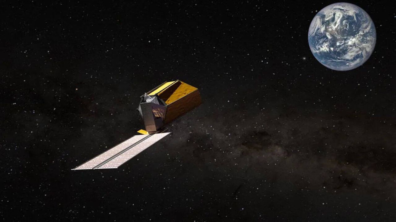
The measurement was taken on December 21, 2024, at the height of Storm Eddie, by the SWOT satellite, an acronym for Surface Water and Ocean Topography, a joint mission of the American space agency NASA with the French CNES. The study was led by oceanographer Fabrice Ardhuin, from the Laboratory of Physical and Spatial Oceanography in France, and published in September 2025 in the scientific journal PNAS, in the United States.
The correct number: 19.7 meters, not 35

The record measured by the satellite was 19.7 meters of significant wave height, not 35 meters as some have claimed. The significant height is a statistical measure that represents the average of the largest waves observed, and it is the official and validated number of the study.
-
Hisense Unveils 615-Liter PureView Fridge with Transparent Door, Smart Display, Voice Control, and UV Purification to Compete with LG and Samsung

-
Are Cleaning Staff in Large Buildings Becoming Obsolete? Autonomous Robots Now Clean Airports, Hospitals, and Shopping Centers for Hours, as Companies Invest in Automating Repetitive Tasks

-
Xiaomi Launches Compact Photo Printer with Bluetooth, Extra Black Ink, and Augmented Reality Photo Printing
-
Teen Invents AI-Powered Traffic Light to Assist Elderly Pedestrians by Extending Crossing Time





The value of 35 meters that circulated in some publications actually refers to an estimate of isolated individual crests that could have occurred within that storm, and not to the record measurement itself. For comparison, the European Space Agency describes the nearly 20-meter wave as being as high as a six-story building or the Arc de Triomphe in Paris, which is already impressive in itself, without the need for exaggeration.
How a satellite measures waves in the middle of the ocean

The SWOT, launched in December 2022, can create two-dimensional maps of the ocean surface, measuring not only the height of the waves but also their length and direction, even when the crests are more than 500 meters apart. This allows for the observation of swells in remote areas of the sea, where buoys and ships rarely manage to record events with the same precision.
Before SWOT, humanity already had wave height data captured by about 15 satellites since 1991, but until December 2024 these measurements had never exceeded 18.5 meters. Not because larger waves didn’t exist, but because the old satellites covered only a small fraction of the ocean and almost always passed far from the center of storms. The luck was that SWOT crossed right through the heart of the Eddie storm at the peak moment of the waves.
The Eddie storm and the waves that crossed the planet
The Eddie storm was an extratropical cyclone of rare intensity, considered to have the highest average wave height in the Pacific in the last decade. It caused deaths and damage along the American coast, from Canada to Peru, and generated the giant waves that marked the famous surfing competition known as the Eddie, in Hawaii, specifically aimed at extreme waves.
But the most fascinating aspect was the reach of this energy. The waves generated by Eddie turned into swell, the type of undulation that travels long distances after the storm passes, and traveled about 24,000 kilometers. They left the North Pacific, crossed the Drake Passage, between South America and Antarctica, and reached the Tropical Atlantic between December 21, 2024, and January 6, 2025, showing how an extreme event at one point on the planet reverberates across oceans.
What the study corrected in ocean models
One of the most relevant results of the research was adjusting how science calculates the energy of longer waves. Contrary to what one might imagine, the problem was not that the models ignored this force: what happened was that they overestimated by up to 20 times the energy transported by longer waves, distributing the force in a different way than the satellite observed in practice.
With direct data from SWOT, researchers began working on a more precise model that takes into account complex interactions between short and long waves, which were previously little considered in open sea forecasts. Instead of revealing an unknown force, the study served to validate and correct existing models, making predictions of extreme waves more reliable in the future, something essential for safety at sea.
Why this matters for ships and platforms
Extreme waves are not just a visual spectacle. For cargo ships, offshore energy platforms, submarine cables, and ports, a wall of water tens of meters high represents a direct risk to safety, navigation, and maritime engineering. Knowing more precisely where and how these waves form can help prevent tragedies at sea and protect structures that cost billions.
Satellite monitoring paves the way for practical applications, such as identifying dangerous areas before waves reach navigation routes, adjusting vessel routes during intense storms, reviewing engineering standards for platforms and coastal structures, and improving models that predict swells and erosion. For the offshore oil and energy sector, in particular, this type of information is strategic for operational safety.
Extreme waves and climate
One of the open questions is whether megastorms like Eddie are becoming more frequent or intense due to climate change. Fabrice Ardhuin’s team investigates this relationship, and the researcher himself is cautious in stating that global warming may be one of the drivers of this phenomenon, but not the only one, as factors such as the seafloor relief, storm paths, and natural climate variations also weigh in.
What is known is that warmer oceans store more energy, fuel stronger storms, and help create the winds that form giant waves. Therefore, the role of SWOT will be central in this investigation: by measuring the ocean in great detail, the satellite will allow for the comparison of extreme events over the years and verify if the energy of storms is changing along with the planet’s climate.
The nearly 20-meter wave captured from space by the SWOT mission is much more than a curious record: it is proof that part of the ocean’s force still escaped traditional measurements and can now be observed directly from orbit, even in remote parts of the sea. The Eddie storm showed that the ocean transports energy in complex ways, and each new record transforms previously invisible phenomena into concrete data for science, navigation, and maritime safety.
Have you ever imagined that a satellite can measure from space a wave the size of a six-story building in the middle of the ocean? What impresses you more, the height of the wave or the fact that its energy traveled 24,000 kilometers? Leave your comment, tell us what you think of this discovery, and share the article with those interested in science, oceans, and space technology.