Portuguese
  Spanish


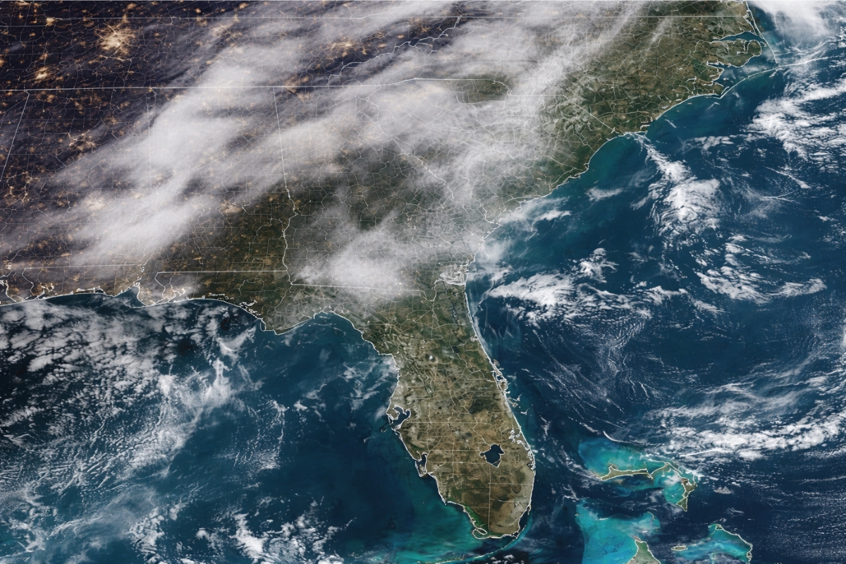


NWS Warning Indicates Minimal Visibility on Roads and Extra Risk for Those Driving in the Early Hours of the Day.
A vast area of radiation fog advanced through the southeastern United States, making Friday morning hazardous for travel in several sections.
The warning applies to 78 counties in Georgia, South Carolina, and Florida, with extremely low visibility on highways and urban roads.
Despite the name, radiation fog has no relation to nuclear radiation and usually arises on humid nights, with cooling of the ground and little wind.
-
A 17-year-old student created an artificial intelligent trash can that moves by itself through schools and parks, finds trash, separates waste with 90% success, and turns recycling into an automatic, mobile task that is harder to ignore in busy public spaces.

-
Detectorist finds 2,700-year-old bronze sword embedded vertically in forest in Poland; artifact may reveal ancient Bronze Age ritual
-
At the bottom of the Mediterranean, Italian engineers have sunk a “plant” in the shape of a giant donut that uses the ocean’s own weight to store energy, storing electricity generated by wind and sun at the sea floor and returning it to the grid without dams, mountains, or chemical batteries.

-
Scientists create robotic bird that uses articulated wings to maintain balance, mimicking hawks and flying with stability where common drones fail.




What Happened and Why It Caught Attention
The fog moved southeast and created poor travel conditions for up to five million people.
The scenario primarily affects drivers, as in many places visibility may be limited to one-quarter mile ahead in the early hours of the day.
The most covered areas include central, eastern, and southeastern Georgia, central and southeastern South Carolina, and parts of northern Panhandle in Florida.
Where the Fog Is Most Intense and Which Cities Are on the Radar

Some of the most impacted cities are Augusta and Macon in Georgia, as well as Columbia and Charleston in South Carolina.
Satellite images from NOAA showed fog formation also in parts of Alabama, Mississippi, North Carolina, and Tennessee in the early hours of Friday.
In these states, flood advisories arose due to excessive moisture and the slow movement of a humid air mass.
What Is Radiation Fog and Why Is It Called That
The term describes the fog that forms when the ground loses heat rapidly during the night, under clearer skies and light winds, saturating the humid air near the surface.
It occurs most frequently in fall and winter when nights are longer and cooling is more intense.
The result is a low, thick layer that can persist until the sun warms the ground throughout the morning.
Heavy Rain on the Way and Alert Timings This Friday
Large areas of these three states may record more than five inches of rain by Saturday.
Most dense fog advisories in land should continue until at least 10 a.m. ET, with an improving trend as the sun warms the ground.
In coastal and maritime areas, there are longer alerts until 1 p.m., including waters off the coasts of Georgia and South Carolina, the port of Charleston, and some bays in the Panhandle of Florida.
Air Quality and Reports of Chemical Odor in the Region
Low fog can trap local pollutants close to the ground for longer, which is concerning in urban areas with traffic and industrial activity.
Before dissipating, factory and exhaust particles can remain near the surface for hours, which can worsen symptoms in people with asthma.
Residents of Georgia reported on social media a chemical smell and the impression of residue on car windows after passing through the fog.
Points of Attention for Those Who Need to Drive
The practical guidance is to reduce speed, use headlights, and maintain a safe distance from the vehicle ahead.
The risk increases on curves, bridges, highway entrances, and sections with wet pavement, where visibility changes rapidly.
With rain expected and high humidity, the combination of radiation fog and wet pavement requires heightened attention throughout the morning.
This Friday’s occurrence puts Georgia, South Carolina, and Florida on alert for slower traffic and a higher risk of incidents in the early morning hours.
With advisories until 10 a.m. ET inland and until 1 p.m. in coastal and maritime areas, the trend is for gradual improvement, but the impact continues directly for those relying on the road in the early hours.