Portuguese
  Spanish
With 17 States Under Weather Warning, Wednesday (11) Concentrates Rainfall of Up to 100 mm Per Day and Winds of Up to 100 km/h, Scenario That Raises the Chance of Power Outages, Falling Branches, Flooding, and Overflows, Especially Between Late Afternoon and Night in Various Regions.
The alert for 17 states redefines the hydrometeorological risk map this Wednesday (11), with forecasts of accumulations of up to 100 mm per day and winds of up to 100 km/h. The potential for impact increases throughout the day and puts pressure on essential services, especially where urban infrastructure already operates at the limit during heavy rain periods.
The forecast has been reinforced by meteorological information indicating instability over Southeast, Central-West, North, and Northeast. In this scenario, the risk is not uniform: it concentrates more in specific bands, with potential for blackouts, falling trees, flooding, overflows, and electrical discharges, especially between afternoon and night when showers tend to gain strength.
Where the Risk Concentrates and Which Areas Enter More Critical Range

In the territorial snapshot, the 17 states on alert include São Paulo, Rio de Janeiro, parts of Minas Gerais and Espírito Santo, Goiás, Distrito Federal, parts of Mato Grosso, Rondônia, Acre, Amazonas, Roraima, Pará, Amapá, Tocantins, Maranhão, Piauí, and parts of Bahia. This shows an extensive instability corridor, affecting capitals, metropolitan areas, medium-sized cities, and rural zones.
-
In Andradina, in the interior of SP, a tannery transformed tilapia skin that slaughterhouses used to throw away into exotic leather for bags, shoes, and even wedding dresses, producing about 2,000 pieces per month and exporting to seven countries, proving that fish waste has become high-value fashion.

-
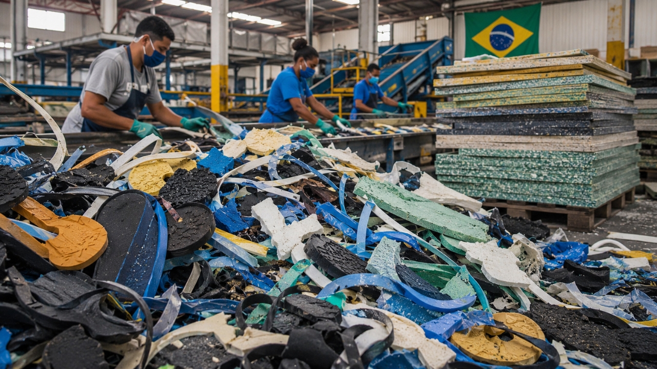
The industrial waste that even recyclers didn’t want has gained value in the interior of Bahia: two entrepreneurs invested R$ 2.8 million to transform 350 tons per year of foam, rubber, and plastic into boards that can replace wood and MDF.

-
What is a red flashlight used for, after all? See why it is so commonly used at night.

-
He has never read a line of code, but he already knows how to work: the French company UMA presented in Paris the Northstar, its first AI-powered humanoid robot designed for factories and warehouses, capable of copying tasks just by observing an employee in action.


Within this group, the most severe classification falls on Rondônia, eastern Amazonas, western Pará, northern Tocantins, and southern Maranhão and Piauí. In these areas, the combination of heavy rain and strong winds increases the chance of simultaneous disruptions. In practical terms, this means more pressure on urban drainage, energy networks, and traffic flow in the same timeframe.
Who is Affected First and How Much the Impacts Can Advance in Routine
When a scenario like this involves 17 states, the effects appear first in the most sensitive areas of the cities: drainage routes, low-lying regions, areas with dense vegetation, and stretches with exposed electrical networks. Inmet is already signaling the possibility of power supply cuts and falling branches and high objects, factors that disrupt movements, schedules, and local service operations.
The expected volume, of up to 100 mm per day, along with gusts of up to 100 km/h, does not act in isolation. Heavy rain quickly raises water levels in streets and streams, while wind exacerbates falls and localized damage. Therefore, the scenario in 17 states is of compounded risk, where a single extreme event can trigger other problems in sequence, such as temporary mobility interruptions and failures in infrastructure.
Why the ZCAS Maintains Instability and Sustains Sequential Storms
The meteorological explanation lies in the operation of the ZCAS, the South Atlantic Convergence Zone. This system organizes a persistent band of cloudiness and rain, favoring repeated episodes of intense precipitation over wide areas. In the current scenario, the ZCAS is fed by an atmospheric river, which transports moisture and reinforces the conditions for storms.
This mechanism helps explain why 17 states are in the same attention window, although with different intensities across the regions. The moisture band extends from the South and East of the Amazon to the Southwest of the Atlantic Ocean, sustaining the continuity of instability. In simple terms, there is enough atmospheric fuel to maintain heavy rain and significant winds during the most critical period of the day.
What Changes Until Saturday and How the Risk Map May Shift in Central Brazil
The indicated trend is for the system to dissipate by Saturday (14). After that, the advancement of an atmospheric blockage may favor drier weather over Central Brazil. This shift does not immediately erase the effects of the previous period but alters the dominant pattern, with a gradual reduction in the persistence of storms in some of the areas currently under the most pressure.
For 17 states, this means a phase transition: from a broad instability scenario to a more restrictive configuration, with less distributed risk. Still, the central point remains the same this Wednesday (11): the combination of heavy rain and strong local wind, as the real impact depends on the vulnerability of each municipality, the drainage response, and the behavior of gusts in the coming hours.
The alert in 17 states is not just a meteorological datum; it is a warning about how rain and wind events can affect energy, mobility, and safety in a chain reaction, especially when the ZCAS operates with support from an atmospheric river. The risk is technical, concrete, and distributed, with greater severity in areas already identified as critical.
In your city, what signal usually appears first on days like this—power outage, flooded street, or falling tree—and what does your family do to reduce impact during the heaviest rainfall?