
 Portuguese
  Spanish
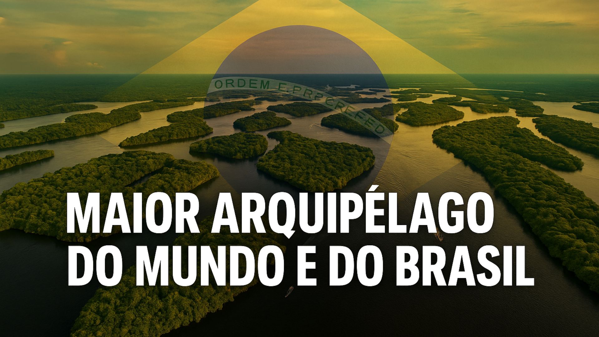
Formed by More Than a Thousand Islands in the Negro River, the Mariuá Archipelago Impresses with its Extension, Complexity, and Environmental Role in the Amazon, Being Considered the Largest River System on the Planet.
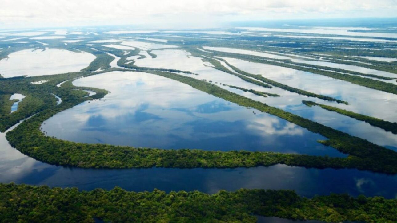
Those navigating the Negro River, in the section of Barcelos, Amazonas, encounter a landscape formed by hundreds of islands, flooded forests, and channels that open and close according to the water level.
It is in this region that the Mariuá Archipelago is located, pointed out by researchers and environmental agencies as the largest river archipelago in the world.
Studies indicate that the system comprises about 1,400 islands spread over more than 275 kilometers of extension, in a section of the Negro River that can reach up to 20 kilometers wide.
-
Most of the world’s wigs and hair extensions are made from Indian human hair and assembled in a single Chinese city, the global wig capital, where 300,000 people rely on this billion-dollar industry.

-
Despite declining smoking rates in the U.S., Zippo’s windproof lighter factory sees record sales in over 180 countries, remaining the largest employer in its region for decades.
-
Brazilian Driver Accidentally Becomes Millionaire for 7 Hours, Returns $25 Million and Now Seeks $2.5 Million Reward in Court

-
McDonald’s Ice Cream Machines Often Break Due to a Single U.S. Manufacturer, Error Codes, and a Lucrative Repair Model


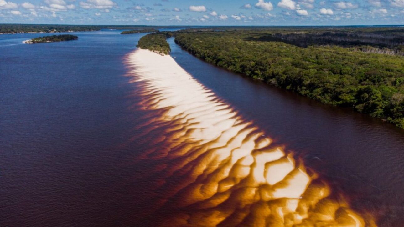
The system is set in an area of black waters, low in sediments and with high levels of dissolved organic matter, contributing to the dark coloration and the predominance of igapó forests, environments that remain flooded for much of the year.
Location and Access to the Mariuá Archipelago
The archipelago is located in the municipality of Barcelos, about 400 kilometers from Manaus by waterway.
It extends between the municipal seat and the border with Santa Isabel do Rio Negro, forming a network of lakes, channels, and paranas that change with the flooding and receding periods.
During high water, the islands connect and the system takes on a continuous appearance; in low water, sandy bars and temporary beaches emerge, revealing the internal channels and meanders.
Comparison with the Anavilhanas Archipelago
Research from Amazonian institutions and official records indicate that Mariuá surpasses the Anavilhanas Archipelago, located closer to Manaus, considered the second largest in the world.
Anavilhanas has just over 400 islands over 100 to 130 kilometers, while Mariuá presents numbers nearly three times larger in both extension and number of islands.
Formation and River Dynamics of the Negro River
According to geographers and hydrologists, the Negro River exhibits unique characteristics among the major Amazonian rivers.
Due to carrying low sediment loads and presenting acidic and clear waters, the river developed, over thousands of years, an anabranching pattern, where multiple channels intertwine to form stable islands.
The alternation between high and low water periods shapes the terrain and defines the aquatic and terrestrial environments of the archipelago.
Biodiversity in the Igapó Forests
According to experts in Amazonian ecosystems, the region harbors high biological diversity, with species adapted to the flooding cycle.
Fish, reptiles, birds, and plants depend on variations in water levels for reproduction and feeding.
The igapó forests, typical of the Negro, are composed of trees that tolerate long periods submerged, sustaining food chains specific to this type of environment.
Local Use, Fishing, and Sustainable Tourism
Navigating between the channels and creeks of the archipelago requires constant attention to levels and currents, which change according to the season.
Fishing, the main economic activity for many local communities, follows the cycles of flooding and drying, influencing access to natural resources.
Nature tourism is also significant in Barcelos, with visitors drawn to seasonal beaches, river landscapes, and wildlife observation in the region.
Conservation and Environmental Management of the Negro River
Although the Mariuá Archipelago does not constitute a specific conservation unit, it is part of a corridor of protected areas of the Negro River.
The management of these areas establishes sustainable use rules and encourages low-impact tourism, according to the Chico Mendes Institute for Biodiversity Conservation (ICMBio).
Measures such as activity zoning and environmental education actions have been applied to reduce pressures on more accessible islands, especially during low water.
Scientific Studies and Cartographic Records
The recognition of Mariuá as the largest river archipelago has been consolidated based on cartographic surveys and satellite images.
Researchers from the National Institute for Amazonian Research (Inpa) and the Federal University of Amazonas (Ufam) documented the extension of over 275 kilometers, the predominance of igapós, and the approximate number of 1,400 islands.
The analyses demonstrate the connectivity of water bodies and reinforce the ecological value of the system.
Counting Differences and Scientific Consensus
There are slight variations in the numbers presented by different studies, due to the methods used to identify islands and define the limits of the archipelago.
Nonetheless, the order of magnitude remains stable in the major scientific and governmental references, maintaining Mariuá as the largest river archipelago in the world, followed by Anavilhanas.
Ecological Value and Social Importance
Researchers point out that Mariuá serves as a natural study environment to understand processes of flooding, ecological connectivity, and the dynamics of floodplain forests.
The archipelago also provides important ecosystem services, such as maintenance of artisanal fishing, water regulation, and preservation of water quality.

Riverside communities living in the region utilize traditional practices compatible with water variations and collaborate with environmental monitoring initiatives.
Logistics and Hydrological Monitoring in Barcelos
The municipality of Barcelos concentrates the necessary infrastructure for transport, research, and tourism in the middle Negro River.
According to technicians from the Geological Service of Brazil, the monitoring of river levels is essential for navigation safety and the planning of seasonal economic activities.
In years of extreme climate, this monitoring helps to prevent impacts on communities and waterways.
Management and Preservation Challenges
Balancing sustainable use and environmental conservation is identified by experts as the main challenge for the future of the archipelago.
The region presents high ecological sensitivity and constant variations in water regimes, which requires coordination among public agencies, researchers, and local residents.
The goal, according to environmental managers, is to ensure that Mariuá maintains its integrity and ecological function, without compromising the riverside livelihoods and the activities that depend on the river.
In the face of this vast expanse of islands and an ecosystem that transforms with each season, what other natural formations in the Amazon are still waiting to be recognized for their true scientific dimension?


Na qualidade de licenciando em Geografia pela UFRJ eu confesso que fico admirado em adquirir mais esse grande saber. Uma matéria espetacular
Bom dia sou do Amazonas e o nome do Arquipélago é MAMIRÁUA