 Portuguese
  English
  Spanish
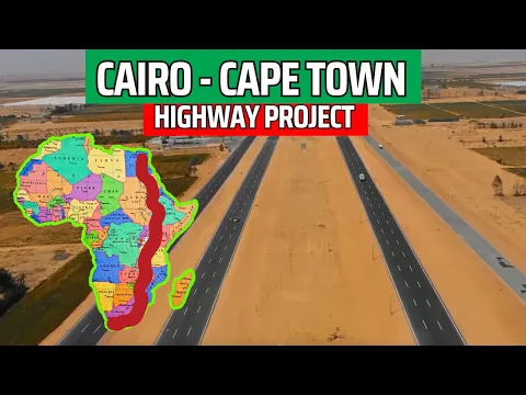
The Cairo–Cape Town Highway Project Aims to Shorten the Distance Between North and South Africa by More Than 10 Thousand Km, Strengthening Trade, Tourism, and Continental Integration with Historical Impact on Logistics and Regional Development
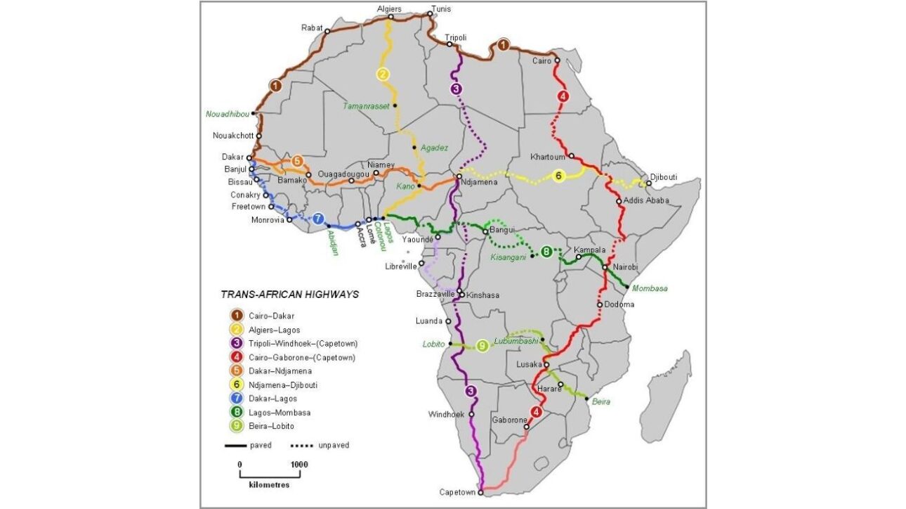
The Longest Road in Africa, officially called the Cairo–Cape Town Highway, is a continental route that connects Egypt to South Africa, crossing over 10,300 km through 11 African countries. The project is part of the Trans-African Highway 4 and aims to promote continental integration through a safe and permanent land route.
The project is integrated into the program of the United Nations Economic Commission for Africa (UNECA) and the African Development Bank, which seek to foster road infrastructure as a pillar of African growth. The route passes through countries such as Egypt, Sudan, Kenya, Tanzania, Zambia, Botswana, and ends at the port region of Cape Town, a strategic point for cargo transport.
The road starts in Cairo, the capital of Egypt, and moves south, crossing deserts like the Sahara and the Nubian Desert, mountainous areas of Ethiopia, and forest sections in Tanzania. The route also includes crossings with other pan-African routes, such as the Lagos–Mombasa Highway and the Beira–Lobito Route.
-
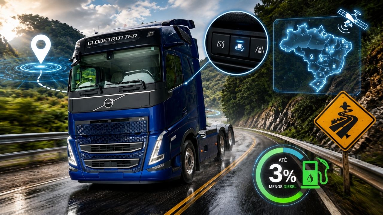
Volvo FH 2026 truck automatically reduces speed in risk areas in Brazil with GPS, activates engine brake without driver intervention, and combines safety with aerodynamics capable of saving up to 3% of diesel in some operations.

-
A viaduct over 40 years old in a city in Minas Gerais was closed due to the risk of collapse, blocked routes for months, exposed maintenance failures, and now requires a R$ 1.7 million project to prevent a collapse in the urban heart for decades.
-
Viaduct used every day by cars, buses, and pedestrians in the center of a São Paulo city becomes a legal case after a report indicates “imminent danger,” cracks, corrosion, and high lethality risk.
-
Without a category A driver’s license, without a minimum age of 21, and without two years of licensing: a new Provisional Measure from the government allows any Brazilian aged 18 to become a motorcycle courier or motorcycle taxi driver with just an Authorization to Drive a Moped on a 50cc motorcycle.


Continental Integration and Economic Impact
With the completion of the highway, the expectation is to reduce the travel time between Cairo and Cape Town to just 5 days of road travel, generating a logistical leap for intra-African trade.
The project will also be essential for regional integration in the context of the African Continental Free Trade Area (AfCFTA), facilitating trade exchanges between different economic blocs on the continent.
In addition to trade, there is growth potential in sectors such as tourism, passenger transport, and investments in urban and rural infrastructure along the route.
Logistical Challenges and Road Conditions
Although most of the transport route is already paved, some sections face logistical challenges, such as potholes, poor signage, lack of support stations, and the risk of robbery in isolated areas, especially in the north of Kenya.
In Ethiopia, crossing mountainous areas requires constant maintenance. In Sudan and southern Egypt, extreme heat and political instability are also risk factors.
However, several countries are investing in road expansion, with projects funded by development banks and public-private partnerships, including Tanzania, Zambia, and Botswana.
A Route of Contrasts and Opportunities
The longest road in Africa is also a showcase of the socioeconomic and geographical contrasts of the continent. On the same route, travelers can pass through megacities like Nairobi and Lusaka, small villages, natural reserves, mountains, and savannahs.
The sections between Francistown, Gaborone, and the southern border are used by truck drivers making the international cargo route, while tourists and backpackers utilize segments in Tanzania and Zambia for adventure tourism and ecotourism.
Logistics and transportation initiatives also aim to create integration corridors between African ports and industrial centers inland, linking road infrastructure with future railway projects.


-

1 person reacted to this.