
 Portuguese
  Spanish
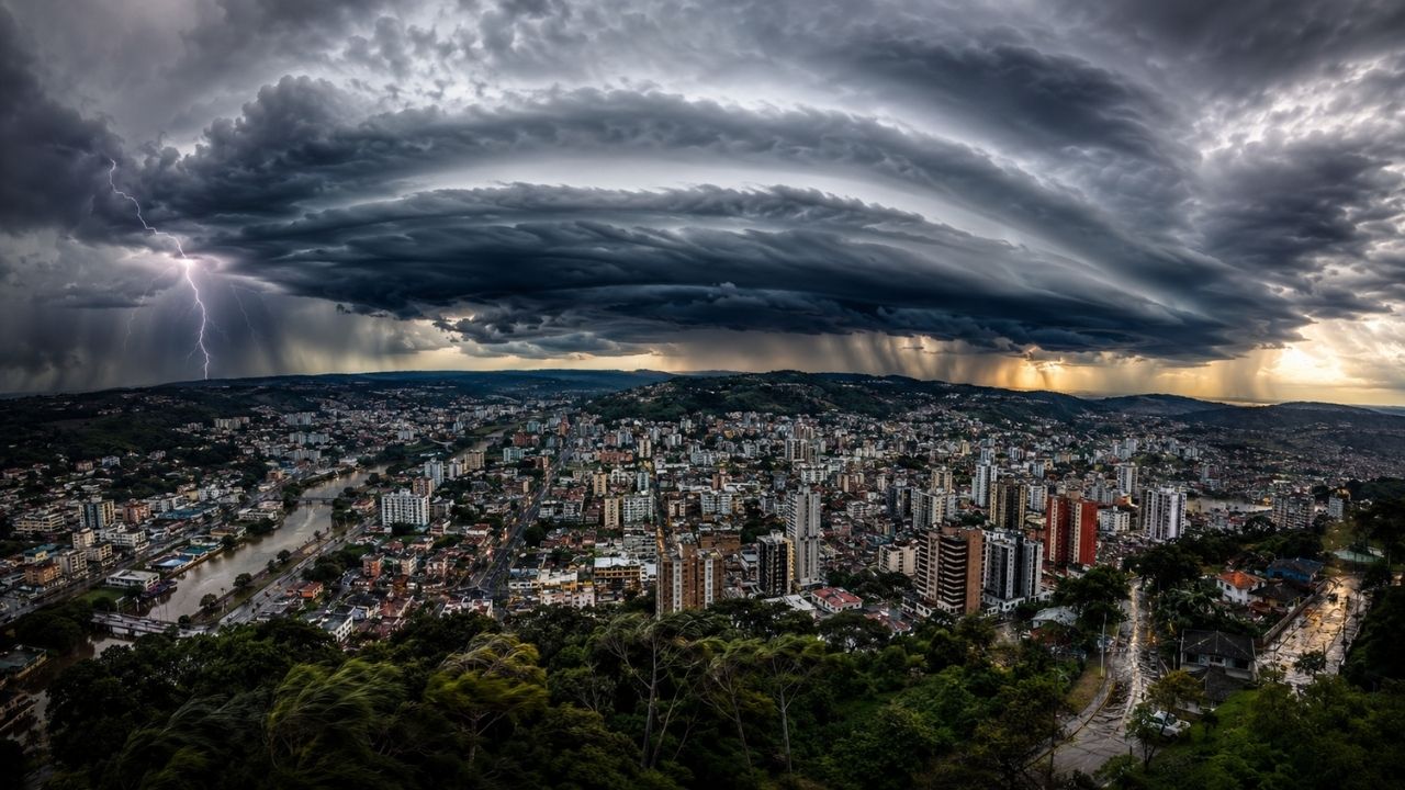
The cyclone associated with a cold front has placed 233 cities on orange alert. The forecast indicates intense rain, hail, and winds from 60 to 100 km/h, with risks of flooding, falling trees, damage to crops, and power outages in Santa Catarina, Paraná, and Rio Grande do Sul.
A cyclone forming at sea, between Rio Grande do Sul and Uruguay, associated with a cold front, has placed 233 cities in the Southern Region on orange alert for storms. The “danger” warning was intensified by the National Institute of Meteorology for this Sunday, June 28, with a forecast of intense rain and hail in areas of Western Santa Catarina, Northwestern Rio Grande do Sul, and Southwestern Paraná.
According to the Inmet alert echoed by NSC Total, the rain is caused by the cold front associated with the system forming in the ocean. The forecast indicates storms between Sunday and Monday, June 29, with intense rain, hail, wind gusts, and risks of impacts such as flooding, falling trees, damage to crops, and power supply interruption.
Orange alert indicates danger for more than 200 cities
The orange alert issued by Inmet represents a condition of danger, not just a common weather change. In the most affected areas, the forecast indicates rain between 50 and 100 mm per day, intense winds from 60 to 100 km/h, and the possibility of hail.
-
Archaeologists Discover 2,300-Year-Old Beer in Sealed Bronze Vessel from Ancient Chinese Tomb

-
35,000-Year-Old Saber-Toothed Tiger Cub Found Intact in Siberian Permafrost, Whiskers, Claws, and Skin Preserved Since the Ice Age
-
Scientists Uncover “Amazon Stonehenge” with 127 Giant Rocks, Shedding Light on Indigenous Solar Observations Before European Arrival

-
Six-Year-Old Uncovers 400-Million-Year-Old Coral Fossil in Backyard, Revealing a Pre-Dinosaur Ocean World


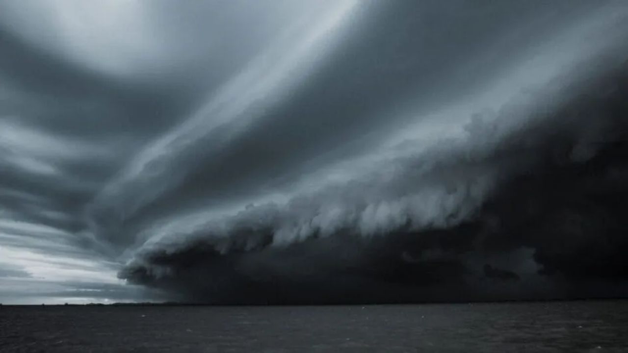
These conditions can cause rapid disruptions, especially in urban areas prone to flooding and in rural regions exposed to strong winds. When heavy rain, hail, and intense gusts occur in the same interval, the risk ceases to be localized and requires regional attention.
Cold front helps organize instability in the South
The cold front acts as one of the drivers of weather change. It advances through the Southern Region and interacts with the cyclone forming in the ocean, creating a favorable environment for heavy clouds, strong showers, and thunderstorms.
This type of combination tends to intensify instability because it organizes moisture and favors the formation of more persistent rain areas. In the case of the issued alert, the main concern is focused on Sunday and Monday, when the system affects different states at different times.
Rio Grande do Sul should have more intense storms at the beginning
On Sunday, Inmet indicates that the instability scenario remains over the South, with emphasis on Rio Grande do Sul, where storms are expected to be more intense. The formation of the cyclone between southern Rio Grande do Sul and Uruguay increases attention on the state.
The indicated timeline shows that the cold front is organized between Paraguay and Southern Brazil, while the cold air of polar origin begins to advance over Rio Grande do Sul. The state is expected to record widespread storms, with heavy rain, lightning, and winds.
Santa Catarina enters the path of heavy rain
In Santa Catarina, instability increases throughout Sunday, with a higher risk of storms during the afternoon and evening. Western Santa Catarina is among the areas under an orange alert, indicating the possibility of severe weather and associated impacts.
On Monday, the cold front advances along the coast of Santa Catarina. The forecast still indicates rain in the form of heavy showers and thunderstorms, although the instability begins to gradually decrease in some areas. Even when the worst of the system passes, the effects may continue for hours in the form of cloudiness, rain, and a feeling of cold.
Paraná also experiences the advance of instability
In Paraná, Sunday starts with sunshine in several areas, but instability advances at the end of the day through the west and south of the state. Southwestern Paraná is among the regions included in Inmet’s orange alert.
On Monday, Paraná is still expected to have cloudiness and rain in some areas, already under the influence of the system’s displacement. The cyclone gradually moves away to the Atlantic Ocean, but the cold front and polar air still help maintain unstable conditions in the Southern Region.
Hail and strong winds increase the risk of damage
In addition to heavy rain, the forecast includes hail. This type of phenomenon can cause damage to roofs, vehicles, crops, and more vulnerable structures, especially when it occurs along with strong gusts.
The winds forecasted in the orange alert areas can reach 100 km/h. Gusts in this range increase the risk of falling trees, localized roof damage, and power outages. Therefore, the practical recommendation is to follow official warnings and avoid unnecessary exposure during storms.
Flooding and power outages are among the risks
Inmet points to the risk of power outages, damage to crops, falling trees, and flooding. In cities with overloaded drainage, intense rain in a short period can quickly turn streets into critical points.
In rural areas, the concern involves crops and structures exposed to wind and hail. The cyclone and the cold front do not affect all municipalities in the same way, but the broad alert shows that the atmosphere is favorable to locally strong events in different parts of the Southern Region.
Yellow alert also covers other areas
In addition to the 233 cities under orange alert, other areas of the Southern Region are under a yellow alert, classified as “potential danger.” In these locations, the forecast is for rain of up to 50 mm per day, winds of 40 to 60 km/h, and also the possibility of hail.
Although the yellow alert is less severe than the orange, it should not be ignored. Even smaller volumes of rain can cause disruptions when they hit vulnerable locations, slopes, areas with a history of flooding, or regions with already saturated soil.
Polar air drops temperatures after the storms
The timeline shows that, after the advance of the cold front and the cyclone, the polar air consolidates over Rio Grande do Sul. On Monday, the state should already feel a more noticeable drop in temperatures, while Santa Catarina and Paraná will still have instability in some areas.
On Tuesday, June 30, the system will be further away in the South Atlantic, losing direct influence over the continent. Even so, the polar air maintains cold mornings in Rio Grande do Sul, with the possibility of temperatures close to or below 10°C and a chance of localized frost on the border with Uruguay.
System loses strength over the continent but leaves effects
With the displacement of the cyclone to the South Atlantic, the trend is a gradual reduction of direct influence over the continent. However, Santa Catarina and Paraná may still remain under indirect influence of the system, with unstable weather and mild temperatures.
This behavior is common in episodes of strong weather change. The peak of the storm passes, but the environment still takes time to fully stabilize. After the rain and wind, the cold becomes the most noticeable mark for part of the Southern Region.
What residents should observe during the alert
In storm situations, the most important thing is to follow announcements from Inmet, Civil Defense, and local authorities. Alerts can change according to the movement of the cold front, the intensity of the rain, and the evolution of the cyclone in the ocean.
It is also wise to avoid flooded areas, not to take shelter under trees during wind gusts, and to be extra careful when traveling. In rural areas, attention should be given to structures, equipment, and exposed crops. The alert does not mean that all locations will have the same impact, but it indicates that the risk exists and can intensify quickly.
The cyclone associated with the cold front has put the Southern Region on alert, with 233 cities under orange alert and other areas under yellow alert. The combination of heavy rain, hail, strong winds, and the advance of polar air creates a risk scenario for residents, properties, crops, and essential services between Sunday and Monday.
Do you live in any of the regions on alert or have you faced storms with hail and strong winds in your city? Tell us in the comments how the weather is there and if your region usually suffers from flooding, falling trees, or power outages during storms.


