Portuguese
  Spanish
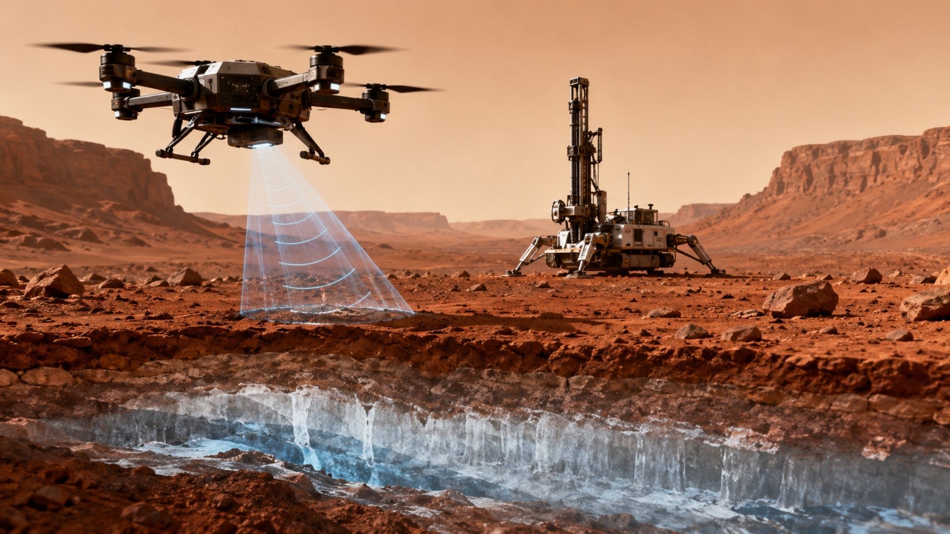
Mars could enter a new phase of water hunting with drones equipped with ground-penetrating radar, capable of flying low, mapping buried ice, and indicating with much greater precision where future missions should drill. The proposal was detailed in a study led by the University of Arizona, published in March, and emerges as a response to a significant limitation of orbiters: they detect large promising regions but still have difficulty saying how deep the ice truly is.
Mars is at the center of this idea because it is already known that the planet holds ice deposits under rocks and dust, but finding the exact most accessible points remains a challenge. In tests conducted on Earth, researchers used radar-equipped drones over debris-covered glaciers in Alaska and Wyoming, considered analogous to Martian formations, and were able to measure ice thickness, overburden depth, and internal layers with higher resolution than obtained by orbital instruments.
According to the Olhar Digital portal, the detail that makes this proposal grow in importance is that it could change the moment when the search for water on Mars ceases to be a broad indication and becomes a much more concrete drilling target. Instead of relying solely on orbital images to choose a large area, missions could use drones as an intermediate step, refining the map before sending probes or drills to the ground.
The strongest detail lies in the ability to fly low and better see what is buried
The great advantage of drones lies in their operating altitude. As they can fly much closer to the terrain than an orbiter, they can produce radar images with superior resolution and reveal more clearly where the debris layer ends and where the ice begins. In the work by the University of Arizona, this allowed not only estimating the thickness of the surface cover but also assessing the purity of the ice and identifying hidden rock layers.
-
Spain Launches World’s Largest Floating Dry Dock: 56-Meter Giant Produces Massive Concrete Structures in A Coruña Using Technology Proven in Brazil

-
AI-powered toys that talk, recognize faces, and collect data face scrutiny from Brazilian government over children’s privacy concerns

-
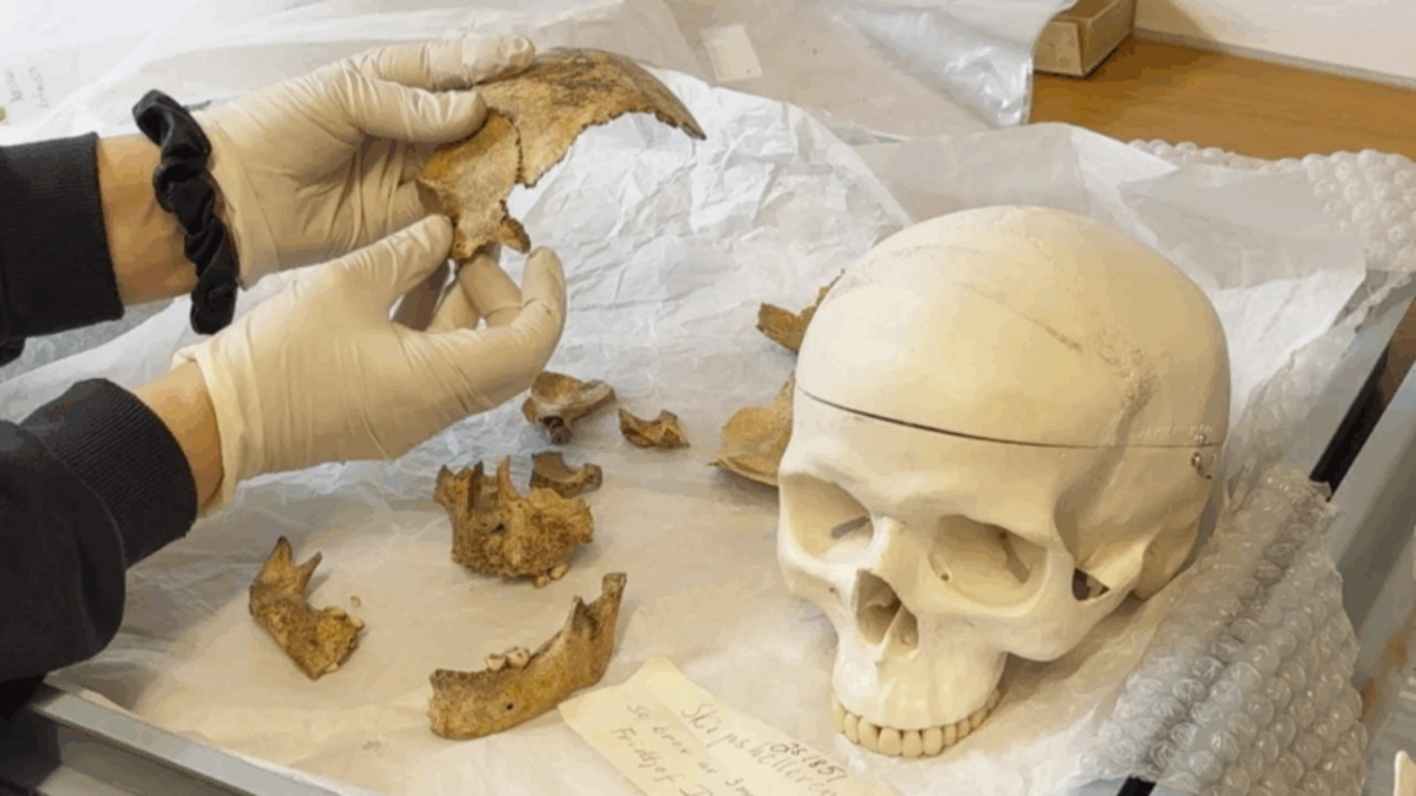
4,000-Year-Old Child’s Skull Unveils Ancient Burial in 7,500-Year-Old Norwegian Rock Shelter, Impressing Archaeologists

-
Norway Defeats Brazil in World Cup but Invests Billions to Preserve the Amazon, Strengthens Amazon Fund, and Joins Brazil in Leading Global Effort Against Tropical Deforestation


This gain seems technical, but it changes the game significantly. Knowing whether the ice is under one meter of loose material or under tens of meters can define whether a location on Mars is viable for drilling or if the effort would be too expensive, too risky, or simply useless for a robotic or crewed mission.
The curious twist is that the solution for Mars is being trained on Earth’s glaciers
The study didn’t start on the red planet, but in cold, rocky landscapes on Earth that resemble what spacecraft have already photographed on Mars. Researchers flew radar over debris-covered glaciers in Alaska and Wyoming and compared the data with excavations and drillings, verifying that the cover thickness measurements matched what was on the ground.
It is precisely this field validation that gives strength to the proposal. The team not only showed that the radar works but also learned practical operating conditions, such as altitude, speed, and flight alignment, decisive points for imagining the future adaptation of the technique to the Martian environment.
The broader context shows that Mars already has detected ice, but precision for drilling is still lacking

The idea of drones does not arise in a vacuum. Today, orbiters like the Mars Reconnaissance Orbiter already use radar to probe the subsurface of Mars. NASA explains that SHARAD sends radio waves and measures their echoes at subsurface interfaces, having revealed large ice-rich deposits beneath the Martian surface. In one of these official examples, the agency states that a detected deposit has an area comparable to that of the state of New Mexico and contains water equivalent to that of Lake Superior.
The problem is that this type of observation is excellent for seeing the big picture, but not necessarily the operational detail that drilling requires. This is where the drone proposal comes in: not to replace orbiters, but to act as a bridge between orbital discovery and the final decision of where to drill.
Why this could change Mars exploration in the coming years

If the technology advances, the impact could be significant for science and human exploration. Water in the form of ice is a strategic resource on Mars because it can support not only research into the planet’s past climate but also future missions that depend on local supply for life support and production of consumables. The more accurate the map of accessible ice, the lower the risk of investing in poorly chosen drilling sites tends to be.
The proposal also fits into a trend opened by Ingenuity. NASA reports that the helicopter made 72 flights on Mars, proved controlled flight on the planet, and paved the way for more sophisticated aerial explorers. In parallel, the agency itself maintains the Mars Science Helicopter in a conceptual stage, designed to carry between 2 and 5 kilograms of payload, including scientific instruments, and to study terrains that rovers cannot reach.
What still needs to be confirmed before this idea becomes a real mission
Despite the advancement, the proposal is still in the realm of potential, not execution on Mars. The Mars Science Helicopter remains in the conceptual and design phase, and transforming radar drones into a routine tool will require resolving limitations in payload, power, communication, and operation in an atmosphere much thinner than Earth’s.
It also remains to be tested how this radar would behave in different types of Martian terrain, as the authors themselves acknowledge that the technology does not work the same way in every environment. What exists today is an important step: the demonstration that, in terrestrial analogs of Mars, the method can provide exactly the kind of detail that was missing to transform the search for ice into a much less uncertain drilling choice.
Ultimately, what’s at stake is not just another gadget flying on Mars. It’s the possibility of seeing beneath the dust with enough precision to make hidden water less abstract and more usable. If orbiters show where to look and rovers show what to touch, radar drones can occupy the middle ground and turn ice exploration from a broad gamble into a real decision route.