Portuguese
  Spanish
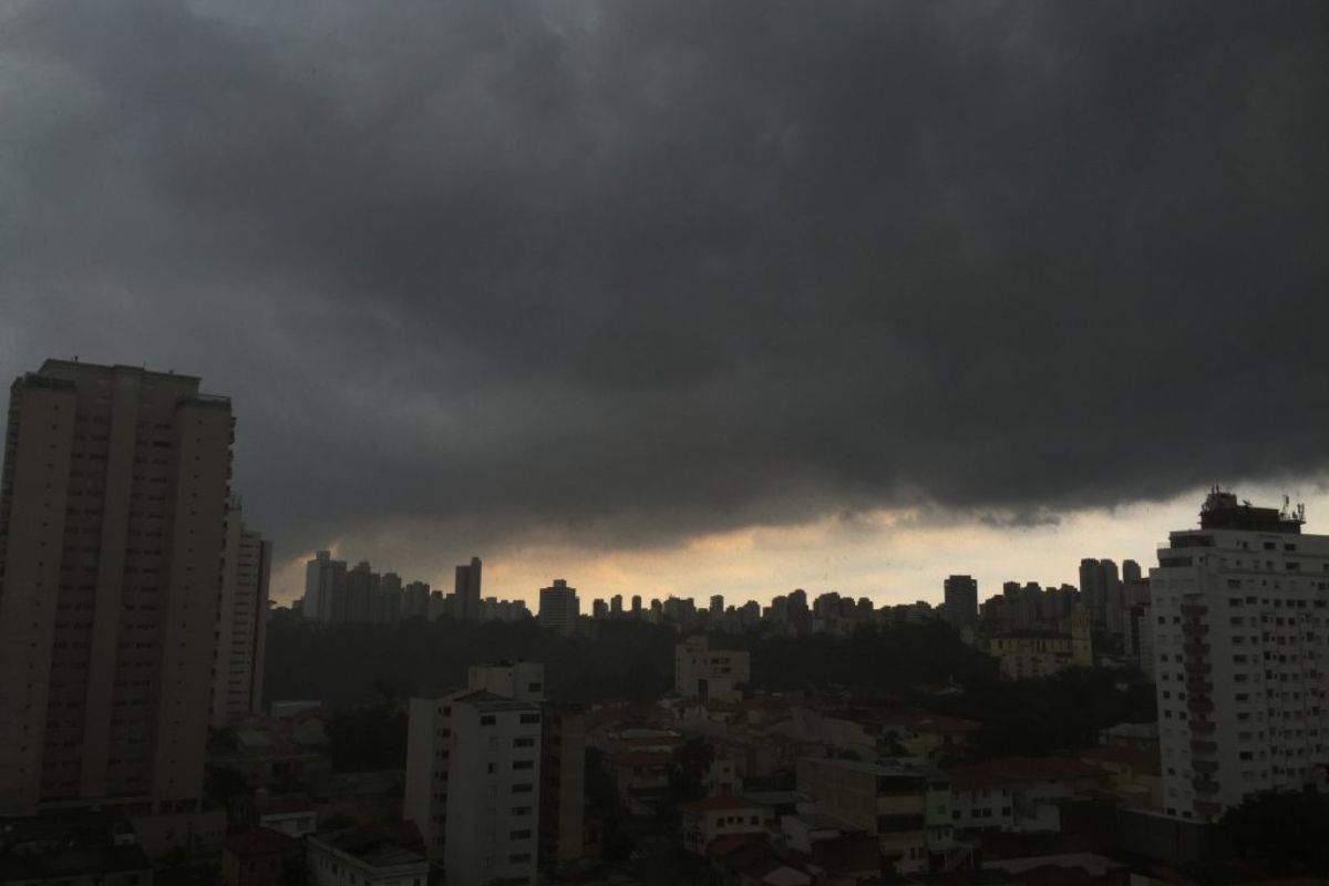
On The Afternoon Of This Monday, 8, São Paulo Entered An Alert State After The CGE Recorded Heavy Rain, Hail, And Winds Above 60 Km/h, And An Extratropical Cyclone With A Cold Front Promises More Intense Storms On Tuesday And Wednesday, In The Capital, In The Interior And Coastal Areas Of São Paulo And Neighboring Regions
On the afternoon of this Monday, December 8, 2025, São Paulo entered an alert state for flooding after heavy rain hits mainly the eastern and southern zones of the capital, with reports of hail in different neighborhoods monitored by the Weather Emergency Management Center. According to the city government’s agency, the alert was triggered around 12:30 PM, when the meteorological radar began indicating instability cores with potential for hail and rapid formation of flooding points.
The same instabilities that are already causing heavy rain in São Paulo are expected to gain even more intensity starting Tuesday, under the influence of an extratropical cyclone combined with the passage of a cold front through the South and Southeast. According to Climatempo and the CGE, storms are forecasted between Tuesday and Wednesday, with rain of moderate to heavy intensity and wind gusts above 60 km/h, which keeps the risk of new flooding and falling trees in Greater São Paulo high.
Eastern And Southern Zones Concentrate First Floods In São Paulo
The CGE reported that the first areas to enter an alert state were the eastern and southern zones of São Paulo.
-
Pennsylvania Mine Creates Ice in Summer Heat and Melts in Winter, Turning a Mountain Crevice into a Reverse Natural Refrigerator

-
China Accelerates Global Expansion of Robotics: From Smart Vacuums to Industrial and Humanoid Machines, Millions Exported to Over 150 Markets
-
Polar Air Mass to Hit Brazil: Temperatures to Plummet in Nine States, Near Freezing in the South with Frost Risk Until Monday
-
Chinese “dark factories” produce electric cars 24/7 with minimal human intervention, as Zeekr assembles 800 units daily, raising concerns in Brazil.


The sub-districts of Mooca, Aricanduva/Formosa, and Penha, in the eastern zone, as well as the Parelheiros region in the southern zone, concentrated the most intense rain cells early Monday afternoon.
In the eastern zone of the capital, shortly before noon, the sky suddenly darkened and there were reports of heavy rain with hail in different areas.
The agency warns that other regions of São Paulo may also register rain showers throughout the day, even with breaks of sunshine between one instability core and another, maintaining the risk of localized flooding.
Hail, Wind Gusts Above 60 Km/h, And Risk Of Falling Trees
In a recent bulletin, the CGE highlighted that, in São Paulo, the scenario for this week’s start is rain varying from moderate to heavy intensity, accompanied by wind gusts that may exceed 60 km/h, especially during the afternoon. These conditions add to the already saturated soil in some areas, increasing the chance of disruptions.
These wind gusts raise the potential for falling trees and branches, damage to weaker coverings, and visibility difficulties in traffic during the moments of heaviest rain.
The recommendation is for drivers and pedestrians to avoid flooded areas, reduce speed on roads, and stay alert to signs of branches, wires, and structures at risk of falling, especially on busy avenues in São Paulo.
Extraterrestrial Cyclone And Cold Front Reinforce Storms In São Paulo
According to Climatempo, the situation in São Paulo is directly linked to the formation of an extratropical cyclone in conjunction with the passage of a cold front.
The formation of the system begins with the intensification of a low-pressure area, still on this Monday, between southern Paraguay, northeastern Argentina, and Rio Grande do Sul, which rearranges the winds at medium and high levels of the atmosphere.
As the cyclone deepens and the cold front advances, more significant rain is expected in the three Southern States and much of São Paulo, including the metropolitan region and the coastal areas of São Paulo.
The trend is that, between Tuesday and Wednesday, the storms will gain strength, with more lightning, wind gusts, and the possibility of hail in various parts of the State of São Paulo, especially in the afternoon and evening periods. The scenario, according to the CGE, is expected to be similar on Wednesday, the 9th.
South, Southeast, And Midwest Enter Alert For Storms
The advance of the extratropical cyclone and the cold front does not only affect São Paulo. The forecast indicates heavy rain and elevated precipitation volume for Rio Grande do Sul, Santa Catarina, and Paraná, which are expected to experience persistent instabilities over the coming days, with a risk of flash floods and flooding in susceptible areas.
In the Southeast, besides São Paulo, Rio de Janeiro and Minas Gerais are also on the route of greater instability, with increasing cloud cover, drops in temperature, and episodes of intense rain.
In the Midwest, Mato Grosso do Sul appears among the States with the highest potential for storms associated with this system.
Among the States that should feel the direct impact of the extratropical cyclone and the cold front are Rio Grande do Sul, Santa Catarina, Paraná, São Paulo, Rio de Janeiro, Minas Gerais, and Mato Grosso do Sul, all on alert for events of heavy rain and wind.
Guidelines For Residents Of São Paulo In Light Of The Coming Days Of Rain
With the forecast of reinforced storms for the coming days, residents of São Paulo are advised to frequently monitor warnings from the CGE, Civil Defense, and meteorological services, as well as to avoid long trips precisely during the hours of highest risk of heavy rain. In case of flooding, the recommendation is not to attempt to cross flooded streets, either on foot or by car.
It is also important to remove loose objects from balconies and backyards, check gutters and drains to facilitate water drainage, and double down on safety in traditionally flood-prone areas of São Paulo.
In neighborhoods close to streams, valley bottoms, or slopes, any sign of overflow, land sliding, or cracks in walls and partitions should be immediately reported to official emergency channels, to expedite assistance and reduce risks to families.
In light of this alert situation, do you think São Paulo is prepared to face increasingly intense and frequent storms, or does the city only react when floods have already occurred?